Showing 390 results

Archival description
Land subdivision--Vancouver (B.C.)
Print preview View:

364 results with digital objects Show results with digital objects

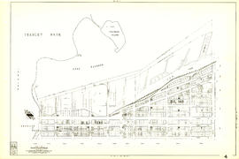
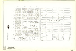
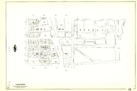
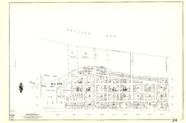
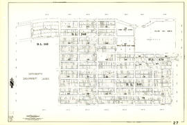
Sheet 9 : Main Street to Clark Drive and Prior Street to Burrard Inlet

Item is a section showing the area from Main Street to Clark Drive and Prior Street to Burrard Inlet. Includes streets, blocks, lots and legal descriptions, and the locations of parks, schools, railways and piers along the waterfront.

Vancouver (B.C.). Engineering Services

Sheet 4 : Chilco Street to Burrard Street and Robson Street to Coal Harbour

Item is a section showing the area from Chilco Street to Burrard Street and Robson Street to Deadmans Island. Includes streets, blocks, lots and legal descriptions, as well as parks and the location of some businesses and organizations along the waterfront.

Vancouver (B.C.). Engineering Services

Sheet 5 : Stanley Park to Nicola Street and English Bay Beach to Robson Street

Item is a section showing the area from Stanley Park to Nicola Street and English Bay Beach to Robson Street. Includes streets, blocks, lots and legal descriptions, and the locations of parks, beaches, schools and golf courses.

Vancouver (B.C.). Engineering Services

Sheet 10 : Clark Drive to Nanaimo Street and Frances Street to Burrard Inlet

Item is a section showing the area from Clark Drive to Nanaimo Street and Frances Street to Burrard Inlet. Includes streets, blocks, lots and legal descriptions, and the locations of parks and a juvenile detention home.

Vancouver (B.C.). Engineering Services

Sheet 12 : Nanaimo Street to Cassiar Street and Pender Street to McGill Street

Item is a section showing the area from Nanaimo Street to Cassiar Street and Pender Street to McGill Street. Includes streets, blocks, lots and legal descriptions, and the locations of bridges, reservoirs and railways.

Vancouver (B.C.). Engineering Services

Sheet 14 : Cassiar Street to Boundary Road and Pender Street to Eton Street

Item is a section showing the area from Cassiar Street to Boundary Road and Pender Street to Kitchener Street. Includes streets, blocks, lots and legal descriptions, and the locations of parks and retirement homes. Also shown are streets and blocks in the area from Boundary Road to Carleton Avenue in Burnaby.

Vancouver (B.C.). Engineering Services

Sheet 15 : Rupert Street to Boundary Road and Kitchener Street to Pender Street

Item is a section showing the area from Rupert Street to Boundary Road and Kitchener Street to Pender Street. Includes streets, blocks, lots and legal descriptions. Also shown are streets and blocks in the area from Boundary Road to Carleton Avenue in Burnaby.

Vancouver (B.C.). Engineering Services

Sheet 17 : Nanaimo Street to Rupert Street and Charles Street to Pender Street

Item is a section showing the area from Nanaimo Street to Rupert Street and Charles Street to Pender Street. Includes streets, blocks, lots and legal descriptions. Includes streets, blocks, lots and legal descriptions, and the locations of parks and schools.

Vancouver (B.C.). Engineering Services

Sheet 20 : Main Street to Clark Drive and Great Northern Way to Prior Street

Item is a section showing the area from Main Street to Clark Drive and Great Northern Way to Prior Street. Includes streets, blocks, lots and legal descriptions, and the locations of parks, railways and railway yards.

Vancouver (B.C.). Engineering Services

Sheet 22 : Maple Street to Drake Street and Fourth Avenue to Thurlow Street

Item is a section showing the area from Maple Street to Drake Street and Fourth Avenue to Thurlow Street. Includes streets, blocks, lots and legal descriptions, and the locations of First Nations reserves, parks, railways and railway yards.

Vancouver (B.C.). Engineering Services

Sheet 27 : University Endowment Lands and Drummond Drive to Camosun Street and Fourteenth Avenue to Fourth Avenue

Item is a section showing the area from the University Endowment Lands and Drummond Drive to Camosun Street and Fourteenth Avenue to Fourth Avenue. Includes streets, blocks, lots and legal descriptions, and the locations of parks and schools.

Vancouver (B.C.). Engineering Services

Sheet 28 : Camosun Street to Balaclava Street and Fourteenth Avenue to Fourth Avenue

Item is a section showing the area from Camosun Street to Balaclava Street and Fourteenth Avenue to Fourth Avenue. Includes streets, blocks, lots and legal descriptions, and the locations of parks and schools.

Vancouver (B.C.). Engineering Services

Sheet 30 : Maple Street to Oak Street and Fourteenth Avenue to Third Avenue and False Creek

Item is a section showing the area from Maple Street to Oak Street and Fourteenth Avenue to Third Avenue and False Creek. Includes streets, blocks, lots and legal descriptions, and the locations of parks, schools and railways.

Vancouver (B.C.). Engineering Services

Sheet 35 : Rupert Street to Ardley Avenue and Grandview Highway to Fifth Avenue

Item is a section showing the area from Rupert Street to Boundary Road and Grandview Highway to Fifth Avenue. Includes streets, blocks, lots and legal descriptions, and the locations of schools and railways. Also included are streets, blocks and railways in the area from Boundary Road to Ardley Avenue in Burnaby.

Vancouver (B.C.). Engineering Services

Sheet 36 : Rupert Street to Carlton Avenue and Twenty-second Avenue to Grandview Highway

Item is a section showing the area from Rupert Street to Boundary Road and Twenty-second Avenue to Grandview Highway. Includes streets, blocks, lots and legal descriptions, and the locations of parks and schools. Also included are streets and blocks in the area from Boundary Road to Carleton Avenue in Burnaby.

Vancouver (B.C.). Engineering Services

Sheet 37 : Rupert Street to Carleton Avenue and Wellington Avenue to Twenty-second Avenue and Elmwood Street

Item is a section showing the area from Rupert Street to Boundary Road and Wellington Avenue to Twenty-second Avenue. Includes streets, blocks, lots and legal descriptions, and the locations of parks and schools. Also included are streets and blocks in the area from Boundary Road to Carleton Avenue in Burnaby.

Vancouver (B.C.). Engineering Services

Sheet 38 : Nanaimo Street to Rupert Street and Twenty-second Avenue to Grandview Highway

Item is a section showing the area from Nanaimo Street to Rupert Street and Twenty-second Avenue to Grandview Highway. Includes streets, blocks, lots and legal descriptions, and the locations of parks, schools and a preventorium (TB hospital).

Vancouver (B.C.). Engineering Services

Sheet 39 : Kingsway and Nanaimo Street to Rupert Street and Ward Street to Twenty-second Avenue

Item is a section showing the area from Kingsway and Nanaimo Street to Rupert Street and Ward Street to Twenty-second Avenue. Includes streets, blocks, lots and legal descriptions, and the locations of parks, schools and railways.

Vancouver (B.C.). Engineering Services

Sheet 40 : Inverness Street to Nanaimo Street and Twenty-second Avenue to Thirteenth Avenue

Item is a section showing the area from Inverness Street to Nanaimo Street and Twenty-second Avenue to Thirteenth Avenue. Includes streets, blocks, lots and legal descriptions, and the locations of parks, schools and railways.

Vancouver (B.C.). Engineering Services

Sheet 41 : Ontario Street to Inverness Street and Twenty-eighth Avenue to Sixteenth Avenue

Item is a section showing the area from Ontario Street to Inverness Street and Twenty-eighth Avenue to Sixteenth Avenue. Includes streets, blocks, lots and legal descriptions, and the locations of parks and schools.

Vancouver (B.C.). Engineering Services

Sheet 42 : Oak Street to Ontario Street and Twenty-eighth Avenue to Sixteenth Avenue

Item is a section showing the area from Oak Street to Ontario Street and wenty-eighth Avenue to Sixteenth Avenue. Includes streets, blocks, lots and legal descriptions, and the locations of parks and schools.

Vancouver (B.C.). Engineering Services

Sheet 44 : Blenheim Street to Arbutus Street and King Edward Avenue to Fourteenth Avenue

Item is a section showing the area from Blenheim Street to Arbutus Street and King Edward Avenue to Fourteenth Avenue. Includes streets, blocks, lots and legal descriptions, and the locations of parks, schools and railways.

Vancouver (B.C.). Engineering Services

Sheet 45 : Discovery Street to Blenheim Street and King Edward Avenue to Fourteenth Avenue

Item is a section showing the area from Discovery Street to Blenheim Street and King Edward Avenue to Fourteenth Avenue. Includes streets, blocks, lots and legal descriptions, and the locations of parks and schools.

Vancouver (B.C.). Engineering Services

Government precinct : major land ownerships

Map is a plan of the area bounded by Oak Street, Broadway, Yukon Street and Sixteenth Avenue, showing streets, blocks, lots and legal descriptions. Map is hand coloured to show property owned by the City, Vancouver General Hospital, the Province of British Columbia, the B.C. Cancer Institute, and private owners within the 'Government Precinct' boundaries. Indicated are the locations of King Edward High School, Vancouver General Hospital, the Model School, Provincial Government building, City Hall, and a Refuge Home. Plan is labelled "G : 1960 March, 320-6A, Gov't Precinct 1957."

Corporation of Point Grey : topographical plan of ABCDE D.L. 317 and HIJK D.L. 318 : Marine Drive & Vancouver & Lulu Railway to Fraser River between Angus St. [Drive] & Milton St

Item is a topographical plan of Point Grey showing the area from Angus Drive to Granville Street and 71st Avenue to the Fraser River, including property in D.L. 317 and D.L. 318. Plan shows the locations of the Vancouver and Lulu Island Railway, as well as ponds, dams, barns, houses and offices.

Sheet J : University Endowment Lands to Wallace Street and Twenty-seventh Avenue to Thirty-eighth Avenue

Item is a section showing the area from the University Endowment Lands to Wallace Street and Twenty-seventh Avenue to Thirty-eighth Avenue. Includes streets, roads and sewers; blocks, lots, and legal descriptions; and parks and schools.

Vancouver (B.C.). Office of the City Engineer

Sheet 7 : Clark Drive to Slocan Street and Seventh Avenue to Eighteenth Avenue

Item is a section showing the area from Clark Drive to Slocan Street and Seventh Avenue to Eighteenth Avenue. Includes streets and roads, blocks, lots, legal descriptions, railways, parks and schools. Map is hand coloured to show tax sale property for sale, property with no water, street widening and drainage, replotting, reserved land for schools, reserved land for parks, sundry land, capital assets not including schools and parks, schools, and parks, as applicable.

Vancouver (B.C.). Office of the City Engineer

Sheet B : Discovery Street to Trutch Street and waterfront to Fourth Avenue

Item is a section showing the area from Discovery Street to Trutch Street and waterfront to Fourth Avenue. Includes streets, roads and sewers; blocks, lots and legal descriptions; and parks and schools. Map shows Jericho Air Station and crown leases.

Vancouver (B.C.). Office of the City Engineer

Sheet E : University Endowment Lands to Wallace Street and Sixteenth Avenue to Twenty-seventh Avenue

Item is a section showing the area from Wallace Street to Trafalgar Street and Sixteenth Avenue to Twenty-seventh Avenue. Includes streets, roads, blocks, lots, legal descriptions, parks and schools. Section is annotated to show tax sale property for sale, property with no water, street widening and drainage, replotting, reserved land for schools, reserved land for parks, sundry land, capital assets not including schools and parks, schools, and parks, as applicable.

Vancouver (B.C.). Office of the City Engineer

Sheet H : Alexandra Street to Cambie Street and Fifteenth Avenue to Twenty-seventh Avenue

Item is a section showing the area from Alexandra Street to Cambie Street and Fifteenth Avenue to Twenty-seventh Avenue.Includes streets and roads; blocks, lots and legal descriptions; as well as parks, schools, hospitals and golf courses.

Vancouver (B.C.). Office of the City Engineer

Sheet 10 : Clark Drive to Slocan Street and Burrard Inlet to Triumph Street

Item is a section showing the area from Clark Drive to Slocan Street and aterfront to Triumph Street. Includes streets and roads, blocks, lots, legal descriptions, railways, parks, boys' detention home and businesses along the waterfront. The Town of Hastings is indicated on the map. Map is hand coloured to show tax sale property for sale, property with no water, street widening and drainage, replotting, reserved land for schools, reserved land for parks, sundry land, capital assets not including schools and parks, schools, and parks, as applicable.

Vancouver (B.C.). Office of the City Engineer

Sheet 13 : Ontario Street to Clark Drive and First Avenue to Sixteenth Avenue

Item is a section showing the area from Ontario Street to Clark Drive and First Avenue to Sixteenth Avenue. Includes streets, roads, blocks, lots, legal descriptions, railways, parks and schools. Includes B.C. Electric Railway car barns. Map is hand coloured to show tax sale property for sale, property with no water, street widening and drainage, replotting, reserved land for schools, reserved land for parks, sundry land, capital assets not including schools and parks, schools, and parks. Annotations in pencil.

Vancouver (B.C.). Office of the City Engineer

Sheet 16 : Maple Street to Oak Street and False Creek to Sixteenth Avenue

Item is a section showing Maple Street to Oak Street and False Creek to Sixteenth Avenue. Includes streets and roads, blocks, lots, legal descriptions, railways, schools and parks. Indicates crown land leased to the C.P.R. and other bodies. Map is hand coloured to show tax sale property for sale, property with no water, street widening and drainage, replotting, reserved land for schools, reserved land for parks, sundry land, capital assets not including schools and parks, schools, and parks.

Vancouver (B.C.). Office of the City Engineer

Sheet 20 : Granville Street to Ontario Street and Robson Street to Sixth Avenue

Item is a section showing Granville Street to Ontario Street and Robson Street to Sixth Avenue. Includes streets, roads, blocks, lots, legal descriptions, businesses, crown leases, city leases, the Granville Street and Connaught (Cambie) Bridges, and the False Creek yards. Map is hand coloured to show tax sale property for sale, property with no water, street widening and drainage, replotting, reserved land for schools, reserved land for parks, sundry land, capital assets not including schools and parks, schools, and parks, as applicable.

Vancouver (B.C.). Office of the City Engineer

Results 51 to 100 of 390