![3695 W. 1st Avenue [3695 W. 4th Avenue]](/uploads/r/null/5/8/7/58744038e1a076d20b534e4bf86d852cbe44838a546395fc49d8a75ca6cd3e1c/9fc1d9e0-4d70-466a-afd9-9ddcf92b1702-CVA786-22_142.jpg)
3695 W. 1st Avenue [3695 W. 4th Avenue]
- COV-S535-F4-: CVA 786-22.02
- Item
- 1978
Part of City of Vancouver fonds
Item is a photograph showing a Bank of Montreal.
137 results with digital objects Show results with digital objects
3695 W. 1st Avenue [3695 W. 4th Avenue]
Part of City of Vancouver fonds
Item is a photograph showing a Bank of Montreal.

Part of City of Vancouver fonds

Part of City of Vancouver fonds

Part of City of Vancouver fonds

Part of City of Vancouver fonds
![General Gordon School [2896 West 6th Avenue]](/uploads/r/null/1/e/b/1ebb6b39518be4a78be1469f506ddcd1f260a14c9b6409f57098f59955481ffb/1ff22fb0-c5b0-47ab-99be-55d75256d72d-CVA786-27_142.jpg)
General Gordon School [2896 West 6th Avenue]
Part of City of Vancouver fonds

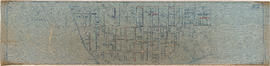
Sewerage system : plan of Point Grey Municipality
Part of City of Vancouver fonds
Item is a map annotated to show the sewer system in Point Grey. Base map was created by the Vancouver Map and Blue Print Co. and shows streets, railways, and district lot and block numbers.
![[Dunbar Street?]](/uploads/r/null/3/e/3ed8eb314f3553b8446f5bde69b1666f31ffd336d5be438201b9e49a29bb60d1/42627732-ea15-4eb1-a9a3-d87a1f992e23-A16596_142.jpg)
Part of City of Vancouver fonds
![General plan - sheet 12 [Cambie Street to Sixteenth Avenue to Arbutus Street to Twenty-third Avenue]](/uploads/r/null/8/5/f/85f228499ffefb33a4420336b35885201d899673637daca6b1eebd8fd0111f3e/4ee908fd-0dfa-4297-8198-99592dee3c2b-LEG1153_142.jpg)
General plan - sheet 12 [Cambie Street to Sixteenth Avenue to Arbutus Street to Twenty-third Avenue]
Part of City of Vancouver fonds

Part of City of Vancouver fonds

Part of City of Vancouver fonds

Part of City of Vancouver fonds

Part of City of Vancouver fonds

Part of City of Vancouver fonds
![General plan - sheet 18 [Cambie Street to Dogwood Avenue to Arbutus Street to Sixtieth Avenue]](/uploads/r/null/7/3/0/730edd4b5bb09f437c0bf207248dd5623603f3054a8b42c57e71efc48dbc508f/3aa6b0df-f6ac-4001-92db-28b342873388-LEG1153_142.jpg)
General plan - sheet 18 [Cambie Street to Dogwood Avenue to Arbutus Street to Sixtieth Avenue]
Part of City of Vancouver fonds
![General plan - sheet 19 [Ash Street to Fifty-ninth Avenue to Arbutus Street to Sixty-seventh Avenue]](/uploads/r/null/c/d/9/cd91342eba2fda61236d03f55e1772cfcacc898fda7f2de3b55408ad37e4f618/ab184e33-c017-49fd-8425-47302485efcc-LEG1153_142.jpg)
General plan - sheet 19 [Ash Street to Fifty-ninth Avenue to Arbutus Street to Sixty-seventh Avenue]
Part of City of Vancouver fonds
Part of City of Vancouver fonds
![General plan - sheet 21 [Heather Street to Seventy-third Avenue to Fraser River]](/uploads/r/null/d/1/6/d1697104a1a4279099944caca836ec97365dd22d65bd611490ee71828ae0ce96/5bf4af24-c2fe-477e-a13d-1ba1c9107389-LEG1153_142.jpg)
General plan - sheet 21 [Heather Street to Seventy-third Avenue to Fraser River]
Part of City of Vancouver fonds
Part of City of Vancouver fonds

Part of City of Vancouver fonds

Part of City of Vancouver fonds

Part of City of Vancouver fonds

Part of City of Vancouver fonds

Part of City of Vancouver fonds
![General plan - sheet 11 [Arbutus Street to Celtic Avenue to Fraser River]](/uploads/r/null/3/f/d/3fd9a37e7d563f1ab5ea2d9d72418a55895d86310b0a78eab48407b8b835b701/136e3b9b-509e-4f21-94e7-d53135afd227-LEG1153_142.jpg)
General plan - sheet 11 [Arbutus Street to Celtic Avenue to Fraser River]
Part of City of Vancouver fonds
Part of City of Vancouver fonds
Part of City of Vancouver fonds

Part of City of Vancouver fonds
Item shows Point Grey harbour facilities and industrial lands, the Jericho naval reserve and golf links through a combination of a map and illustrations. A smaller key plan shows the location of the Vancouver Terminals Company's harbour properties in relation to the rest of Point Grey and Vancouver.

Part of City of Vancouver fonds
Item is a map showing the railway line from New Westminster to Point Grey. Railway data appears to have been added to a base map showing topographic contour lines, shorelines, low tide marks, natural divides, and municipal boundaries.
![[Two firemen in Point Grey Fire Department Chief's automobile]](/uploads/r/null/e/b/c/ebc94a44006330a7417e906a39d686ad1bf925c9b3caeeec600f4fd9a3df3683/096cdfe2-9828-4c08-a730-5decdb017472-CVA354-039_142.jpg)
[Two firemen in Point Grey Fire Department Chief's automobile]
Part of City of Vancouver fonds
![[Members of Point Grey Fire Department with 1914 American-La. France Triple combination truck]](/uploads/r/null/0/2/2/022f957de19348377a9dbc6bb9afcc02540a063e3f81dd8a995d5cc9ca482e92/560499fe-ac5e-47c9-89c1-7cf03395e211-CVA354-040_142.jpg)
[Members of Point Grey Fire Department with 1914 American-La. France Triple combination truck]
Part of City of Vancouver fonds
![[Point Grey Fire Department firefighters and motorized equipment in front of firehall]](/uploads/r/null/1/1/3/113fb9c321052a570412e3113c5ab221aa163dae5546d28d3496f4b0edef26df/e9cbb090-82c4-4973-a9ae-bb2ef6530c32-CVA354-046_142.jpg)
[Point Grey Fire Department firefighters and motorized equipment in front of firehall]
Part of City of Vancouver fonds
![[Chief Turner and Captain Munro of Point Grey Fire Department aboard Fire Chief's automobile]](/uploads/r/null/3/e/5/3e56e5f7a117044aa405bb2770771b159eaa81c0098a98a3b9a0bc8b4ce9b545/a568a13d-a0a2-4bb7-b487-d0ba9f4a08d3-CVA354-047_142.jpg)
[Chief Turner and Captain Munro of Point Grey Fire Department aboard Fire Chief's automobile]
Part of City of Vancouver fonds
Item is a photograph showing Turner in the passenger seat and Munro at the wheel.
![[Cornerstone laying of Firehall No. 18, Point Grey by Chief Raymur's wife. Firehall staff present.]](/uploads/r/null/6/d/c/6dc296475f56a3de4e4ea13f7d0f5b2dd4401d151e219e09733cee9dba44369c/8f61ccc1-8336-4a27-8db5-eb118e10a92d-CVA354-057_142.jpg)
[Cornerstone laying of Firehall No. 18, Point Grey by Chief Raymur's wife. Firehall staff present.]
Part of City of Vancouver fonds

Part of City of Vancouver fonds

Part of City of Vancouver fonds
Item is a photograph showing Chief F. Raymur and Deputy Chief E. Seaford on dais at opening of Point Grey Firehall No. 4 at 70th Avenue and Hudson Street.
![No. 4 Hall P.G.F.D. [Point Grey Fire Department]](/uploads/r/null/1/6/3/1634e7cff884fd88c2cfd881c642857ef4700f10fd3353340a0f8e1e934de17d/b917d413-02c3-4d83-9e38-68d313c69dbe-CVA354-066_142.jpg)
No. 4 Hall P.G.F.D. [Point Grey Fire Department]
Part of City of Vancouver fonds
Item is a photograph showing the opening of Point Grey Firehall No. 4 at 70th Avenue and Hudson Street.
![Chief F. Raymur P.G.F.D. [Point Grey Fire Department]](/uploads/r/null/6/3/b/63ba6cef1c6f6d732c1c7426309d45302294f7987fbf02f0c5011020e4eaa265/50a1ac42-5d80-4e66-bf39-b17a3a6aaeb2-CVA354-081_142.jpg)
Chief F. Raymur P.G.F.D. [Point Grey Fire Department]
Part of City of Vancouver fonds
Item is a photograph showing Chief Frank Raymur seated on dais during and pouring himself a beverage at the opening of Point Grey Firehall No. 4.
![Deputy Chief E. Seaford P.G.F.D. [Point Grey Fire Department]](/uploads/r/null/2/0/a/20a8c5913f8105997ec792ac5bb027a13238da1fb255e8305b939654ba8ed47d/559a6672-9076-4043-af30-ebed854f11a8-CVA354-082_142.jpg)
Deputy Chief E. Seaford P.G.F.D. [Point Grey Fire Department]
Part of City of Vancouver fonds
Item is a photograph showing Deputy Chief E. Seaford seated on dais during the opening of Point Grey Firehall No. 4.

![[Point Grey firefighters aboard 1914 American LaFrance C.S.T. in front of firehall]](/uploads/r/null/1/4/c/14cc76bdef3c711cca950eda014352953ebea6188e18c4de8dabbeffcd1c8bf6/3513a8d1-3c83-4a02-93e4-ebcb422c018b-CVA354-382_142.jpg)
[Point Grey firefighters aboard 1914 American LaFrance C.S.T. in front of firehall]
Part of City of Vancouver fonds
![[Point Grey firefighters assembled with fire trucks in front of fire headquarters]](/uploads/r/null/6/7/5/675e2b31eac12f1aef140161c5c139a2d8feeb99949153b22bc438b057cf3bb8/5e9b1213-d72b-4bce-8f52-e628163a0a17-CVA354-383_142.jpg)
[Point Grey firefighters assembled with fire trucks in front of fire headquarters]
Part of City of Vancouver fonds

Part of City of Vancouver fonds
![[Composite of Point Grey Fire Department staff, equipment and activities photographs]](/uploads/r/null/8/6/b/86bedf4f971a1ee357f68da0afe25b7634f94a448e78fde2efc2ded1d96d6d65/2498493e-038e-4d31-8d35-991c9eddb689-CVA354-385_142.jpg)
[Composite of Point Grey Fire Department staff, equipment and activities photographs]
Part of City of Vancouver fonds
Item is a composite photograph showing ladder drills, pump and ladder test, pump in action, ladder and hose drill, city service car, combination chemical hose car, alarm room, chief's office, chief's car, triple chemical hose & pump car, ladder drill and pump test, [playing] tennis, answering a call, [playing] hand ball, No. 2 hall as well as portraits of fire fighters.
![[Point Grey firefighters assembled with fire trucks in front of fire headquarters]](/uploads/r/null/3/0/0/3003b002d12cead52e0a6cfcfb54691da447227d3013775f47408c577a11ecdd/b096a62d-6792-48d1-a97e-6933feb7eb40-CVA354-386_142.jpg)
[Point Grey firefighters assembled with fire trucks in front of fire headquarters]
Part of City of Vancouver fonds
![[1912 American-La France Hose Chemical wagon and firefighters in front of Point Grey Firehall No. 1]](/uploads/r/null/5/9/0/590a2f772f6506d4206377625b9c2c493282a86428ee8591c5a88e52f5c593d8/0222654e-7112-41a6-8475-f12b5d48c0b4-CVA354-034_142.jpg)
[1912 American-La France Hose Chemical wagon and firefighters in front of Point Grey Firehall No. 1]
Part of City of Vancouver fonds
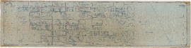
Plan of Sewerage System Point Grey Municipality
Part of City of Vancouver fonds
The map shows the Point Grey Area and its district lot boundaries, street car lines, and postal block numbers. The map displays streets, parks, railways, and schools. Additionally, there are annotations red which mark the sewerage and drainage for the area. The size of the pipes is also incrementally listed.
The Northernmost point on the map is the English Bay and the Southernmost point is the North Arm of the Fraser River. The Easternmost is Ontario St. and Westernmost road on the map is Marine Drive beside UBC.
W.C. Grey was the engineer that produced the map.

Point Grey section A supplementary information
Part of City of Vancouver fonds
Part is a sheet showing assessment and other information relevant to Point Grey section A.

Part of City of Vancouver fonds
Part is a section depicting the area bounded by Imperial Street to English Bay to the University Endowment Lands to Fifth Avenue. The sheet has been extensively annotated, with colour coded areas to depict land use, status of lots as tax sale properties for sale, sewer and water lines, as well as other colour codes that are not noted on the legend at the front of the volume.

Point Grey section B supplementary information
Part of City of Vancouver fonds
Part is a sheet showing assessment and other information relevant to Point Grey section B.