![[Snow in park]](/uploads/r/null/e/b/8/eb840b195ec483461bf0e13d67577358b11554b45b5687e96d721163b1c7dd74/bc340b55-baba-419c-91bf-3e6e0bd36ac3-CVA7-309_142.jpg)
[Snow in park]
![[View from 2596 Dundas Street of the 29th Battalion drilling in Callister Park]](/uploads/r/null/c/8/c83a4b9aeb65eba395fe0e8319d72fc7b452a7886fd8418c7585107656bdfa33/4ce2911b-3648-4dea-8e2c-4e366c878c86-A37135_142.jpg)
[View from 2596 Dundas Street of the 29th Battalion drilling in Callister Park]
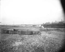
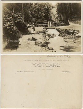
Kitsilano Beach, unused utility poles
Kitsilano Beach, construction materials, bathhouse, and change stall

The city of Vancouver, British Columbia

Staff of Pure Milk Dairy Co. Samuel Garvin Prop. Vancouver B.C. 15/6/16

Samuel Garvin Prop. & staff of pure Milk Dairy Co. Vancouver. B.C. June 15.1916

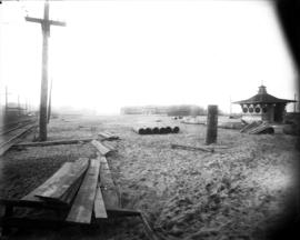
Park on Beach Avenue, facing south
Kitsilano Beach, tennis courts

Victoria Park

Tatlow Park, families using park facilities with homes in the background

Park on Beach Avenue, facing south with children and woman

Stanley Park Vancouver B.C.
![[Ha]stings and Cambie Sts., Vancouver, B.C.](/uploads/r/null/e/c/2/ec2ef8bedeff2bedb35c6288a6b94e5a2cfb9a8a3e1c83175f65e527166e4d7a/43ea6e0e-a15b-49b2-8bf8-7925dc29363f-AM1052P-1063_142.jpg)
[Ha]stings and Cambie Sts., Vancouver, B.C.

Stanley Park, 2nd Beach, B.C.

Twisted trunks of maple trees in Stanley Park with house and garden beyond

Trees and walkway overlooking Coal Harbour in Stanley Park

Grove of cedars and firs, Stanley Park

Bathing beach, English Bay, B.C.
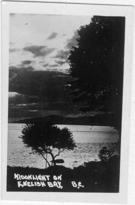
Moonlight on English Bay, B.C.

Brockton Point, Stanley Park from water

Duck pond with Lumberman's Arch in distance, Stanley Park
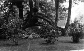
Cleared area with shrubs around maple trees in Stanley Park
![The Sentinal [sic], Stanley Park, Vancouver, B.C.](/uploads/r/null/e/0/7/e0790096e5f9aa3442b75c3eb4d46ed6188657733cf76785ef9c0f3ff3f19058/baf1cb2b-328b-49c3-bfb9-d1407b10807c-AM1052P-1063_142.jpg)
The Sentinal [sic], Stanley Park, Vancouver, B.C.
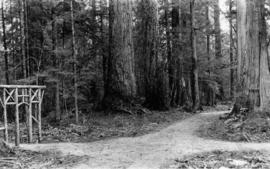
Forest walk and ornamental gateway of cedar logs in Stanley Park

Pathways in Stanley Park looking north

Duck pond and fountain in the snow, Stanley Park
![Hotel Vancouver[,] Vancouver, B.C.](/uploads/r/null/f/e/6/fe6a71415352118aaa55835104433ce0bbd99a73a2c244ab16b410a0477c62f3/0e271fcf-3f01-4968-bd2c-56e2a7553fa0-AM1052P-1063_142.jpg)
Hotel Vancouver[,] Vancouver, B.C.
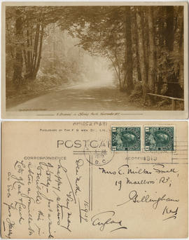
A driveway in Stanley Park, Vancouver BC

Evening, Prospect Point, Stanley Park
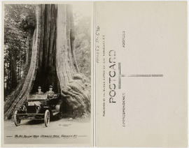
The Big Hollow Tree, Stanley Park, Vancouver, B.C.

Grave of Pauline Johnson, Stanley Park, Vancouver, Canada
The ravine, Stanley Park, Vancouver, B.C.

Outdoor checker board, Stanley Park, Vancouver, B.C.

In Stanley Park, Vancouver, B.C.
![[Victory Square from Cambie and Pender Streets]](/uploads/r/null/1/e/1eca0f5c670823e43d2017c8560b46d02a749e64590b60b2202a2ffce0b31cf4/b738e827-eef3-49b5-9ba2-763a7e2a3354-A09378_142.jpg)
[Victory Square from Cambie and Pender Streets]
![Chambers Family - Group [portrait in Clark Park]](/uploads/r/null/0/3/0324af74bf7073516b0fca5e235edec6c5a8dbf67f93a037d6b98018e56b5063/acc1b80d-d53a-4d46-b436-f91107e7616a-A17123_142.jpg)
Chambers Family - Group [portrait in Clark Park]
![Chambers Family - Group [portrait in Clark park]](/uploads/r/null/1/1/118b69452b8ab91b683435805106082dbaf890e7a2e7b6a6ebbe18623e9dccdf/d3df08b3-a337-4762-ae6d-120ea294fa71-A17124_142.jpg)
Chambers Family - Group [portrait in Clark park]
![[View of the Great Northern (Union) and Canadian National Stations and Thornton Park]](/uploads/r/null/3/f/3f3bf794ce9c38103d6e1f740d743b90cf54e8f2591d95f7406a69a338615147/b1609fd1-5aca-4ca5-87bc-b899b4c76130-A63485_142.jpg)
[View of the Great Northern (Union) and Canadian National Stations and Thornton Park]

Sheet 10 : Clark Drive to Slocan Street and Burrard Inlet to Triumph Street

Sheet 16 : Maple Street to Oak Street and False Creek to Sixteenth Avenue

Sheet 18 : Trutch Street to Maple Street and English Bay to Third Avenue

Sheet 21 : Burrard Street to False Creek and waterfront to Robson Street

Sheet 6 : Knight Street to Slocan Street and Eighteenth Avenue to Twenty-ninth Avenue

Sheet D : Imperial Street to Trutch Street and Fourth Avenue to Sixteenth Avenue

Sheet X : Marine Drive to Ash Street and Fifty-ninth Avenue to Seventy-first Avenue

Sheet 6 : Craddock Street to Boundary Road and Twenty-ninth Avenue to Fortieth Avenue

Sheet 3 : Cambie Street to St. George Street and Twenty-seventh Avenue to Thirty-eighth Avenue

Sheet 13 : Fleming Street to Carlton Street and Forty-seventh Avenue to Fifty-ninth Avenue

Sheet 11 : Cambie Street to St. George Street and Forty-seventh Avenue to Fifty-eighth Avenue