
Water service map of South Vancouver : Kerr Street to Tyne Street and 56th Avenue (54th Avenue) to 67th Avenue (65th Avenue)

Water service map of South Vancouver : Ash Street to Ontario Street and 61st Avenue (59th Avenue) to River Avenue (Marine Drive)

Water service map of South Vancouver : Point Grey boundary to Ontario Street and River Avenue (Marine Drive S.W.) to North Arm of Fraser River
![Collingwood Station [on the B.C.E.R.] Central Park line](/uploads/r/null/9/1/91274133061ed1f0856554d68884180be235d48fe6ad8d73a6437a3d8e6a275c/5aea6d9a-2760-4ff4-924a-cf56eb88582d-A02217_142.jpg)
Collingwood Station [on the B.C.E.R.] Central Park line

Collingwood East
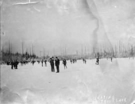
Skating on Trout Lake
![[Members of the Gyro Club at the opening of playground No. 5 in Memorial Park]](/uploads/r/null/e/f/ef2c8a29730c745b960936d024c8db8ee62a1fb078bd47e8187223ff1458ff2e/95e5a641-9500-44ab-ac74-dad9d5d94bcd-A34162_142.jpg)
[Members of the Gyro Club at the opening of playground No. 5 in Memorial Park]
![[Memorial Park opening parade]](/uploads/r/null/b/a/ba3ccff6c8aee6577ae083657ff10fb8b77ac7af511e5c8f706fb833c27be957/7318624e-036a-4147-9ddb-6b8dc28e8b24-A09369_142.jpg)
[Memorial Park opening parade]
![[Looking north over the Chinese market gardens towards Main Street]](/uploads/r/null/e/a/eaf9b88bba7e552dfef6acf759281a0f5d5b3406f8353ea0639e4584753af5bc/9955ed02-fcf9-4178-8829-eb6926856c8e-A37086_142.jpg)
[Looking north over the Chinese market gardens towards Main Street]
![[Looking west from East 64th Avenue (66th Avenue) near Main Street]](/uploads/r/null/8/a/8aa194516d66ebe98d00891761ad8f949935ec7ede3746a1c1e05db72845e7b3/ca6f9059-6540-4098-abb1-e74dc726882b-A37085_142.jpg)
[Looking west from East 64th Avenue (66th Avenue) near Main Street]
![[Opening of Gyro Playground No. 5 at Memorial Park]](/uploads/r/null/3/d/3da74cf293eae5f40c25d388c30b5b5824a7db03ee0f7d02354354492fe46e12/9d6795b0-ea0b-4fee-9c63-feb76cdeb91e-A09344_142.jpg)
[Opening of Gyro Playground No. 5 at Memorial Park]
![[Opening of Memorial Park]](/uploads/r/null/7/8/78570ae6db1d5a4480c607e9cfcdbe2985112ae07ffea8aa103fa5db7543ac6a/47f2e728-61f0-4f6b-9c2e-c1677bc2edc3-A09363_142.jpg)
[Opening of Memorial Park]
![[General store showing products on display in front window]](/uploads/r/null/9/e/9e2f4279e13b48dd382df79b8b6dbc4c7953fb976377b04739d7a1e3e7512529/746b3c68-3322-422c-a6b6-eeb75430782f-A07805_142.jpg)
[General store showing products on display in front window]
![[Group portrait at back door of Fitzgerald McCleery's residence at D.L. 315 (2650 W. 50 Avenue)]](/uploads/r/null/b/3/b32c2fe22269662480a2ea57843b5d97b105b5341dccf4ed41baec83b1bb0224/2352f779-f614-4997-aca4-db11d82f79ec-A24663_142.jpg)
[Group portrait at back door of Fitzgerald McCleery's residence at D.L. 315 (2650 W. 50 Avenue)]
![[Group portrait of Reeve and Council members at opening of Memorial Park]](/uploads/r/null/1/9/19da576b2eeb61f8db8e12ffe4f7173a357e64b4d6e85fd2ed9e45b7c77dc2bf/f39f937f-fcec-4c6a-a465-b25090838f21-A09380_142.jpg)
[Group portrait of Reeve and Council members at opening of Memorial Park]
![[A group in front of the McCleery farmhouse]](/uploads/r/null/1/b/1b7671b0834408e07b06ffab7bf2fd3190277542e278134650f02e0d1eaef232/1e838876-3935-450d-987a-31b25f0db896-A70992_142.jpg)
[A group in front of the McCleery farmhouse]

South Vancouver Auto Camp on Marine Drive about 1 mile east of Fraser Street

David Lloyd George School
![Ferris Rd. Methodist Church. S[outh] Vancouver, B.C.](/uploads/r/null/7/6/7606b833e06d4c3df7eb7ce812a8d7074c6fe4bab422fa506349cfe9550d499e/ef860fc2-649f-4251-acd5-e3404041938b-A04466_142.jpg)
Ferris Rd. Methodist Church. S[outh] Vancouver, B.C.

Gen. Wolfe School. South Vancouver

Marine Drive in South Vancouver

Methodist Church, Ferris Rd., South Vancouver
![Municipal Hall, S[outh] Vancouver [41st Avenue and Fraser Street]](/uploads/r/null/1/8/1856f3ee69bb996645b8d61ccb1df517acdfb9c6cc6b1913b979bed27f379e53/6e917e44-1960-4ba7-abac-537ae45944c5-A04436_142.jpg)
Municipal Hall, S[outh] Vancouver [41st Avenue and Fraser Street]
![[Exterior of the W.A. Grafton residence at 542 West 63rd Avenue]](/uploads/r/null/f/9/f9837efea3e5fb5f0f8b945f0abe577988ea1fba3a893a512f74b2e751feb9a6/9d8f6b06-02d8-4d38-bcd4-c13465e0c181-A61003_142.jpg)
[Exterior of the W.A. Grafton residence at 542 West 63rd Avenue]
![[An open trench for sewer construction on Lakeview Road (Hull Street)]](/uploads/r/null/e/8/e845d82171efbf6016fa7dba8864d5466ffaabe5a9e1f0a833db94d36e545042/ac06d5a1-680e-4b00-a950-07349e94556b-A37200_142.jpg)
[An open trench for sewer construction on Lakeview Road (Hull Street)]
![[Firefighters standing by fire engine in front of South Vancouver Firehall No. 2]](/uploads/r/null/3/0/30369befee7cb3e6ff9976e346e8d38ab0d37fe9547df0c68a4fdb3480020a11/eb215ecb-bea1-4ed6-977a-17437f4d085d-A19278_142.jpg)
[Firefighters standing by fire engine in front of South Vancouver Firehall No. 2]
![[Group of men and firefighters sitting in a South Vancouver fire truck]](/uploads/r/null/4/0/404e077cccf4040ff106e92575bc97047802d5ea2dd50f3b1d2bcee7bfa0cdc9/196ae0f1-8d4b-41a1-afb0-8db0591ee282-A19349_142.jpg)
[Group of men and firefighters sitting in a South Vancouver fire truck]
![[Group portrait of 3 girls]](/uploads/r/null/f/8/f83ebc94d6f92468b190da13a1cdaaeeaf2cd7d7f753317fdf9bff0e37a0f836/ca718b2b-42a4-450d-9c30-0e5a949de4e0-A19362_142.jpg)
[Group portrait of 3 girls]
![[Group portrait of a family]](/uploads/r/null/a/a/aa92cc1b8b2e7d2f37c9c00901985be727b0231e6e3fdcba205ea14c608533de/e3d14238-1591-40a5-943c-7ac1389e0970-A19315_142.jpg)
[Group portrait of a family]
![[Group portrait of sea scouts holding trophies]](/uploads/r/null/c/f/cf5b81ebef8d4b02155d8ce1b3249dd51cc0caec48180630a11d97231695e1b6/37b5e564-3050-47a7-b36c-0eee117b8d5a-A19363_142.jpg)
[Group portrait of sea scouts holding trophies]
![[Head and shoulders portrait of an unidentified man]](/uploads/r/null/8/f/8fc2056a757578ee7ebc1e0d9cfd6e59103431c0bd6533545089048f6e9b82aa/1e964646-7165-4b52-a5bc-802bc74870d9-A19304_142.jpg)
[Head and shoulders portrait of an unidentified man]
![[Head and shoulders portrait of an unidentified man]](/uploads/r/null/f/f/ff804bb1395013e0ef0eb0ffb1f3936c390b226a1d959192552676455426dfba/fe450e3f-be51-4dd4-a25b-9c61a4feee26-A19312_142.jpg)
[Head and shoulders portrait of an unidentified man]
![[Head and shoulders portrait of] S.B. Bennett Xmas, 1916](/uploads/r/null/6/a/6a482eb4a0baff1cfd3548933d2ab5f51ead93647f9731adeec880e827d1c01e/1ef901f9-1ed2-46f8-9b21-8df58a029a55-A19365_142.jpg)
[Head and shoulders portrait of] S.B. Bennett Xmas, 1916
![[Horse and cart travelling along] 34th Avenue [now 33rd Ave.] before paving](/uploads/r/null/1/b/1bea09e65d46b4109283423d33373961bada71fdd08bf41e25c639f1387eb3a6/ec202a7a-9fdb-4901-9fe9-d5885081dc3d-A19285_142.jpg)
[Horse and cart travelling along] 34th Avenue [now 33rd Ave.] before paving
![[House and field]](/uploads/r/null/1/a/1a2b2a67ceeda60f37c2898d28873660da92701b7987279d8ce662448ae1dc87/0ad74e21-e4dc-4a2c-a4d7-1639b88de3ed-A19333_142.jpg)
[House and field]
![[House for sale in South Vancouver]](/uploads/r/null/9/1/911c68296a49f4788d917a5325da76202301a50bfd1c03c899ea1b7a0a349a8c/496bac3f-184a-4945-91d4-6502f2dc45f1-A19358_142.jpg)
[House for sale in South Vancouver]
![[House in South Vancouver]](/uploads/r/null/b/b/bb9fbee9f206be47a0c7d70e334e4a983aed9fe3064eaf2118c353d770499df2/93553ae2-a717-41bb-bb26-c32921ca7bd1-A19359_142.jpg)
[House in South Vancouver]
![[Houses in South Vancouver]](/uploads/r/null/9/6/96beb114cdd36eb0925112d2fd5239b964d9de446cf79bd3c538c89ef082f0b8/090fc4d6-bd26-46bc-835f-1b2282ac15df-A19300_142.jpg)
[Houses in South Vancouver]
![[Man standing in a ditch south of Marine Drive]](/uploads/r/null/6/9/69e5c28f95ae291de523d4354de2fcebdebf0726dbf2f1eb744ae1dece7aa252/45b0aab5-469e-4066-b037-5d0e90812424-A19340_142.jpg)
[Man standing in a ditch south of Marine Drive]
![[Men at work at the Lithtar plant on Joyce Road]](/uploads/r/null/a/c/ac94c10316e7dec58caf2a600757154f400aa9090f890341d21331fe0b9ef0fb/320878ca-17cc-4b9e-87c5-0ff6fab6ab41-A19308_142.jpg)
[Men at work at the Lithtar plant on Joyce Road]
![[Men at work on George St. trunk sewer line]](/uploads/r/null/4/7/4788f026812fbed2f957263e876c418f06e7f0d9bb482079c216d1f8cef201bb/676d5955-0823-49bf-9dbf-2198a6cb4db4-A19325_142.jpg)
[Men at work on George St. trunk sewer line]
![[Men at work on George St. trunk]](/uploads/r/null/1/b/1bb227b4e70168215cb778cc6e5f27437c5577ab681e375c6d8964a80d918fd8/bf07626a-55dc-4c38-9f0b-45cbc05c9827-A19329_142.jpg)
[Men at work on George St. trunk]
![[Men laying bricks between rail tracks at] Main St and 17th Avenue [ in front of the Winram block]](/uploads/r/null/c/8/c8697450d27183fb6e67065417b958fdcfa631f6f8405fce4a7c01593e76d988/fdd59da8-0f9c-4d85-a2f5-eb6cf38a9189-A19262_142.jpg)
[Men laying bricks between rail tracks at] Main St and 17th Avenue [ in front of the Winram block]
![[Men laying] B.C.E.R. tracks - Main St. and 37th Ave.](/uploads/r/null/4/b/4bf176f67fe176156e5885bedfb6ee7376f292d32febe5cb2a81aa7e5c586117/acc1a0c9-e5fd-4c1d-ac0e-3c88b1b2b38a-A19259_142.jpg)
[Men laying] B.C.E.R. tracks - Main St. and 37th Ave.
![[Portrait of an unidentified man in military uniform]](/uploads/r/null/6/4/643e8ab65ac954a83c7e8a6a7521b970bbaf49165977bdf1f3982d3ba43f893b/8e0aa0e1-6dee-44d0-a22b-b65a6a6b9e39-A19296_142.jpg)
[Portrait of an unidentified man in military uniform]
![[Portrait of an unidentified man]](/uploads/r/null/7/3/733a1b53f1618b10b31969a6816919e18f170dc5dbc43c1891d86115f7ffd730/3847a276-b89b-44dc-a23d-3c7a97bd5020-A19353_142.jpg)
[Portrait of an unidentified man]
![[Portrait of an unidentified man]](/uploads/r/null/b/5/b5880a123125c692ec6d1eef1459a7d757953833361bcd992580875e38837742/0fb5f051-5866-4c14-8520-0fbaaaaf7822-A19354_142.jpg)
[Portrait of an unidentified man]
![[Road construction along] 34th Ave. [now 33rd Ave. showing the] laying of bitulithic top finish](/uploads/r/null/9/a/9a5caff7366a9b2eb84ee9067ab596fb2838a0b72863390d05b4ed257fe7b957/1aca593d-bf78-44fd-a723-07514ae8627c-A19288_142.jpg)
[Road construction along] 34th Ave. [now 33rd Ave. showing the] laying of bitulithic top finish
![[Road construction in South Vancouver]](/uploads/r/null/3/f/3f72d6bedfb0da3104587ca0f44cae697ffd9747ca8785369de2e4e42ec57639/ee077f2b-0bce-4923-bed9-415794d41527-A19311_142.jpg)
[Road construction in South Vancouver]
![[Road construction on] 34th [now 33rd Ave. showing] laying [of] bitulithic top finish](/uploads/r/null/3/b/3b0cc756db5e6fb9ed58c629e36003c6d107559f390d418d843f9320fae404d7/6cefc236-3204-421d-ab5b-2ca4bb408677-A19293_142.jpg)
[Road construction on] 34th [now 33rd Ave. showing] laying [of] bitulithic top finish