Print preview Close

Showing 132 results

Archival description
City of Vancouver Archives technical and cartographic drawing collection Land subdivision
Print preview View:

96 results with digital objects Show results with digital objects

Map of portion of New Westminster District with adjacent islands and part of Vancouver Island, B.C.

Item is a map which shows parts of the east coast of Vancouver Island of southern Vancouver Island, the Strait of Georgia, the Gulf Islands, the Sechelt Peninsula, and Greater Vancouver. The map shows the numbers of the district lots for all of the New Westminster Land District.

University Endowment Lands, District Lot 140, group 1, New Westminster District

Item is a map showing proposed land subdivision of the University Endowment Lands and includes a zoning legend. The university buildings and surrounding streets are also included. Notes at the top of the map read, " the design of the subdivision, except with respect to the portion actually subdivided, is tentative" and "the contour elevations are on the City of Vancouver datum which is approximately 100 feet below high water."

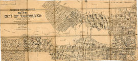
Map of Vancouver, B.C. including Hastings Townsite and D.L. 301

Item is a map which shows Vancouver city streets, blocks, parks and neighbourhood boundaries. Map includes Kitsilano, Shaughnessy Heights, West End, Fairview, Mount Pleasant, Grandview, Rosedale and Hyde Park areas. Map also indicates steamship, car and railway lines.

The map was originally designed to be folded and enclosed in a small folder to which it was attached.

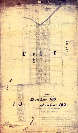
Plan of subdivision of D in lot 183 and subdivision of J in lot 182, City of Vancouver

Item is a subdivision map showing block and lot numbers of subdivisions D and J in lots 183 and 182 respectively. These areas are situated roughly between Burrard Inlet in the north and First Avenue in the south and between Victoria Drive in the east and Clark in the west.

Garden, Hermon and Burwell, Provincial Land Surveyors

Vancouver 1886-1986 : yesterday, gateway to the Pacific : today, crossroads of the world

Map is a souvenir poster reproduced from an original in the National Map Collection, Public Archives of Canada. The map shows lot numbers and lot boundaries for the city of Vancouver as of June 1886. The original map was entitled "Plan of the city of Vancouver, Western Terminus of the Canadian Pacific Railway".

British Columbia federal constituencies

Item is a map sheet with two maps and data regarding federal constituencies in British Columbia. The principal map shows the boundaries of the constituencies. The secondary map is a detail map showing the boundaries in constituencies in Greater Vancouver. The constituency data includes the number of voters in each constituency, the number of votes cast in the 1940 election, and each candidate's name.

City-owned lands-False Creek

Item is a map showing the location of City-owned properties around the perimeter of the western half of False Creek, west of the Connaught Bridge (Cambie Street Bridge) as of Nov. 1969. City-owned lots are outlined in coloured pencil. Notations are also included on land usage, ownership and land transfers os some south shore properties not owned by the City.

Annotations have been made on a part of a copy of a base map originally created to show land transfers between the C.P.R and the Government of British Columbia.

Vancouver (B.C.). Properties Division

Hastings Townsite

Item is a partial sectional map of Hastings Townsite showing streets, railways, legal addresses, some lot sizes, and municipal boundaries. Item has been annotated with information regarding property ownership, including identification of properties included in a 1919 tax sale, and various symbols of unspecified meaning.

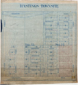
Hastings Townsite : Nanaimo Street to Renfrew Street and Burrard Inlet to Cambridge Street

Part is a sheet of a sectional map of Hastings Townsite showing streets, railways, legal addresses, some lot sizes, and municipal boundaries. Item has been annotated with information regarding property ownership and various symbols of unspecified meaning.

Hastings Townsite : Renfrew Street to Rupert Street and 5th Avenue to 13th Avenue

Part is a sheet of a sectional map of Hastings Townsite showing streets, railways, legal addresses, some lot sizes, and municipal boundaries. Item has been annotated with information regarding property ownership, including identification of properties included in a 1919 tax sale, and various symbols of unspecified meaning.

Hastings Townsite : Rupert Street to Boundary Road and 5th Avenue to 13th Avenue

Part is a sheet of a sectional map of Hastings Townsite showing streets, railways, legal addresses, some lot sizes, and municipal boundaries. Item has been annotated with information regarding property ownership, including identification of properties included in a 1919 tax sale, and various symbols of unspecified meaning.

Hastings Townsite : Nanaimo Street to Renfrew Street and 13th Avenue to Strathcona Road (22nd Avenue)

Part is a sheet of a sectional map of Hastings Townsite showing streets, railways, legal addresses, some lot sizes, and municipal boundaries. Item has been annotated with information regarding property ownership, including identification of properties included in a 1919 tax sale, and various symbols of unspecified meaning.

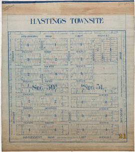
Hastings Townsite : Nanaimo Street to Renfrew Street and Strathcona Road (22nd Avenue) to Government Road (29th Avenue)

Part is a sheet of a sectional map of Hastings Townsite showing streets, railways, legal addresses, some lot sizes, and municipal boundaries. Item has been annotated with information regarding property ownership and various symbols of unspecified meaning.

Hastings Townsite : Renfrew Street to Rupert Street and Strathcona Road (22nd Avenue) to Government Road (29th Avenue)

Part is a sheet of a sectional map of Hastings Townsite showing streets, railways, legal addresses, some lot sizes, and municipal boundaries. Item has been annotated with information regarding property ownership and various symbols of unspecified meaning.

Hastings Townsite : Rupert Street to Boundary Road and Strathcona Road (22nd Avenue) to Government Road (29th Avenue)

Part is a sheet of a sectional map of Hastings Townsite showing streets, railways, legal addresses, some lot sizes, and municipal boundaries. Item has been annotated with information regarding property ownership and various symbols of unspecified meaning.

Map of part of the New Westminster District shewing the proposed new municipality of Burnaby

Item is a map showing boundaries of a proposed new municipality of Burnaby, which would include all land outside the "old" City of Vancouver between Burrard Inlet and the Fraser River and west of North Road. The map also shows the boundaries of District Lots in this area.

Garden, Hermon and Burwell, Provincial Land Surveyors

West section Richmond municipality

Item is a copy of part of a published map of Richmond, B.C. The map shows lot numbers, post offices, dikes, streets, roads, swinging bridges, churches, schools, municipal boundaries and geographical features in the area from Marpole in the north to Gunn Island in the south and from Jacombs Road in the east to Sturgeon Bank in the west. The portion has been annotated with a grid, but information is included which indicates what the lines mean.

Results 51 to 100 of 132