![[Back of] 818 - 826 Main Street](/uploads/r/null/2/b/2bc994c70b7ed51271c77148769e11f13913840e237de9342f1f5476fe0b4a55/6d87d840-1720-40f5-af91-6194ad666a89-A59008_142.jpg)
[Back of] 818 - 826 Main Street
![828 - 830 Main Street [front]](/uploads/r/null/c/3/c3ec6372cb389b3f3002c40f07cf10a993fac41b82b0fea413bb9122c4bde6a3/ad6b48d3-1cdc-4083-bc05-61a3898c2f3d-A59009_142.jpg)
828 - 830 Main Street [front]
![[Back of] 832 Main Street](/uploads/r/null/0/a/0a4ed0ac5fc8779c15083c3723c1a92ec53b82bfab780b771401613661641094/c4f99030-e1c4-4651-9010-0abd9aa0856b-A59012_142.jpg)
[Back of] 832 Main Street
![237 Prior Street [front]](/uploads/r/null/c/6/c6c9a905d4a3087d7e5ac2a11727c63652365242163606c076b0780d773b91c7/3630d6b8-c919-42e2-afa1-83f9eb8e32fb-A59013_142.jpg)
237 Prior Street [front]
![249 Prior Street [front]](/uploads/r/null/a/0/a042bf2d60777bd44837fabfa480ad11e21186abed4df74e154555ab5fdd6264/e05f1807-ec02-4547-93b4-a3976498e093-A59015_142.jpg)
249 Prior Street [front]
![259 Prior Street [Chou Doely Gam cabins front]](/uploads/r/null/c/4/c4dfbcbda5cfa1bb1f5e80a4da2ccfca8742d7a0bd74f845c5039760322962d1/84bddb40-670d-44a8-b81b-ba105f93aa6a-A59021_142.jpg)
259 Prior Street [Chou Doely Gam cabins front]
200 block Prior Street N/S and 200 block Union Street S/S
![224 Union Street [back]](/uploads/r/null/0/9/097cf00086d2c3783c04485d0c3d9a3c8d658e3cbd8531ac48817ebf394a3b4e/fa680b57-04cd-4a33-b83d-6fb093403d87-A59032_142.jpg)
224 Union Street [back]
![226 Union Street [front]](/uploads/r/null/8/8/8842e2123ba538de2aa547a15081ed78738fbb6edefcecc8615b250ce9fcd725/5ff10bf2-82bc-47ea-bbad-830a6a20e82b-A59033_142.jpg)
226 Union Street [front]
![226 Union Street [back]](/uploads/r/null/8/4/84fa1b5ddd666c3c6d9426ed5885795fa28e585fda16f06535664a11f8b7be0a/bcfb75f7-cac1-4675-a4b9-47dca5998510-A59034_142.jpg)
226 Union Street [back]
![264 Union Street [front]](/uploads/r/null/b/3/b3478c612ceb9d033b16ed09e2f52a1dd8f2cb29520e9cc4ad527a9d217b189b/01e220c4-d656-4042-8d3a-69114b290c7d-A59042_142.jpg)
264 Union Street [front]
![[Western Assembly Ltd. shed, 94 West Pender Street (rear)]](/uploads/r/null/f/9/f95f7aba035edf4d5afeb10c133ce3cdd0f7a4521fcdaaa5290bcbc76dbeb60d/4046eb74-bce3-4733-9056-7b8fa52b0d34-A59066_142.jpg)
[Western Assembly Ltd. shed, 94 West Pender Street (rear)]
![[Western Assembly Ltd. shed, 94 West Pender Street (rear)]](/uploads/r/null/3/4/34b5f4a263d5c309c616cd7d2abf02376fe515fe00ed297748ea44a85c0afe32/f4855238-e473-44d7-906f-3e3f59095040-A59070_142.jpg)
[Western Assembly Ltd. shed, 94 West Pender Street (rear)]

McDonald Cedar Products (piers G17 to G19)

McDonald Cedar Products (piers G17 to G19)
![Rear and west side view of building [219 - 221 Prior Street]](/uploads/r/null/2/7/27ba93d2aef133420c8631082e747e51c5c23273430afd0dbe124a406558da82/8cf1a45a-fd1d-48f3-98bd-f26fad39ad22-A59059_142.jpg)
Rear and west side view of building [219 - 221 Prior Street]
![Subject [Iberica Garage and Northland Cafe 219 - 221 Prior Street] as seen looking northwest acro...](/uploads/r/null/5/9/59c867778a549c53cb33629eccef332aa2ec108aee392ce359d8ccbf0353b000/cd57f892-bc00-478d-bb0b-f8a4d50338ff-A59060_142.jpg)
Subject [Iberica Garage and Northland Cafe 219 - 221 Prior Street] as seen looking northwest across Prior Street
![[219 and] 221 Prior Street](/uploads/r/null/b/0/b045e3b739fb000f7ef729743a67e781a07dc8a74ba86808e23fc0db4f7aed18/d597b9dd-ddf4-4c9d-8494-c98bc24b1cc2-A59046_142.jpg)
[219 and] 221 Prior Street
![[219 and] 221 Prior Street](/uploads/r/null/1/6/16519d39f4c06087f60b1270989ec7b655ab61d7a350c02f2eb1546580b0d0ea/bb4e4d5f-e46e-4f9a-bbfd-c58be37656de-A59047_142.jpg)
[219 and] 221 Prior Street
![[219 and] 221 Prior Street [back view of the Iberica Garage and the Northland Cafe]](/uploads/r/null/2/2/2222e00535a17f88b2e1e591a9bae8c13d37d8ded5391080a8f0316afd4edd3a/2757dd36-2905-42d4-a78c-173cfc9a3e22-A59048_142.jpg)
[219 and] 221 Prior Street [back view of the Iberica Garage and the Northland Cafe]
![[219 and] 221 Prior Street](/uploads/r/null/c/d/cd282c2bf7b2f0067fa876724b323da0f28efab180af2a1e6e5ff4889fa7a07b/6913f428-7a6b-4ed7-baa8-d2a0dc3d6467-A59049_142.jpg)
[219 and] 221 Prior Street

Partial view of shoreline from Burrard Bridge

View of boats and debris under Burrard Bridge

Sewage : area bounded by Joyce Street, Boundary Road, Wellington Avenue and Kingsway

Plan of district lot boundaries, City of Vancouver, B.C.

Sheet 10 : Clark Drive to Slocan Street and Burrard Inlet to Triumph Street

Sheet 8 : McLean Drive to Slocan Street and William Street to Seventh Avenue

Sheet 16 : Maple Street to Oak Street and False Creek to Sixteenth Avenue

Sheet 18 : Trutch Street to Maple Street and English Bay to Third Avenue

Sheet 21 : Burrard Street to False Creek and waterfront to Robson Street

Sheet 6 : Knight Street to Slocan Street and Eighteenth Avenue to Twenty-ninth Avenue

Sheet D : Imperial Street to Trutch Street and Fourth Avenue to Sixteenth Avenue

Sheet G : Trafalgar Street to Granville Street and Sixteenth Avenue to Nanton Avenue

Sheet O : Holland Street to Elm Street and Thirty-eighth Avenue to Forty-ninth Avenue

Sheet T : Marine Crescent to Granville Street and Forty-ninth Avenue to Sixty-first Avenue

Sheet X : Marine Drive to Ash Street and Fifty-ninth Avenue to Seventy-first Avenue

Sheet 6 : Craddock Street to Boundary Road and Twenty-ninth Avenue to Fortieth Avenue

Sheet 3 : Cambie Street to St. George Street and Twenty-seventh Avenue to Thirty-eighth Avenue

Sheet 13 : Fleming Street to Carlton Street and Forty-seventh Avenue to Fifty-ninth Avenue

Sheet 11 : Cambie Street to St. George Street and Forty-seventh Avenue to Fifty-eighth Avenue

Sheet 9 : Fleming Street to Carlton Street and Thirty-seventh Avenue to Forty-eighth Avenue

City of Vancouver redevelopment : project 1 : generalized plan of redevelopment
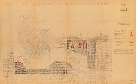
City of Vancouver redevelopment : project 1 : generalized plan of redevelopment

Frank Jones, Commissioner 1956-1958
![2409 Main Street [F.W. Woolworth Co.]](/uploads/r/null/5/c/1/5c182ddd1b224ad36b6d4f9a7583c1e06c1d4e9285d4a9894429c399380c5bfe/1998be35-c0d5-44ef-9e62-48d7f21e39b1-CVA332-25_142.jpg)
2409 Main Street [F.W. Woolworth Co.]
![2409 Main Street [F.W. Woolworth Co.]](/uploads/r/null/f/d/f/fdfdaab03f8fc2d005116b0dd3377d6a2c57a4c3edd0de77d2ca93074889c65a/df886338-9dc6-4d85-997e-68d6b0aed5c9-CVA332-26_142.jpg)
2409 Main Street [F.W. Woolworth Co.]

The Fat Cat and The Boiler Room

Sidewalk scene, Powell Street near Maple Tree Square, Gastown

Guenter's delicatessen

The Quest, Gassy Jack's Place, and Vancouver Supply Company Ltd.