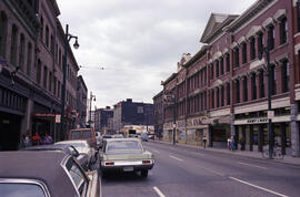
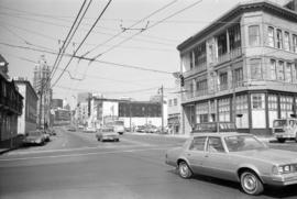
![[00 block Water Street building, 2 of 2]](/uploads/r/null/b/4/e/b4ebc65a207bb871ecd923d3c49e0cc753ee5e32d5589a75e49282bae645e79a/a5a2d90d-eea8-4a81-a896-a3a665aace16-CVA1095-14723_142.jpg)
[00 block Water Street building, 2 of 2]
- COV-S644-: CVA 1095-14723
- Item
- 1973
Part of City of Vancouver fonds
206332 results with digital objects Show results with digital objects
[00 block Water Street building, 2 of 2]
Part of City of Vancouver fonds
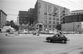
![[00 block Water Street building, 2 of 2]](/uploads/r/null/e/5/b/e5b06c1afc67f9830f03e78f341348ac5977cdd191bc8006c34846a0071c4a28/405f3d53-ea1c-4e9e-80ea-b59b30065e87-CVA1095-14470_142.jpg)
[00 block Water Street building, 2 of 2]
Part of City of Vancouver fonds
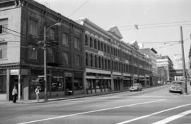
![[00 Block Water Street businesses]](/uploads/r/null/d/f/7/df7ac18bf801975e6d85583cd15639e244d28e411fa77b497281654e737980cd/de6519b1-6ce1-4ebf-ba1e-53af0927d059-CVA1095-08704_142.jpg)
[00 Block Water Street businesses]
Part of City of Vancouver fonds
Item is a photograph that depicts businesses on Water Street. Visible are signs for Daruma Restaurant, Nelly's Barber Shop at 15 Water Street, and Mc and Mc Acklands.
Part of City of Vancouver fonds
Part of City of Vancouver fonds
![[00 block West Hastings Street businesses, 1 of 3]](/uploads/r/null/3/d/d/3ddd4a738c3a3be2e04a0521500f44c082f8b34bef7962f3bf3d8b57bfbe5349/b03af893-cdd2-4dcd-8ea5-607c3353b0ed-CVA1095-14366_142.jpg)
[00 block West Hastings Street businesses, 1 of 3]
Part of City of Vancouver fonds
![[00 block West Hastings Street businesses, 2 of 3]](/uploads/r/null/e/4/e/e4e63dc06ed2a14f74fc8209d4489e7cb8a1e90e4e8af0c202f67ef04cba3a60/0fa81725-a988-4533-a1f5-f85bc513fd4d-CVA1095-14367_142.jpg)
[00 block West Hastings Street businesses, 2 of 3]
Part of City of Vancouver fonds
![[00 block West Hastings Street businesses, 3 of 3]](/uploads/r/null/5/a/4/5a47f7f10208cbf2cdeea815efa5e79349d1171896577e9aa377a4e11d8e8d7c/4d395cf8-8130-4135-ba3b-d8689142e2a9-CVA1095-14368_142.jpg)
[00 block West Hastings Street businesses, 3 of 3]
Part of City of Vancouver fonds
![[00 block West Hastings Street parking lot, 1 of 3]](/uploads/r/null/d/1/9/d19011dcf270a885f1ac2079f25876ce7a1b7e0f2ebef89244b352782f123985/317612ce-01d9-4c20-8946-01cf0eb02c2c-CVA1095-13885_142.jpg)
[00 block West Hastings Street parking lot, 1 of 3]
Part of City of Vancouver fonds
![[00 block West Hastings Street parking lot, 2 of 3]](/uploads/r/null/4/7/b/47b452780a377beb4cd483308904c77b555ef6812faf234d90199d1da2f41856/001588a2-599a-42cc-9b37-dfc0c28c6b1c-CVA1095-13886_142.jpg)
[00 block West Hastings Street parking lot, 2 of 3]
Part of City of Vancouver fonds
![[00 block West Hastings Street parking lot, 3 of 3]](/uploads/r/null/e/2/f/e2fcf3e7e2d886924b106dde373721b5e66fd0f83f2e8324d0d9a9a495351cd2/fb4ec3e7-1306-4373-99a1-3eef20bfdb62-CVA1095-13887_142.jpg)
[00 block West Hastings Street parking lot, 3 of 3]
Part of City of Vancouver fonds
![[00 block West Pender Street]](/uploads/r/null/9/c/1/9c127b44a7c38770f9503070c04241c4f938fe6ec33f52e9f00b96602fec1ccd/d4de8218-d5a1-4668-9a89-e143eff28e46-CVA1095-13951_142.jpg)
Part of City of Vancouver fonds
![[00 block West Pender Street]](/uploads/r/null/8/1/5/815943fe27ba5d33c8dc74b8b1b232f4e80af40955e8cc4b33e50f228d7d68ee/422f5080-7362-43f8-9f2f-753a94560d07-CVA1095-09326_142.jpg)
Part of City of Vancouver fonds
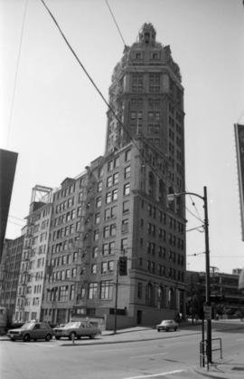
![[00 Block West Pender Street building]](/uploads/r/null/6/3/0/630f038cd72236b85179ac9c29ab55247239927017a0037370d6c4d324e9288c/89128892-2ede-44dd-b04f-0252eaf4a8e1-CVA1095-13097_142.jpg)
[00 Block West Pender Street building]
Part of City of Vancouver fonds
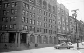
![[00 block West Pender Street businesses]](/uploads/r/null/0/1/d/01d0402ca760e0fd86f3b9e58da53a30e92cf4cdd0a59a4405e44cfecbe3145e/4f9ab104-4457-4d9a-a5ea-3fe8adebed58-CVA1095-14365_142.jpg)
[00 block West Pender Street businesses]
Part of City of Vancouver fonds
![[00 block West Pender Street parking lot and advertisements]](/uploads/r/null/0/e/3/0e3308a2c6ec86d078279bf92ef8679fc262f3ddf573cc564fc03c8f877cb71e/e13b07bc-b0b1-4666-b4bd-7a2cbfe97e6e-CVA1095-14240_142.jpg)
[00 block West Pender Street parking lot and advertisements]
Part of City of Vancouver fonds

Part of City of Vancouver fonds
Image shows the west approach to the Georgia Viaduct, includes a Coca Cola billboard, has two French Maid Products painted advertisements on the south side of the Beatty Street building, and the Sun Tower is in the background.
00 West Cordova Street south side
Part of City of Vancouver fonds
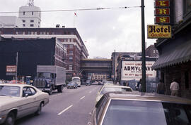
Images show Army & Navy Department Store.

00 West Cordova Street south side
Part of City of Vancouver fonds
Images show Army & Navy Department Store.

00 West Hastings Street north side
Part of City of Vancouver fonds

00 West Hastings Street north side
Part of City of Vancouver fonds
00 West Hastings Street north side
Part of City of Vancouver fonds
Image shows Fields Stores Ltd.

00 West Hastings Street north side
Part of City of Vancouver fonds
Image shows Save-On Meat Market.

00 West Hastings Street south side
Part of City of Vancouver fonds

00 West Hastings Street south side
Part of City of Vancouver fonds
Images show Wosk's Ltd.

00 West Hastings Street south side
Part of City of Vancouver fonds
Image shows San Francisco Pawnbrokers Ltd.

00 West Hastings Street south side
Part of City of Vancouver fonds

00 West Hastings Street south side
Part of City of Vancouver fonds
Images show Wosk's Ltd. at 58 West Hastings

00 West Hastings Street south side
Part of City of Vancouver fonds
Image shows Bank of Montreal.

00 West Pender Street north side
Part of City of Vancouver fonds
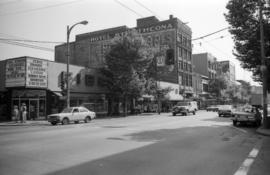
Image shows Arco Hotel.

00 West Pender Street north side
Part of City of Vancouver fonds
00 West Pender Street north side
Part of City of Vancouver fonds
00 West Pender Street north side
Part of City of Vancouver fonds
00 West Pender Street south side
Part of City of Vancouver fonds
00 West Pender Street south side
Part of City of Vancouver fonds
00 West Pender Street south side
Part of City of Vancouver fonds

00 West Pender Street south side
Part of City of Vancouver fonds
Image shows Chatham Steel Wholesale.

00 West Pender Street south side
Part of City of Vancouver fonds
![[000 block East Pender Street, 1 of 3]](/uploads/r/null/f/c/6/fc6342f0781510b485897f7d121b1fe81058df12cdeb13398cf943a0f3dd6fea/161768a3-63dd-42d2-af82-3064386b12cf-CVA1095-06779_142.jpg)
[000 block East Pender Street, 1 of 3]
Part of City of Vancouver fonds
![[000 block East Pender Street, 2 of 3]](/uploads/r/null/d/1/8/d18d6a25f2c6cc70667449fdca3e0630ee758cc181894c02e7f370005acc0b24/832fd3d3-228b-4ebb-a975-8d717fe931d6-CVA1095-06780_142.jpg)
[000 block East Pender Street, 2 of 3]
Part of City of Vancouver fonds
![[000 block East Pender Street, 3 of 3]](/uploads/r/null/9/1/f/91ff6069571188213682e32a5f679d941cbbaeca77bf16a8fee67b1b4646879c/6bc09737-b5e6-42e7-9640-58472f208b00-CVA1095-06781_142.jpg)
[000 block East Pender Street, 3 of 3]
Part of City of Vancouver fonds
Item includes census land delineation code for cities, municipalities and villages.
Item includes inset maps of Creston area and Rossland Trail area, as well as census land delineation code for cities, municipalities and villages
09-03 : Okanagan Similkameen and Kettle Valleys
Item includes inset map of the Okanagan Valley, as well as census land delineation code for cities, municipalities and villages
Item includes census land delineation code for cities, municipalities and villages.
Item includes inset map of Nanaimo area and greater Victoria, as well as census land delineation code for cities, municipalities and villages
09-06 : Kamloops-Lillooet Region
Item includes census land delineation code for cities, municipalities and villages.
09-07 : Central Mainland Coast
Item includes census land delineation code for cities, municipalities and villages.
Item includes census land delineation code for cities, municipalities and villages.
Item includes census land delineation code for cities, municipalities and villages.