![[Sheet 11 : Wall Street to Rupert Street and McGill Street to Burrard Inlet]](/uploads/r/null/e/b/eb84fb8de9ca2e1644a2e39bcbaad5253c563e8716cf25114e675fb7d40365ea/0935fb81-4662-411a-bdfd-c9823c7fb82b-MAP339_142.jpg)
[Sheet 11 : Wall Street to Rupert Street and McGill Street to Burrard Inlet]
![[Sheet 13 : Rupert Street to Gilmore Avenue and Eton Street to Burrard Inlet]](/uploads/r/null/f/0/f03aaa2671556fb722cf612a9736c0a6b919aff4af5a9dbe048dd93863af5773/30eb2a4c-b404-4552-81da-7461e4aacfaa-MAP339_142.jpg)
[Sheet 13 : Rupert Street to Gilmore Avenue and Eton Street to Burrard Inlet]
![[Sheet 16 : Rupert Street to Gilmore Avenue and Fifth Avenue to Kitchener Street]](/uploads/r/null/6/2/6247d4ce631b144e891bbf078d02b8397e56f53625f45e0c464d4bc0e213b752/d68185e8-9db3-488c-a115-03184f2e1941-MAP339_142.jpg)
[Sheet 16 : Rupert Street to Gilmore Avenue and Fifth Avenue to Kitchener Street]
![[Sheet 14 : Cassiar Street to Carleton Avenue and Pender Street to Eton Street]](/uploads/r/null/a/4/a404347152c9328da5ec443862d19bc937a2199f1ce3cde01729819bfd1272d2/5ec2b15f-3c41-4c16-8567-f00ced74929f-MAP339_142.jpg)
[Sheet 14 : Cassiar Street to Carleton Avenue and Pender Street to Eton Street]
![[Sheet 15 : Rupert Street to Carleton Avenue and Kitchener Street to Pender Street]](/uploads/r/null/b/7/b7b353e0ba4ef92f21d8b4148594896da61b022d62168ec30d592e80b71eb373/6461e269-e3e0-4cad-b202-be701b9eac5b-MAP339_142.jpg)
[Sheet 15 : Rupert Street to Carleton Avenue and Kitchener Street to Pender Street]
![[Sheet 19 : Clark Drive to Nanaimo Street and Second Avenue to Frances Street]](/uploads/r/null/6/e/6ead2ad53e7927dc776c7c6e209eaf9f3e6dc61a60b191a0180e7c1e60ef8ace/46817199-aca3-4b79-afda-f95b0d9f2f0b-MAP339_142.jpg)
[Sheet 19 : Clark Drive to Nanaimo Street and Second Avenue to Frances Street]
![[Sheet 21 : Homer Street to Main Street and Fourth Avenue to Georgia Viaduct]](/uploads/r/null/8/c/8c7ce2ae32274b3000b670b2a47c1114fd3c3faf20caeaef1a64c8137aab4f37/d256dda0-fa87-4985-97d6-ed6431e5a608-MAP339_142.jpg)
[Sheet 21 : Homer Street to Main Street and Fourth Avenue to Georgia Viaduct]
![[Sheet 23 : Balaclava Street to Maple Street and Third Avenue to English Bay]](/uploads/r/null/3/a/3a54a965065dcf8e280a31b4062305fcb93608d40098e982820d383458c84410/0437e9bd-e467-4a81-83ee-f6e9e7ec43b2-MAP339_142.jpg)
[Sheet 23 : Balaclava Street to Maple Street and Third Avenue to English Bay]
![[Sheet 22 : Maple Street to Drake Street and Fourth Avenue to Thurlow Street]](/uploads/r/null/4/2/42281b3ab55033f1c62b4ea532ffecc218f82690d1735cd3bb58cfbb1c9a5424/cb682ac6-121a-4bac-99a4-5470e73d38f4-MAP339_142.jpg)
[Sheet 22 : Maple Street to Drake Street and Fourth Avenue to Thurlow Street]
![[Sheet 24 : Jericho Beach to Balaclava Street and Fourth Avenue to Cameron Avenue]](/uploads/r/null/e/7/e737857a87702a8fbd029d7bdb109697279cac537d45931818415e380dd2867c/67258081-9a3b-44c0-9191-8a3719f6c999-MAP339_142.jpg)
[Sheet 24 : Jericho Beach to Balaclava Street and Fourth Avenue to Cameron Avenue]
![[Sheet 25 : Blanca Street to Jericho Beach and Fourth Avenue to Locarno Beach]](/uploads/r/null/a/a/aa0a0c46231b6c2f088187b2268cd829388fc6dd96aa8123f7a8f43d92c642cb/395c09b4-af3a-4986-8987-c83c92a27d94-MAP339_142.jpg)
[Sheet 25 : Blanca Street to Jericho Beach and Fourth Avenue to Locarno Beach]

[Sheet 27 : University Endowment Lands and Drummond Drive to Camosun Street and Fourteenth Avenue to Fourth Avenue]
![[Sheet 29 : Balaclava Street to Maple Street and Fourteenth Avenue to Third Avenue]](/uploads/r/null/d/6/d672783fbbcdf46b6e25dc13c2f50caa22e19935f01490a9053af4afffc83c80/9a39458e-9f4b-43a8-a595-082419eecd5b-MAP339_142.jpg)
[Sheet 29 : Balaclava Street to Maple Street and Fourteenth Avenue to Third Avenue]
![[Sheet 30 : Maple Street to Oak Street and Fourteenth Avenue to Third Avenue and False Creek]](/uploads/r/null/2/f/2f9cbcb3930282909d8a62f01384c5c21cf803594c41529ced8de9bed70e9575/e94bfa39-bc0b-46aa-9bdd-b2c0b97f5eba-MAP339_142.jpg)
[Sheet 30 : Maple Street to Oak Street and Fourteenth Avenue to Third Avenue and False Creek]
![[Sheet 32 : Main Street to Clark Drive and Sixteenth Avenue to Great Northern Way]](/uploads/r/null/1/2/1275197193b0488ed8a599413ce061f9bd30140e8bcc64728b9f05c994d8909a/718a0877-7ea9-4090-a67c-7e61c28e238e-MAP339_142.jpg)
[Sheet 32 : Main Street to Clark Drive and Sixteenth Avenue to Great Northern Way]
![[Sheet 33 : Clark Drive to Nanaimo Street and Thirteenth Avenue to Second Avenue]](/uploads/r/null/5/e/5ef811f96e8c284708c2b73dafde35219a65ddca967ebd7473adfc3e76a171d6/a1b4e29f-54ea-431a-8eff-df608d7e60ff-MAP339_142.jpg)
[Sheet 33 : Clark Drive to Nanaimo Street and Thirteenth Avenue to Second Avenue]
![[Sheet 35 : Rupert Street to Ardley Avenue and Grandview Highway to Fifth Avenue]](/uploads/r/null/b/9/b99ee96b798b34d2651dd213f0a858725b96bd6d586dd8d3701744c75c085139/a2e07931-8625-4adb-a51a-547f78416127-MAP339_142.jpg)
[Sheet 35 : Rupert Street to Ardley Avenue and Grandview Highway to Fifth Avenue]
![[Sheet 34 : Nanaimo Street to Rupert Street and Fifth Avenue to Grandview Highway]](/uploads/r/null/4/d/4dec0865cb529d2b3586764b85cb4fe3474714725cb43f9b355eec779ad8162d/6493e9ac-b956-4a83-88fc-b8d6c13efcdf-MAP339_142.jpg)
[Sheet 34 : Nanaimo Street to Rupert Street and Fifth Avenue to Grandview Highway]

[Sheet 37 : Rupert Street to Carleton Avenue and Wellington Avenue to Twenty-second Avenue and Elmwood Street]
![[Sheet 38 : Nanaimo Street to Rupert Street and Twenty-second Avenue to Grandview Highway]](/uploads/r/null/c/a/cad90f0f77fa879900b59b4a35c25c5e44009065121168e70a62d613ae189442/cb54334e-9bba-4633-aa5c-0d322a73ef41-MAP339_142.jpg)
[Sheet 38 : Nanaimo Street to Rupert Street and Twenty-second Avenue to Grandview Highway]
![[Sheet 36 : Rupert Street to Carlton Avenue and Twenty-second Avenue to Grandview Highway]](/uploads/r/null/2/a/2a5d48ee373aa9984afbf5119a86658558d79c8c5df27b60fdf83e4bb2673a3d/2b3f592c-cadf-4bac-a188-0a08249104da-MAP339_142.jpg)
[Sheet 36 : Rupert Street to Carlton Avenue and Twenty-second Avenue to Grandview Highway]
![[Sheet 40 : Inverness Street to Nanaimo Street and Twenty-second Avenue to Thirteenth Avenue]](/uploads/r/null/9/3/9367a0c50f6fa513d717a1972b1bac72acde6d41b002fefcf48ddbd8c8122e8a/c7bfac0b-bf44-441b-b059-fd7bbc0bd4a0-MAP339_142.jpg)
[Sheet 40 : Inverness Street to Nanaimo Street and Twenty-second Avenue to Thirteenth Avenue]
![[Sheet 41 : Ontario Street to Inverness Street and Twenty-eighth Avenue to Sixteenth Avenue]](/uploads/r/null/c/2/c22ca2538905633f64373261ce970df6216075ce4de9e22d491c2e212ce17c1f/616ab944-e39a-4c66-abb4-918b17cc3252-MAP339_142.jpg)
[Sheet 41 : Ontario Street to Inverness Street and Twenty-eighth Avenue to Sixteenth Avenue]
![[Sheet 39 : Kingsway and Nanaimo Street to Rupert Street and Ward Street to Twenty-second Avenue]](/uploads/r/null/0/4/0409c276b1c046750a9680e1310ce46ec18fce0f1dfc928aab80fbe273730918/665972e9-723b-462b-b30f-95f1484b2c51-MAP339_142.jpg)
[Sheet 39 : Kingsway and Nanaimo Street to Rupert Street and Ward Street to Twenty-second Avenue]
![[Sheet 42 : Oak Street to Ontario Street and Twenty-eighth Avenue to Sixteenth Avenue]](/uploads/r/null/c/7/c7489c984c3ec99abcbb22a87a294856654f9c25046416db253386367e8f4001/9f397dcd-244e-47bf-8acc-e4ae1dcd8a0d-MAP339_142.jpg)
[Sheet 42 : Oak Street to Ontario Street and Twenty-eighth Avenue to Sixteenth Avenue]
![[Sheet 43 : East Boulevard to Oak Street and Laurier Avenue to Fourteenth Avenue]](/uploads/r/null/8/8/8846e3e6c19438103b656786c264d5dcccc37b59de3cf8fa85bb05f01b65d8f9/9fb3d6cb-93e9-48d0-be52-05cc55ad4ec4-MAP339_142.jpg)
[Sheet 43 : East Boulevard to Oak Street and Laurier Avenue to Fourteenth Avenue]
![[Sheet 44 : Blenheim Street to Arbutus Street and King Edward Avenue to Fourteenth Avenue]](/uploads/r/null/2/f/2fdf5060ec6fdc47756dc75416312dd42047abea2beed2d99f086c73bd0c8726/2fe0f45d-ad6c-46e6-9a9f-50c795523f5f-MAP339_142.jpg)
[Sheet 44 : Blenheim Street to Arbutus Street and King Edward Avenue to Fourteenth Avenue]
![[Sheet 47 : Camosun Street to Blenheim Street and Thirty-third Avenue to King Edward Avenue]](/uploads/r/null/5/9/59c6b01a85dc6051f7cfecf1f33eb7e7017beb24d0dd57b512fcddc2063e3e8f/eabe5a9f-362b-46a4-9efc-275f9b96459b-MAP339_142.jpg)
[Sheet 47 : Camosun Street to Blenheim Street and Thirty-third Avenue to King Edward Avenue]
![[Sheet 50 : Oak Street to Ontario Street and Thirty-seventh Avenue to Twenty-eighth Avenue]](/uploads/r/null/a/3/a3b7d0414ced2d15d401c5747a576809010cc56bb00c564251adecdb35091358/01957154-6807-4889-bc0f-a1f2455ab066-MAP339_142.jpg)
[Sheet 50 : Oak Street to Ontario Street and Thirty-seventh Avenue to Twenty-eighth Avenue]
![[Sheet 45 : Discovery Street to Blenheim Street and King Edward Avenue to Fourteenth Avenue]](/uploads/r/null/7/b/7b9edfc2a053f0ba6c95af404ad3bf4f22a5e63ff6ddcd9acea2fd6dc469d916/ef5279fc-e406-412e-9886-eddb46d44c27-MAP339_142.jpg)
[Sheet 45 : Discovery Street to Blenheim Street and King Edward Avenue to Fourteenth Avenue]
![[Sheet 46 : Blanca Street to Discovery Street and Sixteenth Avenue to Fourteenth Avenue]](/uploads/r/null/9/0/90f542cbf378be4c0b5366f96f6c5575e76ea3a215a1d517a5c1b7c12ca2425c/8324fff9-cff3-4306-89c6-e6157d1e36a0-MAP339_142.jpg)
[Sheet 46 : Blanca Street to Discovery Street and Sixteenth Avenue to Fourteenth Avenue]

[Sheet 55 : Cecil Street and McHardy Street to Patterson Avenue and Kingsway to Monmouth Avenue and Price Street]
![[Sheet 53 : Inverness Street to Nanaimo Street and Forty-first Avenue to Thirty-second Avenue]](/uploads/r/null/a/9/a9fdfc1181cd3a36ad078c24a5892d8bfc60c5456733839fa59914d5700e6509/5f8f4fc4-26e4-49f3-b5d4-acced16d8490-MAP339_142.jpg)
[Sheet 53 : Inverness Street to Nanaimo Street and Forty-first Avenue to Thirty-second Avenue]

[Sheet 54 : Nanaimo Street to Joyce Street, Cecil Street and McHardy Street and Forty-first Avenue to Ward Street and Vanness Avenue]
![[Sheet 56 : Doman Street and Joyce Street to Boundary Road and Forty-ninth Avenue to Kingsway]](/uploads/r/null/5/e/5ee0f6b78ce9f3b0e0e39795d6220cd37d587872bad7b41b67f4d29c7cb49d4c/f8a321d6-ea4f-4e1f-85da-6d12e149ea85-MAP339_142.jpg)
[Sheet 56 : Doman Street and Joyce Street to Boundary Road and Forty-ninth Avenue to Kingsway]

[Sheet 57 : Nanaimo Street to Doman Street and Joyce Street and Forty-ninth Avenue to Forty-first Avenue]
![[Sheet 58 : Inverness Street to Nanaimo Street and Forty-ninth Avenue to Forty-first Avenue]](/uploads/r/null/5/5/55825f5529a2ab4a1b9c04e6d086f342c86830cc9828262a5f7b22eab255b346/4ce8baf7-a89b-4c24-bec2-d1a45477ca67-MAP339_142.jpg)
[Sheet 58 : Inverness Street to Nanaimo Street and Forty-ninth Avenue to Forty-first Avenue]
![[Sheet 59 : Quebec Street to Inverness Street and Forty-seventh Avenue to Thirty-seventh Avenue]](/uploads/r/null/0/1/015bc0f349dc1228105d4cdd774354b22820bad860e0a822b707d62c3eb343f5/b9fe9076-66e5-4167-b081-e65e8b625778-MAP339_142.jpg)
[Sheet 59 : Quebec Street to Inverness Street and Forty-seventh Avenue to Thirty-seventh Avenue]
![[Sheet 60 : Oak Street to Quebec Street and Forty-sixth Avenue to Thirty-seventh Avenue]](/uploads/r/null/b/5/b5e1b3fe1dda55eb9d0029fcbe47cb6048a48720c1ad1f7b1897640d35203319/e097b4d6-7a5c-41bc-9ca5-1b9e7b57eccc-MAP339_142.jpg)
[Sheet 60 : Oak Street to Quebec Street and Forty-sixth Avenue to Thirty-seventh Avenue]
![[Sheet 61 : Cypress Street to Oak Street and Forty-first Avenue to Thirty-third Avenue]](/uploads/r/null/e/c/ecb192d35087c4f7d7713e1578ae0bc7f934c92ab822401e070cf7a4cf61fdf3/1cfa7241-9da6-4626-aedb-d6bfa44f7d5e-MAP339_142.jpg)
[Sheet 61 : Cypress Street to Oak Street and Forty-first Avenue to Thirty-third Avenue]
![[Sheet 63 : Carnarvon Street to Cypress Street and Forty-first Avenue to Thirty-third Avenue]](/uploads/r/null/4/3/43f21afad72cf7d769c23be0a8b778e288335df1801a3b9d42bace4e74c8ea1a/64b6fa50-ede8-4087-81fc-6b7da9b7dfd1-MAP339_142.jpg)
[Sheet 63 : Carnarvon Street to Cypress Street and Forty-first Avenue to Thirty-third Avenue]
![[Sheet 64 : Balaclava Street to Cypress Street and Forty-ninth Avenue to Forty-first Avenue]](/uploads/r/null/6/d/6d41bb5db0383d13fdc92e51638fb1e2c9ac8e11a664fd9070ee16be3212d8f5/07989ba9-42ff-4d9a-ac56-a25405a93120-MAP339_142.jpg)
[Sheet 64 : Balaclava Street to Cypress Street and Forty-ninth Avenue to Forty-first Avenue]
![[Sheet 62 : Cypress Street to Oak Street and Forty-ninth Avenue to Forty-first Avenue]](/uploads/r/null/7/c/7c5b951f94dee2cfd6a1b82979539f15bd77424ef36377f8e2db0e7bfb4aae10/78c561eb-987a-4aef-9574-18f261df2111-MAP339_142.jpg)
[Sheet 62 : Cypress Street to Oak Street and Forty-ninth Avenue to Forty-first Avenue]
![[Sheet 65 : Camosun Street to Carnarvon Street and Forty-first Avenue to Thirty-third Avenue]](/uploads/r/null/4/0/407c98f21cf3d2ce519b79e8a505fd6a325c965dc1550cdbc00d96b7bc7e5e3d/04862e6e-5125-4593-84de-c80135fd76ce-MAP339_142.jpg)
[Sheet 65 : Camosun Street to Carnarvon Street and Forty-first Avenue to Thirty-third Avenue]
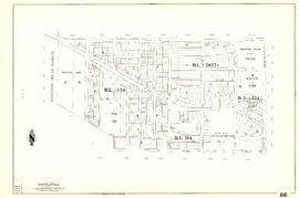
[Sheet 66 : Musqueam Indian Reserve to Balaclava Street and Forty-ninth Avenue to Forty-first Avenue]

[Sheet 67 : Musqueam Indian Reserve to Musqueam Park and North Arm, Fraser River to Southwest Marine Drive]

[Sheet 69 : Musqueam Indian Reserve to Macdonald Street and North Arm of the Fraser River to Forty-ninth Avenue]
![[Sheet 72 : Oak Street to Quebec Street and Fifty-eighth Avenue to Forty-sixth Avenue]](/uploads/r/null/d/9/d95b8e85252fc5bb5a704534795819328aaac0251d8659e64190e79cd61b3037/43d93b13-ddc2-4f78-9ba2-07fbbcf3baa9-MAP339_142.jpg)
[Sheet 72 : Oak Street to Quebec Street and Fifty-eighth Avenue to Forty-sixth Avenue]
![[Sheet 75 : Nanaimo Street to Kerr Street and Bobolink Avenue to Forty-ninth Avenue]](/uploads/r/null/d/1/d14981939464fabe5e1b9488ecd26d62b3e16b1f4d1b8e00ece1bac6fa0dbdfa/a8e1d890-9726-473c-8f49-69d918d62d56-MAP339_142.jpg)
[Sheet 75 : Nanaimo Street to Kerr Street and Bobolink Avenue to Forty-ninth Avenue]
![[Sheet 78 : Kerr Street to Ivy Avenue and North Arm of Fraser River to Southeast Marine Drive]](/uploads/r/null/9/0/90c6186a1aa17588ec162078d412440a826f55dc10a9d49f8e74df97a4d3ff6e/0a3e4f49-3d6d-4dec-95f1-08aa42e666d8-MAP339_142.jpg)
[Sheet 78 : Kerr Street to Ivy Avenue and North Arm of Fraser River to Southeast Marine Drive]