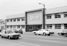
- COV-S639-1-F05-: CVA 790-0127
- Item
- [1985?]
Part of City of Vancouver fonds
2373 results with digital objects Show results with digital objects
Part of City of Vancouver fonds

Part of City of Vancouver fonds

Part of City of Vancouver fonds

Part of City of Vancouver fonds
Part of City of Vancouver fonds
Part of City of Vancouver fonds

Part of City of Vancouver fonds

Part of City of Vancouver fonds

Part of City of Vancouver fonds
Part of City of Vancouver fonds
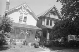
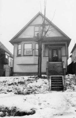
364 West 10th Avenue (revised address 366 West 10th Avenue)
Part of City of Vancouver fonds

Part of City of Vancouver fonds
Part of City of Vancouver fonds

Part of City of Vancouver fonds
![85 [89] West 11th Avenue](/uploads/r/null/e/0/2/e02bcad161f5a77c1196424af8ffd57316e918c6e6b3a40177af43b8de6eee9c/5de6d8ed-0cf3-4cb0-a24b-aa8cd06246b6-CVA790-0241_142.jpg)
Part of City of Vancouver fonds
![85 [89], 95 West 11th Avenue](/uploads/r/null/9/4/b/94ba801df745925c62ed6cf7efd178d1127680acc9815ef9b7dbc691cec0b46d/331f0315-5d6a-49c0-bbbe-9787554c5c9c-CVA790-0242_142.jpg)
Part of City of Vancouver fonds
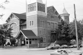
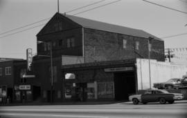
10th & Quebec (Evangelistic Tabernacle)
Part of City of Vancouver fonds
Part of City of Vancouver fonds
Part of City of Vancouver fonds

2740 Guelph Street (Florence Nightingale Elementary School)
Part of City of Vancouver fonds
![[Unidentified house at 12th and Manitoba]](/uploads/r/null/1/9/7/197542186b945fc0fff7d12aa17188e3ebe52575ad708e8785d8ae7e1ee6c6a1/aeb290ad-7318-4867-bc04-c376072ac81b-CVA786-52_142.jpg)
[Unidentified house at 12th and Manitoba]
Part of City of Vancouver fonds

Part of City of Vancouver fonds
Part of City of Vancouver fonds

Project 2 area "h" and part of "b" : identification plan
Part of City of Vancouver fonds
Item is a map created to show the boundaries of redevelopment areas "b" and "h" in Project 2 and Project 2 clearance areas 8 & 9. The map also shows City-owned property, Adjacent lots in same ownership, as well as property, streets and lanes be acquired for the project. The portion of the City depicted in the map is the area between Main Street and Clark Drive and between Evans Avenue and 10th Avenue (D.L.200, D.L. 264A, D.L. 301, and D.L. 2037).
Part of City of Vancouver fonds

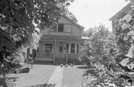
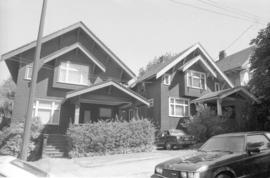
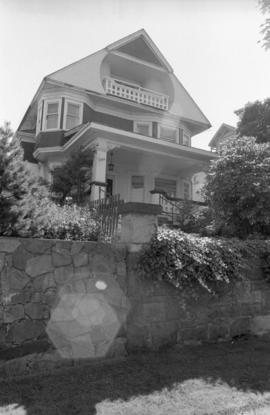
Homes with stone walls in Mount Pleasant area
Part of Pacific Press fonds

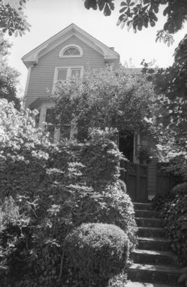
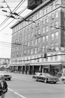
611 E. 7th Avenue, Ivanhoe Apartments
Part of City of Vancouver fonds
![856 E 7th Ave [taken] from road in front of house](/uploads/r/null/1/e/1/1e169ed63448aab64322b92f24f6a0030be4c303645c922538a70931ea5b0441/05d9134e-b168-4f4c-a951-ecbce0562b66-2018-034_142.jpg)
856 E 7th Ave [taken] from road in front of house
Item is a photograph showing houses along East 7th Avenue and two kids playing with a sled in the snow
856 E 7th Ave with fences yard
856 E 7th Ave, Barb and Paddy on front porch
![Garbage landfill - Old pictures [9 of 31]](/uploads/r/null/9/4/94fb11917aad0449cdbc95be0775314fca7563b96e5d5e2a7b957887a89f9025/aecb037f-1613-461c-955d-12289359846d-A66343_142.jpg)
Garbage landfill - Old pictures [9 of 31]
Part of City of Vancouver fonds
Item is a photograph showing the former City dump site at the China Creek park area.
![Garbage landfill - Old pictures [7 of 31]](/uploads/r/null/0/3/037966d3a480af8424da9a1074db4e1880d14c9ede6d18349b6e9ac0e302292e/824b6bec-79e8-44d6-b681-4e7505ba7055-A66341_142.jpg)
Garbage landfill - Old pictures [7 of 31]
Part of City of Vancouver fonds
Item is a photograph showing the former City dump site at the China Creek park area.
![Garbage landfill - Old pictures [10 of 31]](/uploads/r/null/8/5/85376a196eb8953473fd8b7aa51cfea56ad0e1027bf81d21ddf725dd758d359d/9c6df894-addb-4b63-beda-ccc08692a63b-A66344_142.jpg)
Garbage landfill - Old pictures [10 of 31]
Part of City of Vancouver fonds
Item is a photograph showing the former City dump site at the China Creek park area.
![Garbage landfill - Old pictures [11 of 31]](/uploads/r/null/5/1/51b55b6e59c2a514670b4dc3de2f2e0c39304b23ff9b09be4c16885b9f6f0cf7/6917c07e-f0c3-44ed-9022-d02e589a8cbb-A66345_142.jpg)
Garbage landfill - Old pictures [11 of 31]
Part of City of Vancouver fonds
Item is a photograph showing the former City dump site at the China Creek park area.
![Garbage landfill - Old pictures [4 of 31]](/uploads/r/null/b/9/b94bff5190db17d08ae01c0041ce3774bb9a08f2b9291ca1ddf03063c148c27e/18f9ccf3-2a16-4982-9906-fb91edd129a7-A66338_142.jpg)
Garbage landfill - Old pictures [4 of 31]
Part of City of Vancouver fonds
Item is a photograph showing the former City dump site at the China Creek park area.
![Garbage landfill - Old pictures [6 of 31]](/uploads/r/null/2/c/2c7449d52c703aefdd3555e806652c4fd424bde88d2e97dc0c7ec730ac624405/211a505d-59cf-4c5d-a4e6-8b83cc27e299-A66340_142.jpg)
Garbage landfill - Old pictures [6 of 31]
Part of City of Vancouver fonds
Item is a photograph showing the former City dump site at the China Creek park area.
![Garbage landfill - Old pictures [31 of 31]](/uploads/r/null/e/c/ec58eeb7be7b665555ef7fe7e31a2f6279d478f0dd1b602b9cb0e4497e1823a0/46779ce3-de32-407b-b480-32b4111db799-A69141_142.jpg)
Garbage landfill - Old pictures [31 of 31]
Part of City of Vancouver fonds
Item is a photograph showing the former City dump site at the China Creek park area.
![Garbage landfill - Old pictures [3 of 31]](/uploads/r/null/1/f/1f1cb63a4c09b13221d2994d99285a5fb79adaf5e3aa7e93f048b2a9ab68acd7/76544567-3db2-4348-9690-33b6f096f10d-A66337_142.jpg)
Garbage landfill - Old pictures [3 of 31]
Part of City of Vancouver fonds
Item is a photograph showing the former City dump site at the China Creek park area.
![Garbage landfill - Old pictures [8 of 31]](/uploads/r/null/8/9/89ce2feb6a90009a9ab06c6b7acf119aa58cee7b728898e1a491c5b172cbcaca/50b78bb8-0f46-4e53-ab93-58b104a96791-A66342_142.jpg)
Garbage landfill - Old pictures [8 of 31]
Part of City of Vancouver fonds
Item is a photograph showing the former City dump site at the China Creek park area.
![Garbage landfill - Old pictures [5 of 31]](/uploads/r/null/c/1/c1ceb137beb8928bd7f7b521e56630c42adb798000ac8c51bd08854db62ded65/4a798901-45fe-4299-87aa-ca36371c4397-A66339_142.jpg)
Garbage landfill - Old pictures [5 of 31]
Part of City of Vancouver fonds
Item is a photograph showing the former City dump site at the China Creek park area.
2214 Main Street, International Order of Odd Fellows Hall
Part of City of Vancouver fonds
Item is a photograph showing the Arcadian Hall.
![[2222 Main Street]](/uploads/r/null/7/3/f/73f445af78b859aae79f8b93f9bc0d69db340df02c143575a9ffda8a1178429f/224cdaa7-f4e3-4890-92fd-da3f9e322eec-CVA786-55_142.jpg)
Part of City of Vancouver fonds
Also shows a partial view of the building at 2214 Main Street.
![[2720 Yukon Street - McDonald Lodge, 2 of 2]](/uploads/r/null/7/2/b/72b5d830b733ed69cb8b96211832ad0df4362aa25dc3a7ffce8829112eb7fc91/723107a0-c401-4ce7-9cff-97c14f0b24b9-CVA1095-00267_142.jpg)
[2720 Yukon Street - McDonald Lodge, 2 of 2]
Part of City of Vancouver fonds
![[House on 2600-2700 blocks of Yukon street]](/uploads/r/null/b/6/3/b631b17b1debf3234ad7d06116459826a95848b142900c3bd418dc01de67f50f/003c9b20-95d3-4477-9e9e-c60eb979cc9c-CVA1095-00266_142.jpg)
[House on 2600-2700 blocks of Yukon street]
Part of City of Vancouver fonds
![[2720 Yukon Street - McDonald Lodge, 1 of 2]](/uploads/r/null/b/7/0/b70c45559c5f8be44540b2ce8e50c06864be30fc6178523464f2640e8a121394/f56dcb4d-f2ef-4d2c-b468-c7326eb4f472-CVA1095-00268_142.jpg)
[2720 Yukon Street - McDonald Lodge, 1 of 2]
Part of City of Vancouver fonds
![[2636 Yukon Street, 2 of 2]](/uploads/r/null/c/1/2/c1271a1dbe52bebc929924cba80a1c00e7aad74a9c24c7a174f4bf33381a8d6e/ee204789-a9d0-4904-8c18-95500d739887-CVA1095-00271_142.jpg)
Part of City of Vancouver fonds
Item is a photograph that depicts an exterior view of 2636 Yukon St. taken from the intersection at West 11th Ave.
![[2636 Yukon Street, 1 of 2]](/uploads/r/null/0/3/b/03bd5eb1b5040d925925fbc828947119b726e1f45e3f7bddee4ce61f5680f08c/2dc392fd-c55e-4761-85fc-ecacad13a1b7-CVA1095-00270_142.jpg)
Part of City of Vancouver fonds
Item is a photograph that depicts an exterior view of 2636 Yukon St. taken from the intersection at West 11th Ave.
![[House on 2600-2700 blocks of Yukon street]](/uploads/r/null/1/e/7/1e7b674ba2c5010b93c826239d1e78cfe5a099b68287324285b2b9f4a2961aee/3f426bef-a8d9-4ded-bee8-761339a64868-CVA1095-00272_142.jpg)
[House on 2600-2700 blocks of Yukon street]
Part of City of Vancouver fonds
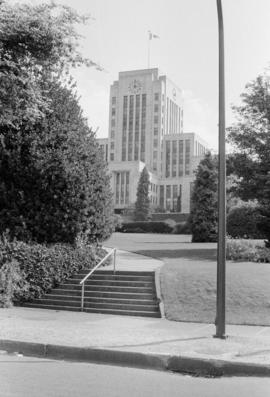
![[Lovers II sculpture, Vancouver City Hall]](/uploads/r/null/0/e/4/0e4e722c677a0ee8051d54c70a5e176b25c7ad83091cd7b87c72fb6267db6752/5f0a14df-b5a3-48c0-a28a-4e0f2332aa0d-CVA1095-00282_142.jpg)
[Lovers II sculpture, Vancouver City Hall]
Part of City of Vancouver fonds
Item is a photograph that depicts the sculpture Lovers II by Gerhard Juchum, located at City Hall, 453 West 12th Ave.
![[Captain George Vancouver sculpture, Vancouver City Hall]](/uploads/r/null/d/6/8/d68711f3517de2847bef248a2bb956b46dcacff457d5d92dfc293c0e06fdee79/b088fbb4-0b6c-4cbd-b278-a04c3107180d-CVA1095-00281_142.jpg)
[Captain George Vancouver sculpture, Vancouver City Hall]
Part of City of Vancouver fonds
Item is a photograph depicting the Captain George Vancouver sculpture by Charles Marega, located outside City Hall (453 West 12th Ave.)