Print preview Close

Showing 783 results

Archival description
City of Vancouver Archives technical and cartographic drawing collection Vancouver (B.C.)
Print preview View:

662 results with digital objects Show results with digital objects

Vancouver, British Columbia

Item is a map showing New Westminster Land District, including lands alienated or covered by application under the Land Act; surveyed timber leases, licences, or berths; Indian reserves; Government reserves; provincial forest boundaries; tree farm licences; municipality boundaries; and park boundaries. Includes a key plan of maps published in the same publisher's series and a reliability diagram noting data sources.

Vancouver, British Columbia

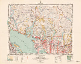
Item is a topographical map showing lands alienated or covered by application under the Land Act, timber leases, native reserves, government reserves, and various boundaries, as well as campsites, picnic sites, forest service lookouts, post offices, settlements, schools, hospitals, mines, dykes, historic monuments, roads, trails, railways, power lines, phone lines, air harbour or seaplane anchorages, etc. Sheet contains an index map showing adjoining maps in the series.

Vancouver, British Columbia : northerly portion, former City of Vancouver : major street plan

Item is a map which has been removed from a copy of the report "A plan for the City of Vancouver, British Columbia, including Point Grey and South Vancouver and a general plan of the region", commissioned by the Vancouver Town Planning Commission from the planning consultants Harland Bartholomew & Associates.

The map shows the existing and proposed revisions to the major street plan in the northern portion of Vancouver. The map also shows present street widths, lines of vehicles and roadway widths versus proposed street widths, lines of vehicles and roadway widths.

Harland Bartholomew and Associates

Vancouver, British Columbia : south-westerly portion, formerly Point Grey : major street plan

Item is a map which has been removed from a copy of the report "A plan for the City of Vancouver, British Columbia, including Point Grey and South Vancouver and a general plan of the region", commissioned by the Vancouver Town Planning Commission from the planning consultants Harland Bartholomew & Associates.

The map shows existing and proposed additions to the major street plan in part of the city that is the former Municipality of Point Grey. The map also shows present street widths, lines of vehicles and roadway widths versus proposed street widths, lines of vehicles and roadway widths.

Harland Bartholomew and Associates

Vancouver, British Columbia : [urban analysis maps]

Maps show land use, land slope and elevation, density of buildings, structural material of buildings, height of buildings, water supply systems, sewage systems, electric power systems, gas trunk systems, population distribution, daytime population distribution, dwelling units, schools, hospitals and doctors, land transportation, port facilities, food manufacturing, textile manufacturing, wood product manufacturing, metal product manufacturing, transportation equipment manufacturing, non-metallic mineral and chemical products manufacturing, retail and wholesale food enterprises, retail and wholesale building materials enterprises, retail and wholesale drugs, general merchandise, apparel and accessories enterprises, retail and wholesale clothing and shoes enterprises, retail and wholesale furnishing enterprises and hotels and eating places in the Greater Vancouver area (including West Vancouver, North Vancouver, Vancouver, Burnaby, New Westminster, the northern portion of Richmond and the western portion of Coquitlam). Much of the data for these maps was derived from the 1961 census of Canada.

Vancouver, British Columbia, Canada

Item is a pamphlet re: Vancouver's Golden Jubilee celebrations July 1-Sept. 7, 1936. The text gives a brief history of Vancouver and describes the climate and geography of the city and surrounding areas. The pamphlet includes an oblique aerial photograph of downtown Vancouver, Kitsilano, Fairview and Stanley Park, with numbers indicating sites of interest, which are listed adjacent.

Vancouver, British Columbia, south-easterly portion, formerly South Vancouver : major street plan

Item is a map which has been removed from a copy of the report "A plan for the City of Vancouver, British Columbia, including Point Grey and South Vancouver and a general plan of the region", commissioned by the Vancouver Town Planning Commission from the planning consultants Harland Bartholomew & Associates.

The map shows major streets of sufficient width, major streets to be widened, new major street connections, present street widths, present lines of vehicles, present roadway widths, proposed street widths, proposed lines of vehicles, proposed roadway widths and pleasure drives in the area of the former Municipality of South Vancouver.

Harland Bartholomew and Associates

Vancouver, Canada

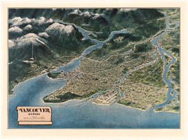
Item is a map of the Lower Mainland from the City of Vancouver east to Port Coquitlam, including the North Shore municipalities, Vancouver, Burnaby, New Westminster, the western portion of Port Coquitlam, Richmond, and the northern portion of Surrey. The pictorial map is in the form of an oblique aerial view oriented to the E/NE.

Visitors map of Vancouver

Part is the front sheet of an unfolded tourism brochure showing Vancouver tourist attractions, The sheet includes a map of downtown Vancouver, with transportation information, a map of the roads in Stanley Park, photographs and information on various sites and attractions in the city, as well as general promotional information.

Results 751 to 783 of 783