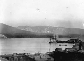
![[Japanese sailing vessel in Vancouver harbour]](/uploads/r/null/6/1/615722a6da22cd03e9c4c0a3c5a9e5e6e9d40ec814b9d461ae00ff9f79998ffe/d2b7e6ef-acc3-4201-afe4-ab04642e0307-A37903_142.jpg)
[Japanese sailing vessel in Vancouver harbour]
- AM1376-: CVA 1376-176
- Item
- [between 1895 and 1915]
462 results with digital objects Show results with digital objects
[Japanese sailing vessel in Vancouver harbour]

Part of City of Vancouver Archives technical and cartographic drawing collection
Item is a sheet with three nautical charts. The main chart depicts Burrard Inlet from Atkinson Point [Point Atkinson] in the west to the "townsite of Port Moody" in the east. The inset charts depict Vancouver Harbour and the Second Narrows.

Looking over Brockton Point, Stanley Park
Part of Major Matthews collection
Photograph shows Coal Harbour and Stanley Park from the West End.

Port Arthur, Ont., from harbor
Part of Major Matthews collection
Vancouver, British Columbia. Souvenir from the lion gateway
Part of City of Vancouver Archives technical and cartographic drawing collection
Item is a promotional brochure for the City of Vancouver, included as a holiday supplement in the Vancouver Daily and Weekly World newspapers. The brochure was designed to be folded.
![[Dominion Day yacht regatta in Coal Harbour]](/uploads/r/null/d/e/de027b7418d095270d7d76f9c609f3d924507203208849d0fc2b36ca166162c2/1153f149-4cdb-4ca6-aa6d-2976c0a1f3ef-A23868_142.jpg)
[Dominion Day yacht regatta in Coal Harbour]
Part of Major Matthews collection
Photograph shows British warships in background
![[Dominion Day yacht regatta in Coal Harbour]](/uploads/r/null/0/2/02115bcbe055e44cd524e7d9789a4c3c573b9135535dc356fd61ce3261849da2/24baef54-23d7-4082-af0a-c8fc86b1e753-A23867_142.jpg)
[Dominion Day yacht regatta in Coal Harbour]
Part of Major Matthews collection
Photograph shows British warships in background
![[Dominion Day yacht regatta in Coal Harbour]](/uploads/r/null/d/6/d66898646ee342c02f5c29a64d3a6f117c0e7903da11149a2570dfe40f685e54/d208807d-6e4b-4537-bf8f-2d8549486aa0-A23869_142.jpg)
[Dominion Day yacht regatta in Coal Harbour]
Part of Major Matthews collection

Port Arthur, Ont., showing Thunder Bay
Part of Major Matthews collection
![[View of Deadman's Island and Coal Harbour]](/uploads/r/null/8/0/80683adb4e0b7498798804e3d05daf6be844a6f263642f946a52c6c79c258681/c2f926a9-4ca4-48d8-a08d-207d4325c9b1-A08035_142.jpg)
[View of Deadman's Island and Coal Harbour]
Part of Major Matthews collection
J.S. Matthews' notes with print or negative in Archives.
Victoria, B.C. from Government Buildings
Photograph shows the Sir James Douglas obelisk

![[View of Coal Harbour from Vancouver]](/uploads/r/null/a/d/ad3804d91a35387f53f4c5858b7f68b9c622339a85523df7f8917001ab7d3c74/187cecca-d78f-4911-826f-3d952d4df917-A01985_142.jpg)
[View of Coal Harbour from Vancouver]
Photograph shows part of Vancouver waterfront, Coal Harbour, Deadman's Island, and Stanley Park.
Privy Council (Canada) collection
Item is an extract of a report of a Committee of the Privy Council, dated 8 July 1893, regarding foreshore rights in Vancouver of the Canadian Pacific Railway Company, with two accompanying maps. One map is in the file; the other one is catalogued as Map 648.
![Granville [Townsite], B.C. Aug., 1885](/uploads/r/null/1/a/4/1a45ddd637fe3f3726748d5096017a8461446b9a013c408ed2b1666c8433e1f9/405fdc0d-6d88-41b7-937f-36cc7f51518a-MAP553_142.jpg)
Granville [Townsite], B.C. Aug., 1885
Part of City of Vancouver Archives technical and cartographic drawing collection
Item is a fire insurance map of the "Coal Harbour" [south shore of Burrard Inlet] area. The Hastings Saw Mill Company and Coal Harbour Fishery are shown in detail. Other businesses along Front Street are identified including hotels and stores.

Part of Major Matthews collection

Part of Major Matthews collection
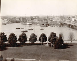
Panoramic view
Proceedings of the annual convention.