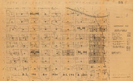
Plan of subdivision of block 120 (explanatory plan 8011), district lot 181
- COV-S305---: LEG1349.13
- Item
- [ca. 1965]
Part of City of Vancouver fonds
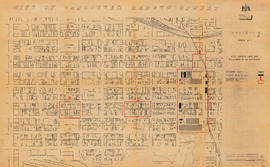
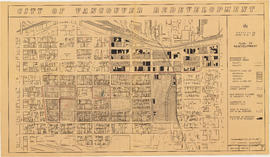
Item is a map annotated to show locations of hydro, telephone, water and gas services and sewers on the east side of the area cleared for development between Campbell Avenue, Raymur Avenue, Hastings Street, and Union Street. Base map is a subdivision plan for the area.


![The west end of Block 86 [Keefer Street - south side]](/uploads/r/null/7/1/8/718449a61ef28d000997ee1b4ee269fef37aabc4b15790ac496d415a6878035c/1751ccf4-5686-4608-93fb-1a3262368ccb-CVA181-22_142.jpg)


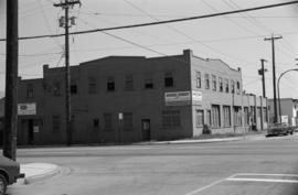
![Hammond Furniture Company, Clark [Drive] & Venables [Street]](/uploads/r/null/8/1/e/81e78c9c953010ab1b13f90115cbc4b4a94422ead144075d3bfddeb258138330/65ea534d-0296-4540-a394-effbb45127b8-CVA786-66_142.jpg)


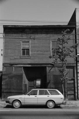

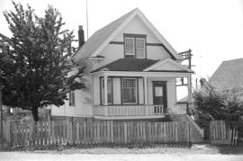
![304 [Dunlevy Avenue]](/uploads/r/null/8/9/a/89a7f6ce776009a2785fb8ca17c9ed28251a12cfecf77fa9d7bc6c8176313138/c6e67ba8-a0c9-403e-b4ae-825d736cc624-CVA786-44_142.jpg)
![303 Cordova Street [East]](/uploads/r/null/3/f/2/3f2109d8dee7b8bd220b3a93aee5400c92e0437588ee4d95fdc2c231426a1177/6dd452d9-56b6-4327-bff6-b2e0d45650cf-CVA786-44_142.jpg)