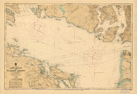
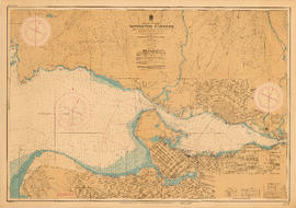
Howe Sound and Howe Sound (southern portion)
- AM1594-: MAP 5
- Item
- 1952
Part of City of Vancouver Archives technical and cartographic drawing collection
Item contains two nautical charts of Howe Sound; one chart shows the southern portion (Bowen Island and Gambier Island) only, while the other shows the Sound from Burrard Inlet in the south to Squamish in the north. Charts show soundings in fathoms, tidal information, bench marks, locations of cables, and characteristics of land at shorelines.