Showing 31 results

Archival description
City of Vancouver Archives technical and cartographic drawing collection Vancouver Map & Blue Print Company
Print preview View:

23 results with digital objects Show results with digital objects

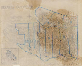
Commercial map of Greater Vancouver and district

Item is a map sheet containing two maps. The principal map depicts greater Vancouver, including portions of North and West Vancouver, Richmond and Surrey. The information depicted on the map includes streets, postal blocks, streetcar and railway lines, parks and golf courses, and schools. The map includes 1/2 mile distance circles centred on old City Hall at Main and Hastings.

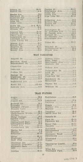
The sheet includes an inset map of Granville Island. Depth of water given along shorelines of Burrard Inlet, English Bay, and along the West Vancouver coast from First Narrows to Howe Sound. The sheet includes an index of streets.

Commercial Map of Greater Vancouver and District [BC]

Commercial map of Greater Vancouver and District depicts railroads, paved streets, streetcar stops, schools, buildings. Uniquely, the map shows the city divided by Postal Block numbers and half mile circles that radiate from City Hall on the corner of Main and Hastings.
The map has large red arrows and clippings of libraries pasted to it that show six proposed library locations and sketch plans. Also included on the map, is an index of all depicted roads in the Hastings, Point Grey, South Vancouver, and Burnaby areas. A legend and compass rose are located in the bottom left hand corner of the map.
The westernmost is road on the map is Marine Drive and the easternmost is North Road while the northernmost is Dempsey Street, and the southernmost is 20th Road.

Commercial Map of Greater Vancouver and District [BC]

The map shows the Greater Vancouver district, Point Grey, West Vancouver, North Vancouver, South Vancouver, and Burnaby - in 1886. In correspondence, the legend and map display railroads, paved streets, schools, and buildings. Uniquely, the map shows the city divided by Postal Block numbers and half mile circles that radiate from City Hall on the corner of Main and Hastings. The Westernmost road on the map is Marine Drive and the easternmost is Columbia Street. Northernmost road on the map is Dempsey Street, and the Southernmost point is No. 20 Road.

A detailed compass, in the bottom left hand corner of the map, shows Magnetic North. The annotation M.49 appears in the bottom right hand corner and the top left hand corner of the map. Two copies of the map are available, one a blue line the other a linen copy.

Indexed guide map of the city of Vancouver and suburbs

Part is a map showing district lots, blocks, and boundaries between the City of Vancouver, Point Grey, South Vancouver, Burnaby, New Westminster, and parts of Richmond, North Vancouver and West Vancouver. Concentric circles indicate the distance in miles from the intersection of Main Street and Hastings Street in intervals of 1/2 mile.

Indexed guide map of the City of Vancouver and suburbs

Item is a map showing district lots, blocks, and boundaries between the City of Vancouver, Point Grey, South Vancouver, Burnaby, New Westminster, and parts of Richmond, North Vancouver and West Vancouver. Concentric circles indicate the distance in miles from the intersection of Main Street and Hastings Street in intervals of 1/2 mile. Cover and street index attached.

Perspective of Greater Vancouver from Grouse Mountain (elevation 4000 ft.)

item is an illustrated, map-like pictorial view of Greater Vancouver. Locations of districts, waterways, beaches, golf courses, principal parks and significant buildings are identified by matching an index list to corresponding letters and numbers on the vertical and horizontal axes along the border of the map.