Vancouver Harbour. British Columbia
- AM1594-: MAP 436
- Item
- 1960
Part of City of Vancouver Archives technical and cartographic drawing collection
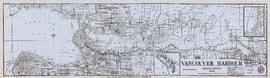
Item is a map sheet containing three nautical charts. The main map shows English Bay and Burrard Inlet and the land bordering these bodies of water, including North and West Vancouver, Downtown Vancouver, the University Endowment Lands and Port Moody. Inset maps depict the north arm of Burrard Inlet and a chart showing Vancouver Island in relation to the B.C. coast and the state of Washington, U.S.A.