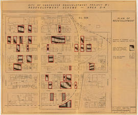
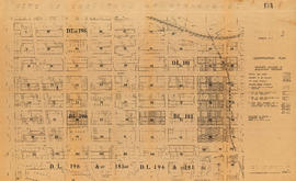
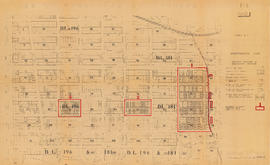
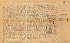
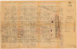
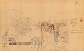
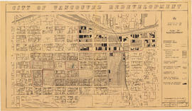
Item is a map showing boundaries of clearance areas for project 2 (areas 5 (part), 6 and 7) and project 1 (area 3). Maps also show sewers to remain, sewers to be abandoned, water lines to remain, water lines to be abandoned, gas lines to remain, gas lines to be abandoned, power lines existing underground, proposed diversions of power lines, power lines existing overhead, proposed overhead power lines and long distance telephone lines existing underground. Larger map shows area from Hastings Street in the north to Union Street in the south and from Heatley Avenue in the east to Gore Avenue in the west. Smaller map shows area from Powell Street in the north to Hastings Street in the south and from Clark Drive in the east to Glen Drive in the west. Item also shows estimates of costs for utility diversions and rearrangements for areas 5, 6 and 7.
Attached label indicates that the map was approved by Council Sept. 17, 1963.