
800 Bute Street west side
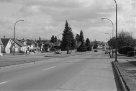
![[View of East] 14th [Avenue at] Pr[ince] Albert [Street]](/uploads/r/null/0/1/010770a09e6b951038e7dad4c2ce27438a83fb7350925f78117330ce85476fd0/94ceafce-9318-4281-b19c-84263016beee-A59118_142.jpg)
[View of East] 14th [Avenue at] Pr[ince] Albert [Street]
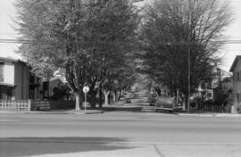
![[View of the] 300 block Railway [Street]](/uploads/r/null/5/a/5ace8d71bcf997ec706d0ebe80604d0a8f7ba3edc8c1bc1de3526310684f5af6/6ca377c9-3602-4c83-a634-94701e6192af-A59192_142.jpg)
[View of the] 300 block Railway [Street]
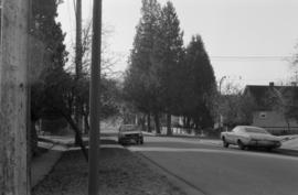
![Strath[cona] Rehab[ilitation]](/uploads/r/null/0/2/02b1fed48044b74102e9925a7d95d4e41c852514c6df4fa62c81951fda863407/96950589-6fda-44af-b35b-66aab9e359d9-A59208_142.jpg)
Strath[cona] Rehab[ilitation]
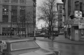
![[Cordova Street looking west at Jackson Avenue.]](/uploads/r/null/7/b/7b6818d1a76e50216589304905b401c5dedf6da81e2e67f846e8bdbf8f7ab8c7/ae00d516-b739-47f5-b32a-672eb41756a5-A59214_142.jpg)
[Cordova Street looking west at Jackson Avenue.]
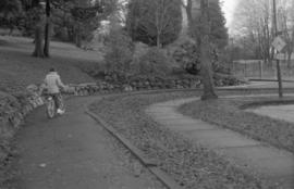
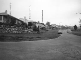
![Shorepine [Walk]](/uploads/r/null/7/1/71bf9a13adf952a3536edc91da0a9a8b24e934b51afd127077c90f184d41e638/3f934b51-6a29-4509-ad2b-5302707018bd-A59364_142.jpg)
Shorepine [Walk]
![[Western facing view of Powell Street]](/uploads/r/null/3/5/354a5b4cb820ea3e7ff033b58bcd50c763ad8bea52b057371125d56d7b8ce312/f12dd2a8-5cbd-4b41-adff-54eae1eff23c-A59642_142.jpg)
[Western facing view of Powell Street]
King Edward Avenue (25th)
East 40th Avenue, looking west (Main to Ontario), London Plane

East 42nd Avenue, looking northwest (Main to Ontario), London Plane

East 43rd Avenue, looking west (Main to Ontario), Horse Chestnut

Ontario Street and West 46th Avenue, looking North Catalpa and Cedar on west side
Ontario Street and West 45th Avenue, looking south - Cedar (same trees as frame 8A)
Almond Park, West 13th Avenue, street end
B.C. EL - R.O.W. (British Columbia Electric Railway Right-of-Way)

B.C. EL - R.O.W. (British Columbia Electric Railway Right-of-Way)
![Main [Street] and 49[th Avenue intersection, 4 of 4]](/uploads/r/null/0/b/5/0b582d11960df8d6ebb414627ea8916f04441bcda28e7b234ffd8927bb0c9fb6/409b52a8-ffaf-41bf-9dd1-9928e58313fc-2019-103.0950_142.jpg)
Main [Street] and 49[th Avenue intersection, 4 of 4]
![Manitoba [Street] and 49[th Avenue intersection, 3 of 4]](/uploads/r/null/2/a/0/2a099eed23e57329fec37ac866a4617dd88375e81097670556fe8cd2de8febac/649448aa-7d84-4346-8522-57ea77f15256-2019-103.0954_142.jpg)
Manitoba [Street] and 49[th Avenue intersection, 3 of 4]
![Willow [Street] and 41[st Avenue intersection, 2 of 4]](/uploads/r/null/6/e/6/6e6208570654b6cc666c3d9025e1d4a85197200a094ff7991b5a789d95bc0366/e9eda376-cdf7-4372-ad16-1a5c9e4aa13b-2019-103.0962_142.jpg)
Willow [Street] and 41[st Avenue intersection, 2 of 4]
![Willow [Street] and 41[st Avenue intersection, 3 of 4]](/uploads/r/null/a/3/4/a34582244847290663782d7db69add82ef7bab4535091a5bca031e1576e40405/7190ebd8-9e21-470b-93b0-4a93e5f05406-2019-103.0963_142.jpg)
Willow [Street] and 41[st Avenue intersection, 3 of 4]
![Main [Street] and 41[st Avenue traffic controller]](/uploads/r/null/8/0/9/809b346562c9fad6c8e0ca55ed59e43afc27a6b02e495dfee7e8e21c8d0ccfb4/4f4a8426-ffa9-4378-9186-9022e4f0d6f9-2019-103.0971_142.jpg)
Main [Street] and 41[st Avenue traffic controller]
![Main [Street] and 36[th Avenue intersection, 3 of 4]](/uploads/r/null/7/3/b/73b433085366c52d85087a24590e0405bd2564b58f6971ad1d53735853511a1a/e268c216-4efa-419b-bbc5-275eff93b39f-2019-103.0979_142.jpg)
Main [Street] and 36[th Avenue intersection, 3 of 4]
![Ontario [Street] and 33[rd Avenue intersection, 1 of 4]](/uploads/r/null/e/6/9/e69fe4f93a34cb4f668999168e0a434186bd1ae3e1993c6f46658f6d529be9e4/6bde50eb-fe67-4141-8c32-1b861a5e603f-2019-103.0987_142.jpg)
Ontario [Street] and 33[rd Avenue intersection, 1 of 4]
![Main [Street] and 28[th Avenue traffic controller]](/uploads/r/null/d/f/c/dfc289a6a96d7454a25b514d10571d0fd4277a20f88217e7495751f04f4acc68/7cd741af-8022-488e-ad5d-22c62e2fdc96-2019-103.0991_142.jpg)
Main [Street] and 28[th Avenue traffic controller]
![Main [Street] and King Ed[ward Avenue intersection, 2 of 5]](/uploads/r/null/9/7/7/977db0f995e60c6a2a21d31d7b81a6884b2d6034f8fa2315613a084481da8d94/7aacebbe-9674-428b-9db2-df43b9113454-2019-103.0998_142.jpg)
Main [Street] and King Ed[ward Avenue intersection, 2 of 5]
![Main [Street] and King Ed[ward Avenue intersection, 5 of 5]](/uploads/r/null/8/9/5/8958bf2244117707eec2cf38c8655a4b79f7cc5e5d448e434149e4110b3a9384/5ade109d-a539-4651-9ef5-fce583040955-2019-103.1001_142.jpg)
Main [Street] and King Ed[ward Avenue intersection, 5 of 5]
![Davie & Granville [after heavy snowfall]](/uploads/r/null/9/5/957a5cb72e66af500c4a5348592f923ed6d5231c93ae0eb0929df0f007d44f61/6a9458e8-2283-4d5d-b455-8aa0e5367350-A16575_142.jpg)
Davie & Granville [after heavy snowfall]
![[Hastings and Richards after heavy snowfall]](/uploads/r/null/e/9/e9d02bd659129635b1478a4fc6e9bf0c9cd8498067eba2c1fb866a9d52e3db0d/8d97b4f0-d8ea-43e9-a1e1-bbdd77d4f1ba-A16577_142.jpg)
[Hastings and Richards after heavy snowfall]
![[600 block Hastings St. W. after heavy snowfall]](/uploads/r/null/1/e/1e87b92ddb583d44c61d56889b5e305648cf593c9a1dd564c5f68991f9d48398/5fc1063f-3fc6-43ed-835d-539dd82a3927-A16578_142.jpg)
[600 block Hastings St. W. after heavy snowfall]
![[Pender Street at Cambie Street, looking west]](/uploads/r/null/3/d/3d91c3d4cd2181022a308d60e8fad6da587efcfa17cc0a68527eb95c215bc009/5a8ff240-1741-4881-b137-7b3a66b98a1d-A43705_142.jpg)
[Pender Street at Cambie Street, looking west]
![[Granville St. at Hastings St., looking south]](/uploads/r/null/a/2/a2b150fdc2d0d1091b88dcb4036e315291c2712f91faf805ab8ed329a1a56990/cd90450d-d6b2-45e1-8810-c58b313df506-A43716_142.jpg)
[Granville St. at Hastings St., looking south]
![[Granville St. at Hastings St., looking south]](/uploads/r/null/3/f/3f5c9c270d59846d9552f5e5c9c93dd128d30ad0698afa539c75b12d1c38afc0/93642b9d-f977-478f-9940-f53ece9cdca0-A43717_142.jpg)
[Granville St. at Hastings St., looking south]
![[700 E Hastings St]](/uploads/r/null/e/d/ed03592c91e746bd2bdb2f7bd19463f38d2315e8700fb0347925fabcb17aa532/ca970500-4326-4da5-bcd5-c6553ee5fda4-A43723_142.jpg)
[700 E Hastings St]
![[Looking north from Hastings Street along Hawkes Avenue]](/uploads/r/null/c/6/c6b7721c67508d95616838456d2e6f7fcb948b0917845c03dd2885e884026c85/090e0d28-920a-4794-bafe-7ce84481a5d2-A43725_142.jpg)
[Looking north from Hastings Street along Hawkes Avenue]
Eddington Drive, south side, from Haggart Street to Paton Street - view west

Haggart Street, east side, from 32nd Avenue north - view south

Puget Drive, east side, Eddington Avenue to lane south - view north

Slocan Street, west side, 1st to 2nd Avenues - view northwest

Slocan Street, west side, 6th to 7th Avenues - view northwest
![Abbott and Cordova [streets looking] west](/uploads/r/null/9/e/9e6ecc370bc289e5be80f2c7024a559ad55f83ec49ec64c8f3a8df89481637f7/f7d058c6-cc09-4ac7-85bf-be6f0d56c87c-A42713_142.jpg)
Abbott and Cordova [streets looking] west
![Abbott and Hastings [streets looking] east](/uploads/r/null/f/a/fa0d67515affc3ab9a0a5625d6d6d6e103e07a6f1a5d936f025bfd1d86416738/bf20e84f-2d2c-4ba3-a778-dfd77978f715-A42715_142.jpg)
Abbott and Hastings [streets looking] east
![Abbott and Hastings [streets looking] west](/uploads/r/null/1/a/1a3c9bdca5e9a05a681433abe9fe739bf52e86440936b967e1a49e5ea06628b0/99dd753a-1f99-4729-89d6-21b755a5eeb1-A42717_142.jpg)
Abbott and Hastings [streets looking] west
![Abbott and Pender [streets looking] east](/uploads/r/null/f/8/f83eaf09fec1ebf23e21a3db3691921915705e4f383ef44a5027be0102269396/3566daa7-37b0-43c3-96e2-f30d512ad817-A42719_142.jpg)
Abbott and Pender [streets looking] east
![Abbott and Pender [streets looking] south](/uploads/r/null/b/b/bb5e90c611916f1b8ac5bbd1c7756bb79e72acbd41bf494dd418f633f3c49dca/284f1b6d-4e1e-4720-966f-571e057fc42c-A42720_142.jpg)
Abbott and Pender [streets looking] south
![Alder and 6th. [Avenue looking] north](/uploads/r/null/b/5/b5e8014aa997d96e6cbf92700ea83aa8dc54d72042b05322e9852ba8ceff9488/44a9a5d1-bf83-4a5b-81ab-2a25d3fa29eb-A42722_142.jpg)
Alder and 6th. [Avenue looking] north
![Alder [Street] and 6th [Avenue looking] south](/uploads/r/null/a/e/ae393bfbc80a207f68cd15f0f0b40ecc6636b45191de8f943d48ac6dfb55edf6/a8b1130e-2354-4236-8727-50a9e570eb1b-A42724_142.jpg)
Alder [Street] and 6th [Avenue looking] south
![Alma [Street]and Broadway [looking] east](/uploads/r/null/a/f/afd0dff1de21eae47f3b74fc927c36b4de2199db612635f05b427be03980332c/786e1118-45c9-4bea-8ef1-6a645e4399fe-A42727_142.jpg)
Alma [Street]and Broadway [looking] east
![W Blvd and 37[th Avenue intersection, 7 of 7]](/uploads/r/null/3/9/b/39ba281388109c5d462b4058a66d864463ca5b38d96852c634928df2e67c1a97/635087c3-aa13-43c2-af07-cbda9f2387d5-2019-103.0448_142.jpg)
W Blvd and 37[th Avenue intersection, 7 of 7]
![Arbutus [Street] and 33rd [Avenue intersection, 2 of 5]](/uploads/r/null/2/3/a/23a948997f2d45a82c626782a59c2ebc93ae40d763153f1990feeff647072f28/a9dd1be5-892b-4523-aa36-0af44653ebce-2019-103.0451_142.jpg)
Arbutus [Street] and 33rd [Avenue intersection, 2 of 5]
![Arbutus [Street] and 33rd [Avenue intersection, 3 of 5]](/uploads/r/null/2/a/2/2a20d0273a324db72bb281d51043f9a5127c13882509ca0f8847b9bf2d1a1f4b/a94064ab-4eca-4c0d-b4d1-04fd43b55421-2019-103.0452_142.jpg)
Arbutus [Street] and 33rd [Avenue intersection, 3 of 5]