City of Vancouver, B.C. area map : Camosun Street to Granville Street and King Edward Avenue to 49th Avenue
City of Vancouver, B.C. area map : Cartier Street to Inverness Street and 57th Avenue to the North Fork of the North Arm of the Fraser River
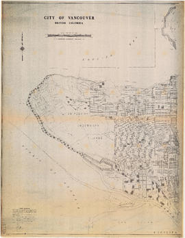
City of Vancouver, B.C. area map : Discovery Street to Granville Street and English Bay to King Edward Avenue
City of Vancouver, B.C. area map : Granville Street to Inverness Street and 37th Avenue to 57th Avenue
City of Vancouver, B.C. area map : Granville Street to Inverness Street and 6th Avenue to 37th Avenue
City of Vancouver, B.C. area map : Heatley Avenue to Boundary Road and Burrard Inlet to 2nd Avenue/5th Avenue
City of Vancouver, B.C. area map : Inverness Street to Boundary Road 54th Avenue to the North Arm of the Fraser River
City of Vancouver, B.C. area map : Inverness Street to Boundary Road and 2nd Avenue/5th Avenue to 32nd Avenue
City of Vancouver, B.C. area map : Inverness Street to Boundary Road and 32nd Avenue to 54th Avenue
City of Vancouver, B.C. area map : Maple Street to Heatley Avenue and Burrard Inlet to 6th Avenue
City of Vancouver, B.C. area map : Wallace Street to Cartier Street and 49th Avenue to the North Arm of the Fraser River
City of Vancouver, B.C. area map : western boundary with University Endowment Lands to Camosun Street and English Bay to 16th Avenue; Musqueam Indian Reserve no. 2
City of Vancouver, British Columbia : 1981 census of Canada
City of Vancouver, British Columbia : Cypress Street to Boundary Road
City of Vancouver, British Columbia : Point Grey to Cypress Street
Commodities shipped overseas through Port of Vancouver
Cycling in Vancouver
Cycling in Vancouver
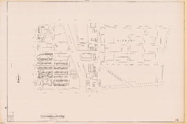
Downtown peninsula
Downtown peninsula - Vancouver, B.C. : contour lines at 10 foot intervals, datum line - 100
Existing service stations, retail shopping centres and commercial zoning : a basis for regulating location of service stations
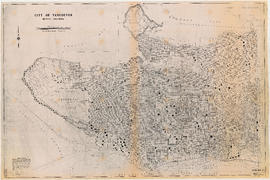
Greater Vancouver British Columbia Railroads and Harbour
Historical park development
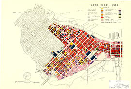
Land use - 1954
Map of City of Vancouver showing schools, parks, community centres, libraries, health units
North-East Burnaby Study, revised Simon Fraser townsite plan : 1967 City of Vancouver alternative proposals
Official Regional Plan : proposed amendments within the City of Vancouver
One way streets : Illustrated map of Downtown Vancouver
One way streets : illustrations of special intersections
Port of Vancouver water-borne exports
Port of Vancouver water-borne imports
Preliminary report on civic centre
Present use. Vancouver harbour
Proposed development of waterfront. South shore Burrard Inlet
Proposed elevated waterfront roadway
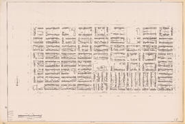
Sectional map of Vancouver showing streets, block and lot outlines, and building perimeters : Map 10 : Clark Drive to Nanaimo Street and Burrard Inlet to Frances Street/Ferndale Street
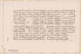
Sectional map of Vancouver showing streets, block and lot outlines, and building perimeters : Map 11 : Nanaimo Street to Rupert Street and Burrard Inlet to McGill Street
Sectional map of Vancouver showing streets, block and lot outlines, and building perimeters : Map 12 : Nanaimo Street to Cassiar Street and McGill Street/Wall Street to Pender Street
Sectional map of Vancouver showing streets, block and lot outlines, and building perimeters : Map 13 : Rupert Street to Boundary Road and Burrard Inlet to Eton Street
Sectional map of Vancouver showing streets, block and lot outlines, and building perimeters : Map 14 : Cassiar Street to Boundary Road and Eton Street to Pender Street
Sectional map of Vancouver showing streets, block and lot outlines, and building perimeters : Map 15 : Rupert Street to Boundary Road and Pender Street to Kitchener Street
Sectional map of Vancouver showing streets, block and lot outlines, and building perimeters : Map 16 : Rupert Street to Boundary Road and Kitchener Street to 5th Avenue
Sectional map of Vancouver showing streets, block and lot outlines, and building perimeters : Map 17 : Nanaimo Street to Rupert Street and Pender Street to Charles Street
Sectional map of Vancouver showing streets, block and lot outlines, and building perimeters : Map 18 : Nanaimo Street to Rupert Street and Charles Street to 5th Avenue
Sectional map of Vancouver showing streets, block and lot outlines, and building perimeters : Map 19 : Clark Drive to Nanaimo Street and Frances Street/Ferndale Street to 2nd Avenue
Sectional map of Vancouver showing streets, block and lot outlines, and building perimeters : Map 20 : Main Street to Clark Drive and Prior Street to 2nd Avenue/Great Northern Way