
Aldermen Harry Rankin, Michael Harcourt, John J. Volrich, Boyce and Kennedy taking Oath of Office

City of Vancouver, British Columbia. Downtown Vancouver
Judy Rogers, City Manager 1999-2008
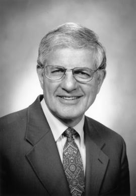
Portrait of Gordon Price

Portrait of Gordon Price
Portrait of Fred Bass

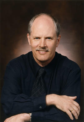
Portrait of Don Lee
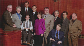
Vancouver City Council 2002-2005

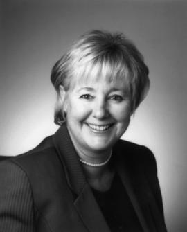
Portrait of Sandy McCormick

City of Vancouver and School District no. 39 : voting divisions : general local elections : November 20, 1999

Kenneth Dobell, City Manager 1990-1998
![City of Vancouver B.C. area map [Cartier St. to 49th Ave. to Wallace St. to Fraser River]](/uploads/r/null/b/9/0/b90512d5b7ab999c429946e004afaeefa347e648d05cbe127e548941cf053492/4bf26a05-6451-4c58-be1b-4491a36347e0-LEG1493_142.jpg)
City of Vancouver B.C. area map [Cartier St. to 49th Ave. to Wallace St. to Fraser River]
![City of Vancouver B.C. area map [Inverness St. to 37th Ave. to Granville St. to 57th Ave.]](/uploads/r/null/b/b/b/bbb5627e84fb0e74ba863c698c350f1c776909c66fe285c49945f91a0bde6e48/94cc8c2d-2d95-4552-a8e4-3a917b38ed69-LEG1493_142.jpg)
City of Vancouver B.C. area map [Inverness St. to 37th Ave. to Granville St. to 57th Ave.]
![City of Vancouver B.C. area map [Granville St. to King Edward Ave. to Camosun St. to 49th Ave.]](/uploads/r/null/e/4/e/e4ea196e799a3d1ee8d3079227c9235d74e38168dd3aff7c4b7a93c85167a9b5/621c46bb-2cd2-48dd-a571-9ec8eba8daa2-LEG1493_142.jpg)
City of Vancouver B.C. area map [Granville St. to King Edward Ave. to Camosun St. to 49th Ave.]
![City of Vancouver B.C. area map [Granville St. to English Bay to Camosun St. to King Edward Ave.]](/uploads/r/null/7/5/d/75d60ce8c1fe40f83cb5b7de4529e76beb62bdafa0d97adf3107aa442fb8bd5f/40e84138-eca4-4329-ba26-49c60dbbbf56-LEG1493_142.jpg)
City of Vancouver B.C. area map [Granville St. to English Bay to Camosun St. to King Edward Ave.]
![City of Vancouver B.C. area map [Boundary Rd. to Burrard Inlet to Heatley Ave. to 2nd/5th Ave.]](/uploads/r/null/1/9/8/198a72e4b463634523e5e77cb805ac077ff62a32d5ea05b80b290b127914f37d/0ac9e098-c69e-4196-b616-3cbb4b65d289-LEG1493_142.jpg)
City of Vancouver B.C. area map [Boundary Rd. to Burrard Inlet to Heatley Ave. to 2nd/5th Ave.]
![City of Vancouver B.C. area map [Boundary Rd. to 32nd Ave. to Inverness St. to 54th Ave.]](/uploads/r/null/4/1/9/41967d0a3fb3b7bb9709efd337b0392ff4c58c5e8f835dd04e8e292d202fa135/46a3719b-4bd0-4fa2-858e-37480c570f7c-LEG1493_142.jpg)
City of Vancouver B.C. area map [Boundary Rd. to 32nd Ave. to Inverness St. to 54th Ave.]
![City of Vancouver B.C. area map [Point Grey]](/uploads/r/null/f/f/3/ff34e5b2e9358c8cd595440a33fee383fb78e50a4a5bd338548ffe242f0d6872/12eef633-8974-41fa-ab84-57f3e747b090-LEG1493_142.jpg)
City of Vancouver B.C. area map [Point Grey]
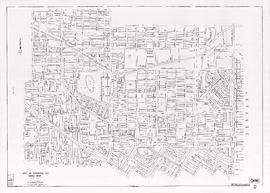
City of Vancouver B.C. area map [Boundary Rd. to 2nd/5th Ave. to Clark Drive/Inverness St. to 32nd Ave.]
![City of Vancouver B.C. area map [Inverness St. to 57th Ave. to Cartier St. to Fraser River]](/uploads/r/null/8/5/4/8544d9a63a23de971d0737695ffff0ba8470d708780abff07e44cd080ee38c4d/42dcb1f3-2fce-4372-82e4-68410ccb122a-LEG1493_142.jpg)
City of Vancouver B.C. area map [Inverness St. to 57th Ave. to Cartier St. to Fraser River]
![City of Vancouver B.C. area map [Heatley Ave. to Burrard Inlet to Maple St. to 4th/6th Ave.]](/uploads/r/null/7/f/5/7f5dab9b372be433325b43cd1c75ae4f7509ca456ae9e74bb78d27d76b850748/fc10b0d6-7525-4483-9212-f7172a93114c-LEG1493_142.jpg)
City of Vancouver B.C. area map [Heatley Ave. to Burrard Inlet to Maple St. to 4th/6th Ave.]
![City of Vancouver B.C. area map [Boundary Rd. to 54th Ave. to Inverness St. to Fraser River]](/uploads/r/null/c/a/0/ca079c63d386e99664763d5674f6bdf8b5f822bd670e5531b02bb917e14de7bf/1d29872a-3121-4986-b9c0-229d0c2cd3a1-LEG1493_142.jpg)
City of Vancouver B.C. area map [Boundary Rd. to 54th Ave. to Inverness St. to Fraser River]
![City of Vancouver B.C. area map [Clark Dr./Inverness St. to 6th Ave. to Granville St. to 37th Ave.]](/uploads/r/null/2/5/2/252edff70e6c084c05c63f810d048c09215e22656c63906cab4b80945bdae68c/916807b0-00b3-491c-b26f-1668281abc3c-LEG1493_142.jpg)
City of Vancouver B.C. area map [Clark Dr./Inverness St. to 6th Ave. to Granville St. to 37th Ave.]
![Abbott and Cordova [Streets looking] north](/uploads/r/null/8/a/8aab879fc7571cea390137d122ac3a89381071b678502757448c72f1fa930e4f/7cda2f7c-4836-4e9a-bb47-04f727a330f0-A42710_142.jpg)
Abbott and Cordova [Streets looking] north
![Abbott and Cordova [streets looking] east](/uploads/r/null/7/0/707fb0b0f3ba16b327f9d40a0a0a94b3f918509e20ac40ab413928d75ff1b6a8/c28af97b-ce7e-4953-b6ff-6e0979093ac1-A42711_142.jpg)
Abbott and Cordova [streets looking] east
![Abbott and Hastings [streets looking] north](/uploads/r/null/5/8/58a47efab97572b4c13cd6b981dd3dac02110898a57c7c528946196e79ba9346/863bf6d2-596f-499c-868a-28abd249fb85-A42714_142.jpg)
Abbott and Hastings [streets looking] north
![Alder [Street] and 6th [Avenue looking] west](/uploads/r/null/9/c/9c3510984925b6c73b0f03fe9efc1a5f0c4f319bc1012d03aa9caa3e5b60cb47/373b8340-f09c-4f8c-b47d-a21aa18ae822-A42723_142.jpg)
Alder [Street] and 6th [Avenue looking] west
![Alma [Street]and Broadway [looking] south](/uploads/r/null/4/d/4dafffe711c2871a06198b0ffd371738a92f41b9a756e865cf32b41bb712a733/f1a34532-ad4a-4a7f-a67d-e800c9132525-A42726_142.jpg)
Alma [Street]and Broadway [looking] south
![Alma [Street] and Broadway [looking] north](/uploads/r/null/f/e/fe19941ed63249d77fd1b5a19cf8c68f6469fc9a1fa766c7170f69506850e2d1/d27e2826-b62d-4fd1-aac2-de85149a4ae5-A42728_142.jpg)
Alma [Street] and Broadway [looking] north
![Main and Union [Streets looking] west](/uploads/r/null/e/b/eb84964dbf933c1442a61ec0968b329a7e271791ed535386b9f0a6643a914aac/80bdc5d8-5b0b-4ea9-bf2d-637b34a3c532-A44078_142.jpg)
Main and Union [Streets looking] west
![Moberley [Road] and 6th [Avenue looking] west](/uploads/r/null/f/e/fe05afaf19cf8c1575b65911683a135a2f1903e7f649bd375057bba80e398326/eb040ea1-5d1e-4016-a9dd-9eb722bca801-A44109_142.jpg)
Moberley [Road] and 6th [Avenue looking] west
![Marine [Drive] and 41st [Avenue looking] east](/uploads/r/null/9/2/9295290dc76739cb2ca54e7bdb040c637cc703d3a692dd9055a60b02ff9bfcdc/fb404960-0fce-4148-bfb7-271e44273788-A44111_142.jpg)
Marine [Drive] and 41st [Avenue looking] east
![Nanaimo and Hastings [Streets looking] east](/uploads/r/null/4/2/4277dd885fd35a7516f0ec6c916d53646e052b31145d0bebabff2d7b7362a76a/421cb517-8ee7-43a8-b6ed-3848f71d6f74-A44140_142.jpg)
Nanaimo and Hastings [Streets looking] east
![Nanaimo [Street] and Kingsway [looking] north](/uploads/r/null/2/5/2585376fed1c2542b3b194ebbf7ed615c8c9a113d4b53ffeff70af26fbcd2c99/a1c0cde3-fbc5-4841-b759-d67effa69418-A44143_142.jpg)
Nanaimo [Street] and Kingsway [looking] north
![Nanaimo [Street] and Broadway [looking] east](/uploads/r/null/2/6/2628a624a25e6c520d99577488c0e80df649937260c1beddad9eb25076d852ea/e83ca108-1737-419f-b058-c79bcec86c10-A44151_142.jpg)
Nanaimo [Street] and Broadway [looking] east
![Oak [Street] and Broadway [looking] south](/uploads/r/null/c/b/cbba5b7775083151ea5354bee5259b9143f7e4f8691955d3c7e07e4548460ba2/9ef14bc0-0b73-418f-8c16-b2d213074f5f-A44160_142.jpg)
Oak [Street] and Broadway [looking] south
![Oak [Street] and 12th [Avenue looking] north](/uploads/r/null/e/7/e716819cc94a5e03baff80d4bd7010d2d565ab4cf7f41b49c52ab9b32b1afb86/596b5506-7b75-496e-9e87-2ad483b10197-A44168_142.jpg)
Oak [Street] and 12th [Avenue looking] north
![Oak [Street] and 57th [Avenue looking] east](/uploads/r/null/8/a/8a6aa800afe04e85d476cbf5660ddc260605aab9249bdd6a3dd799d2e863d1ee/95fe19c6-8e3f-4efd-8909-7ddd8a24fb99-A44180_142.jpg)
Oak [Street] and 57th [Avenue looking] east
![Oak [Street] and 49th [Avenue looking] east](/uploads/r/null/3/6/36c0d8fe26aff01d6b4e97ed070e6e7bb6570a35b46da642c7f40d9c9b16469f/052db798-9c96-4c2a-98fe-d8391e2d97ef-A44184_142.jpg)
Oak [Street] and 49th [Avenue looking] east
![Oak [Street] and 41st [Avenue looking] west](/uploads/r/null/5/1/519508db1d558c229e1a03f7a01569c429f120d55a070845879fb39cd2c7596f/7c3a83ec-9967-46d9-84b2-2136840d4683-A44186_142.jpg)
Oak [Street] and 41st [Avenue looking] west
![Oak [Street] and 19th [Avenue looking] south](/uploads/r/null/6/1/61f3736c303098eac454d80524d35325f63db23beb77e13bc97e285af19109de/ae681077-6eaa-4fe7-b0f5-7766d5d8c893-A44192_142.jpg)
Oak [Street] and 19th [Avenue looking] south
![Oak [Street] and 19th [Avenue looking] east](/uploads/r/null/9/5/958b359880cabffa4221f400cf6b2e3fda191212153638fa8fc68e1be9df6068/cde84a7d-2c6a-49bd-a1aa-dadf604c544d-A44193_142.jpg)
Oak [Street] and 19th [Avenue looking] east
![Oak [Street] and 19th [Avenue looking] north](/uploads/r/null/2/5/255389ea1b491ecf8b5e3ae4b369fe7f2c48257da97966abcbb833591236662b/6351f1e7-630d-4e65-b00f-01403fae7621-A44195_142.jpg)
Oak [Street] and 19th [Avenue looking] north
![Prince Edward [Street] and King Edward [Avenue looking] north](/uploads/r/null/5/a/5a7760811915d5634cc3848ae9b5e6c7016fb92edc7af553c05da4d3789517c4/c03b8a27-0513-415f-a595-cda89f23b531-A44204_142.jpg)
Prince Edward [Street] and King Edward [Avenue looking] north
![Quebec [Street] and 2nd [Avenue looking] north](/uploads/r/null/3/9/3934ec11312248adb169b0dc88e19898613cf86e4350f5c84f4ba48f46aceed8/38426e53-bcfe-4e86-a4f4-ecbf7607e86c-A44209_142.jpg)
Quebec [Street] and 2nd [Avenue looking] north
![Richards and Cordova and Water [Streets looking] east](/uploads/r/null/e/9/e9b75b48480e6f90070ea491afb7aa29cdcedb2be03f9c22fe46c39b98517714/a634c145-0cd6-4953-ae80-08d3fd212497-A44221_142.jpg)
Richards and Cordova and Water [Streets looking] east
![Richards and Davie [Streets looking] north](/uploads/r/null/e/2/e2dbda49971bcbc3d4114641c310a2ffdd0e8e32b8be2befb4ccd62ad9ea4211/81510d38-c18c-4b4c-b32b-1a0b423fdfc1-A44231_142.jpg)
Richards and Davie [Streets looking] north
![Renfrew [Street] and 1st [Avenue looking] south](/uploads/r/null/d/e/de3859eb11f1df83a9c4d59a891040602fb18eb4e341f4fa39d2d8ce7419e229/f97d1c31-f712-4e87-9c4a-420c1fed00d4-A44244_142.jpg)
Renfrew [Street] and 1st [Avenue looking] south
![Renfrew [Street] and 22nd [Avenue looking] east](/uploads/r/null/4/c/4c9243ddc4a2d00e2ce825e259ecdc16d238f5b8734cba6f26bb96d888499ba5/e49fe29e-b507-44c6-9a74-c7cb2b720ad4-A44247_142.jpg)
Renfrew [Street] and 22nd [Avenue looking] east
![Renfrew [Street] and 22nd [Avenue looking] west](/uploads/r/null/9/2/92fdc69591b136091c94e24cc51493d0b40f3cd775c9ae7ff219265e5a6b1242/d4b106e3-049f-4c9c-80f9-d307042fb938-A44248_142.jpg)
Renfrew [Street] and 22nd [Avenue looking] west