![[View of the Oak Street, B.C. Electric and Middle Arm bridges]](/uploads/r/null/8/d/8d4f4dea792a3128229aecfd55a12d3a3432476462ad8cd9991e1ebb16cae075/62c52137-d9af-48bd-a8bc-2a12293b382d-A24441_142.jpg)
[View of the Oak Street, B.C. Electric and Middle Arm bridges]
![[View of the Marpole rail and highway bridges]](/uploads/r/null/3/9/39d081635b9fd32192951910755276ab7921e8ca55e3206da51189c0b65a8080/015c04a5-11d7-4d15-95ab-e794ef8e9f32-A24442_142.jpg)
[View of the Marpole rail and highway bridges]
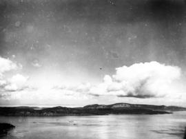
![[View of Pasley Island in Howe Sound]](/uploads/r/null/5/6/56ccb0c9a28a04d8d9eea97ed1f83c3199ad3a9e83a6a6f772a9d888668dbd89/f4a51183-b104-4fdf-984e-4486f9cc57a1-A33259_142.jpg)
[View of Pasley Island in Howe Sound]
![[View of Oak Street, Marpole rail and highway and Middle Arm bridges]](/uploads/r/null/4/1/4199f99a2a9078cbea68581cb0c930996461009cc1719feede4e449ea5a2379d/94cbe073-4e30-45d0-baea-1b0cb58d69b4-A24443_142.jpg)
[View of Oak Street, Marpole rail and highway and Middle Arm bridges]
![[The Malibu Club from the air]](/uploads/r/null/8/4/84af9ce4b59a192b718b53f0cc73247ecb96e71fc39ca29a306561109eae9386/f24d271e-7bc5-4c99-871b-b40a888223ac-A33224_142.jpg)
[The Malibu Club from the air]

The Lion's from the air.
![[S.S. "Lady Alexandra"]](/uploads/r/null/7/4/e/74e87d22579d72c80b76610fb6a3083e0a77f35f8abf9edcf8901caa3937305e/0a29283e-c0ae-465f-b3c8-bc4c0e86379a-CVA374-95_142.jpg)
[S.S. "Lady Alexandra"]
![[S.S. "Lady Alexandra"]](/uploads/r/null/6/2/9/629c61730ba93aebf4e46ce7d9fdd83f7f73f931af3af6cc8c7c545b559b05d4/39a64a9f-c6fa-4d04-a1b3-95333b270700-CVA374-93_142.jpg)
[S.S. "Lady Alexandra"]
![[S.S. "Chilcotin" in Devestation Channel]](/uploads/r/null/3/1/31fee18f1a65b8c477904c06780b3c3821c1d46086039885c3bf92e6f0098aa0/749c2538-35ff-4854-a513-b2045cd8027e-A24285_142.jpg)
[S.S. "Chilcotin" in Devestation Channel]
![[Oblique view of the Rocky Mountains]](/uploads/r/null/2/6/26f8815910d1af6d2b8b3f2c9894623155c377fcc7c8fb5d1634c6e7da23893b/3ba52b25-96eb-4b9d-88bc-904d100c71f1-A23401_142.jpg)
[Oblique view of the Rocky Mountains]
![[Oblique view of the Rocky Mountains]](/uploads/r/null/c/d/cd6eb6aeb38e42bd484276125b2fadb3e40ca7faae4cad75bf8b2d8f06f67b08/56118201-6980-4764-b078-4dd47a42a6ee-A23403_142.jpg)
[Oblique view of the Rocky Mountains]
![[Oblique view of the Rocky Mountains]](/uploads/r/null/b/f/bf99ef9bc0a6a9efd8a7bb39db94378f070b8d5cc4c38ac36de7d8b3ad333e03/c539df55-1733-4bdd-bf4d-2f087affec08-A23404_142.jpg)
[Oblique view of the Rocky Mountains]
![[Oblique view of the Rocky Mountains]](/uploads/r/null/6/5/65005f18b3dd84cbef3f3a67b6ff13ba948b7d2f4f17919e0f08a60ddafc1667/0ef46386-87de-40bd-8b71-109dbd7f1f58-A23407_142.jpg)
[Oblique view of the Rocky Mountains]
![[Oblique view of the Rocky Mountains]](/uploads/r/null/0/1/01774493347b730cb29f6d6a3388384b80d6ec28767384e01da80a2c9ca3d40b/cafbe145-6e9d-4bac-87b6-bcdc0b016ea2-A23400_142.jpg)
[Oblique view of the Rocky Mountains]
![[Oblique view of the Rocky Mountains]](/uploads/r/null/3/7/37e03596049729c16f687c059b410afeea453bde541c30608d2d76c6748556e3/5abe5764-060b-4df0-b382-bba4be958bad-A23402_142.jpg)
[Oblique view of the Rocky Mountains]
![[Oblique view of the Rocky Mountains]](/uploads/r/null/4/7/47aaad13b9c1322243a6ea265300da5085022decd4e988ad7bce18fa4118f21f/7bc5a2c4-242f-4920-b78c-0809352231e4-A23405_142.jpg)
[Oblique view of the Rocky Mountains]
![[Oblique view of the Rocky Mountains]](/uploads/r/null/6/7/67d7407537b26d42dc5f05eac383d42ea276067f9e5feee59fdc3e30f5a872bc/0fb5be27-f73e-4343-bbb1-219d33d47033-A23406_142.jpg)
[Oblique view of the Rocky Mountains]
![[Northern view of Oak Street bridge under construction]](/uploads/r/null/3/c/3ce95649becd6661bfb266e929ef9f7f0fb0047a4e0c644d3975486d3b9ddc9c/cf895488-0c64-458d-913c-9deac49a536c-A24440_142.jpg)
[Northern view of Oak Street bridge under construction]
Maitland & Maitland [Copy of aerial photograph of mill site]
Maitland & Maitland [Copy of aerial photograph of mill site]

Landscape - general : Fraser Valley farmland
![[H.M.C.S. "Vancouver"]](/uploads/r/null/4/0/40d05283991f8a914e2f61116a8aa8fdd34edba558afb1cedac93df18b745017/22fe1139-eab9-4358-ac03-5356b4e12a8a-A67012_142.jpg)
[H.M.C.S. "Vancouver"]

Geographical : Fraser River, dry interior

Geographical : Cranberry farm?

Geographical : Cascade Mountains

Composite Aerial Mosaic of Metropolitan Vancouver Compiled from 50 Individual Photographs Taken in 1952 from Altitude of 20,000 feet
![[Coast Mountains]](/uploads/r/null/d/0/d017804b1a1412562b7ead5ebcfc3ae5ca83228f1d6ac6445a6821dffc216433/7f42bfd3-c145-4ee7-96e8-d1bf09928898-A23447_142.jpg)
[Coast Mountains]

Capilano Valley and the Lions from the air
![[Canadian Pacific Airlines] "Empress of Vancouver" over city of Vancouver](/uploads/r/null/6/b/6ba4ed2071cb0964df7f0fc2336187077a7a9f4bd20495de3bb21849830457dc/8c45c9d3-f69c-47f4-9801-da5254d0abf4-A23430_142.jpg)
[Canadian Pacific Airlines] "Empress of Vancouver" over city of Vancouver
![Canadian Pacific [Airlines] "Empress of [Vancouver" in the air]](/uploads/r/null/b/b/bb4c7a7b97f535a860c37dd1687e9ffbdd659e9981b5aa798a5047aaa0304be5/9faa21b4-94f2-47bb-801e-68444de1ed50-A23432_142.jpg)
Canadian Pacific [Airlines] "Empress of [Vancouver" in the air]
![Canadian Pacific [Airlines] "Empress of [Vancouver]" in the air](/uploads/r/null/5/1/51636b9581d5a98c5d1a2e9a940e68e7cf54290524ef44c878a1e3546d59f13f/0d7f17a2-5788-418a-b1bb-a387115cfd35-A23433_142.jpg)
Canadian Pacific [Airlines] "Empress of [Vancouver]" in the air
![[Agassiz-Rosedale Bridge]](/uploads/r/null/b/9/b9a0eb51c46b2d4d18d17731a36fa41612fd8d34f153433851eda3dd6d55e728/ab733b8f-00dc-42e4-bf26-7ef4383180bb-A24439_142.jpg)
[Agassiz-Rosedale Bridge]
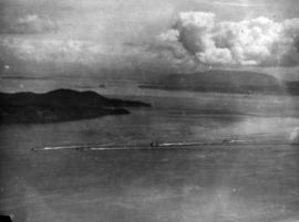
![[Aerial view of western side Bowen Island, Langdale and Keats Island]](/uploads/r/null/c/f/cfa3b48707527f99931a8687eb7821100c5cf3941db7aec18fcb3355c4cd0320/ce3f1d50-7991-4fec-bd64-b5d9b2f2afe2-A31871_142.jpg)
[Aerial view of western side Bowen Island, Langdale and Keats Island]
![[Aerial view of the Fraser River flood and surrounding areas]](/uploads/r/null/2/7/2749ceab3695f079945c8ceab77aa0cc238ba9056472d06ca9c52cd99d68e7a9/ff9c67ca-9723-40de-8d61-71df0fb7a708-A23476_142.jpg)
[Aerial view of the Fraser River flood and surrounding areas]
[Aerial view of S.S. "Prince Robert" en route to mainland with King George VI and Queen Elizabeth]

[Aerial view of S.S. "Prince Robert" en route to mainland with King George VI and Queen Elizabeth]

[Aerial view of S.S. "Prince Robert" en route to mainland with King George VI and Queen Elizabeth]

[Aerial view of S.S. "Prince Robert" en route to mainland with King George VI and Queen Elizabeth]

[Aerial view of S.S. "Prince Robert" en route to mainland with King George VI and Queen Elizabeth]
[Aerial view of S.S. "Prince Robert" en route to mainland with King George VI and Queen Elizabeth]
[Aerial view of S.S. "Prince Robert" en route to mainland with King George VI and Queen Elizabeth]

[Aerial view of S.S. "Prince Robert" en route to mainland with King George VI and Queen Elizabeth]

[Aerial view of S.S. "Prince Robert" en route to mainland with King George VI and Queen Elizabeth]

[Aerial view of S.S. "Prince Robert" en route to mainland with King George VI and Queen Elizabeth]

[Aerial view of S.S. "Prince Robert" en route to mainland with King George VI and Queen Elizabeth]
![[Aerial view of Ripple Rock prior to blasting in the Seymour Narrows ]](/uploads/r/null/2/a/2a502b9f749a5237c71cd2eebffdb5d9cf761c2fe79592e06d90aa7d2fdcb122/d8917a3e-684b-4ed5-aff6-4c4fee905c19-A33747_142.jpg)
[Aerial view of Ripple Rock prior to blasting in the Seymour Narrows ]
![[Aerial view of portion of Bowen Island, Langdale and Keats Island]](/uploads/r/null/f/5/f58d336d3b69110ac58eeb23c1fbda9d8ef018235e990e24a9a7d138d5f6915e/840eafa7-a8ff-4e69-a9be-033cafca1570-A31875_142.jpg)
[Aerial view of portion of Bowen Island, Langdale and Keats Island]
![[Aerial view of Poplar Island, New Westminster, during the Fraser River flood]](/uploads/r/null/3/6/36467dd9e46f14d73fcc41b882f34e88c1f1e1fc4dcdeac47a02edc9c0c0e548/eeb199bd-5e48-4161-8c01-5977acd83cee-A23474_142.jpg)
[Aerial view of Poplar Island, New Westminster, during the Fraser River flood]
![[Aerial view of listing steamship]](/uploads/r/null/c/f/1/cf147e8a7f2c41e98eea833cb1ffd9c737f189d3d6ba1864571c7fd4c7e1dcb8/dbed410b-30ac-451e-9c77-59429aca9d0e-CVA260-1164_142.jpg)
[Aerial view of listing steamship]
![[Aerial view of listing steamship]](/uploads/r/null/9/c/f/9cf64e48aa4eda2b775d8bf2e4aa2c850282c1dc83b8e5b13e6326338a10d1fa/d046e317-b83b-4f70-aa37-cd78ac781ffd-CVA260-1163_142.jpg)
[Aerial view of listing steamship]
![[Aerial view of Lake Burwell and Pallisade Lake]](/uploads/r/null/e/c/ec6ebb33b99e97d877368c8a985c8c2e8f42609a1fb0578283c72980548ef789/2c699e9e-ccd4-40ad-8f15-576e8671fce2-A34092_142.jpg)
[Aerial view of Lake Burwell and Pallisade Lake]