Print preview Close
Showing 25 results
Archival description25 results with digital objects Show results with digital objects

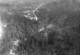
View of Capilano Canyon
![[Photograph of Capilano Crushing Co., plant #1, 606 Marine Dr., West Vancouver B.C.]](/uploads/r/null/a/8/a84134ad033f61f6fd54ebe6dfbd15b0a9ee2087e7063eae8f431106a9b93fd0/8d78a63e-a5d6-449b-9839-3d88cc65171b-A38721_142.jpg)
[Photograph of Capilano Crushing Co., plant #1, 606 Marine Dr., West Vancouver B.C.]

North Vancouver waterfront
![[Looking East along North Shore of Burrard Inlet showing] Lyall Shipyards](/uploads/r/null/7/6/7678fa1b56c04440934da67100938dfff341a5d4c13498df784bdf7ceaa20409/5d643fec-17a2-48f6-bb2f-536d1e76a73a-A44689_142.jpg)
[Looking East along North Shore of Burrard Inlet showing] Lyall Shipyards

Lions Gate Hospital Area : North Vancouver Medical Centre Area

Geographical : Burrard Inlet

Capilano Valley and the Lions, Canyon View Hotel in foreground
Capilano Creek looking south showing Canyon View Hotel
![[Burrard Dry Dock, North Vancouver]](/uploads/r/null/c/5/c55ceb38142386448aae582a068e8e5638fb8c4f3d405e48d5801e955308b049/3204e6d8-0956-4a3d-bd89-b8448f94deb9-A23408_142.jpg)
[Burrard Dry Dock, North Vancouver]
![[Burrard Dry Dock from the air]](/uploads/r/null/f/6/f697efd23e2530d394af63aea6c7ce4ff6241e55b1020a7b50e6b59f588d3c9b/546ed067-3280-4554-b322-b4cdedc13652-A43331_142.jpg)
[Burrard Dry Dock from the air]
![[Aerial view of the waterfront east of the Lions Gate Bridge]](/uploads/r/null/2/f/2f4f758732e66be5c9a630c9bc1a3825a9e67e23c0cbb7f5c3aa4673f87b3612/f436e785-f0d0-4e8a-bcbb-d1dd7bf332f2-A61181_142.jpg)
[Aerial view of the waterfront east of the Lions Gate Bridge]
![[Aerial view of the Cleveland Dam, Capilano Lake and a portion of the Glenmore subdivision]](/uploads/r/null/3/9/399b03da5e7aff8921c363411aff0ff59308b840b0fcf3d1f9e45e54612a6398/241ed6bf-dc7b-4f29-930e-542982da6184-A33748_142.jpg)
[Aerial view of the Cleveland Dam, Capilano Lake and a portion of the Glenmore subdivision]
![[Aerial view of the Cleveland Dam and Capilano Lake]](/uploads/r/null/2/d/2dd436651b825b9f47ef30c7faef322e33a7a58fafcada712d5da71134736c7d/af2b6b11-8b8c-4e04-9855-a2c6380c8e6f-A33749_142.jpg)
[Aerial view of the Cleveland Dam and Capilano Lake]
![[Aerial view of Seymour Creek Dam]](/uploads/r/null/6/8/68188aefc4414456bd2dacd0cd9dfff2a6c2d96bb8400e47a69f24748909569a/44276fbd-2bce-4c02-a993-5d8e4085bd11-A34093_142.jpg)
[Aerial view of Seymour Creek Dam]

[Aerial view of North Vancouver, First Narrows, Stanley Park, West End, Coal Harbour, Burrard Inlet, Vancouver Waterfront and Downtown]
![[Aerial view of Cleveland Dam]](/uploads/r/null/7/6/76e433a06ca4446d457454da245c93b33735b7734edffb74927fc5b352ee5dd6/9c627964-b2fa-4eb4-9fdb-152ce6425ea4-A34094_142.jpg)
[Aerial view of Cleveland Dam]
![[Aerial view of Burrard Inlet, Vancouver waterfront and North Vancouver waterfront]](/uploads/r/null/7/e/7ebb42bad115eb635562fde51fb418b1e63ecf9048f15193681f167f6966c96a/874ecdbf-b7e9-4561-b45f-1003efcc073f-A66601_142.jpg)
[Aerial view of Burrard Inlet, Vancouver waterfront and North Vancouver waterfront]
![[Aerial view of Burrard Inlet, Hastings-Sunrise, Burnaby and the District of North Vancouver]](/uploads/r/null/d/f/df7e11c97173ce0473c454f0a01569b641972f6efdc12bf192edbc42119542d6/6d72f89b-9b55-48c4-bef6-04eb2137f1d3-A66600_142.jpg)
[Aerial view of Burrard Inlet, Hastings-Sunrise, Burnaby and the District of North Vancouver]
![[Aerial view looking west south-west of the] District of North Vancouver](/uploads/r/null/e/c/ec241a495ce73acb4df544a3511e33bf47855c3f9780f6fdf330d5e1998b35f4/4b33b03c-3b2c-434d-877d-de90ed039d2a-A23500_142.jpg)
[Aerial view looking west south-west of the] District of North Vancouver
![[Aerial view looking west of the] District of North Vancouver](/uploads/r/null/9/5/958342bfc158583761e59a85838c811fc69beaa535cf44a6a97fc6da0b2b9fec/fc695e17-8926-494e-b8d0-bef82af0912c-A23498_142.jpg)
[Aerial view looking west of the] District of North Vancouver
![[Aerial view looking south-west of the] District of North Vancouver](/uploads/r/null/0/d/0d8adb3b55d68b7df4c4925829b8ff3b87c6f13f3a1ec81d303a4854c57064b0/0e67b80d-8372-4feb-93c5-e9c63b1d4541-A23499_142.jpg)
[Aerial view looking south-west of the] District of North Vancouver
![[Aerial view looking south-west of the] District of North Vancouver](/uploads/r/null/a/b/ab2ec4570d14f519cdac8220126fd3bf21b20665ef1313681e9bbfbb2e1dd1c5/69236007-852b-4154-94da-29459b1bc14a-A23495_142.jpg)
[Aerial view looking south-west of the] District of North Vancouver
![[Aerial view looking south of the] District of North Vancouver [between Seymour and Lynn Creeks]](/uploads/r/null/e/f/efec87eb86f83a0865fb63dd855e51942b3f5e6b75c5f105b15ef3db57d5b5c9/107091fb-3414-4f25-bc79-e59cee44fbab-A23496_142.jpg)
[Aerial view looking south of the] District of North Vancouver [between Seymour and Lynn Creeks]
![[Aerial view looking north-east of the] District of North Vancouver](/uploads/r/null/9/5/95a056a0d3b5e734a0ac2527276ac4aca69e5dade031eb57596c7d359c95cdc4/50dcb21d-5cb6-41b7-ba47-eab3470af912-A23497_142.jpg)
[Aerial view looking north-east of the] District of North Vancouver
![[Aerial view looking north of the] Vancouver Wharves Ltd.](/uploads/r/null/a/3/a3e50a2d6a7688fca44a9f2fae2ec7ad724640047b3512a075ae83d4e5a3378e/ce172262-4f02-498d-ab6c-e23b06e50b09-A23502_142.jpg)
[Aerial view looking north of the] Vancouver Wharves Ltd.