![Wing's Hotel [at] 143 Dunlevy [Avenue]](/uploads/r/null/a/4/a438b384b68baa82689e29a7436de0457fda7ba103553ba9567b6ab2e13d8ea8/47f00995-1467-4fdd-bb3a-0e646fbf9d63-A59188_142.jpg)
Wing's Hotel [at] 143 Dunlevy [Avenue]
- COV-S511---: CVA 780-323
- Item
- Apr. [19]79
Part of City of Vancouver fonds
Photograph also shows businesses on the ground level of Wing's Hotel including Sports and Vintage Cars (393 Powell Street), Emmanuel Mission (395 Powell Street), Bill's Bargain Centre Used Furniture Store (397 Powell Street), and Powell Shoe Repair Store (399 Powell Street)
![[Western Assembly Ltd. shed, 94 West Pender Street (rear)]](/uploads/r/null/f/9/f95f7aba035edf4d5afeb10c133ce3cdd0f7a4521fcdaaa5290bcbc76dbeb60d/4046eb74-bce3-4733-9056-7b8fa52b0d34-A59066_142.jpg)
![[Western Assembly Ltd. shed, 94 West Pender Street (rear)]](/uploads/r/null/3/4/34b5f4a263d5c309c616cd7d2abf02376fe515fe00ed297748ea44a85c0afe32/f4855238-e473-44d7-906f-3e3f59095040-A59070_142.jpg)
![[Western Assembly Ltd. shed, 94 West Pender Street (rear)]](/uploads/r/null/d/b/db46d229e885b574fe44a0193e9d777d0792c46d57682de856e13ba32bf45e4d/1767a6e9-7f65-4f77-81b6-ebc77b4957b6-A59069_142.jpg)
![[Western Assembly Ltd. shed, 94 West Pender Street (rear)]](/uploads/r/null/4/9/492ec4de27318ded629f59e34564bfa87aa272ead8ce13c616f8f77d56ac7e6c/1fe45c06-61c0-4e6a-951d-bdbe60ae8815-A59067_142.jpg)
![[Western Assembly Ltd. shed, 94 West Pender Street (rear)]](/uploads/r/null/3/c/3ca1db079afe7c07ccfa546c35347701684943b72b522684e4ab0c854ff0c578/a8086357-3f3f-4d5e-88a4-2766da433b51-A59068_142.jpg)
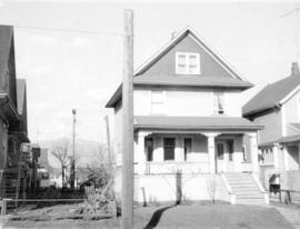
![[View of three "old" houses. Centre one, 747 East Pender Street]](/uploads/r/null/1/7/179537c0d75cce724d5663ee85e640539a41908ce3ec36e97eb83605cec5749a/65f357f3-f8ac-4fc2-8149-be03f244a0ed-A47162_142.jpg)
![[View of three houses on Jackson Avenue from the corner of Oppenheimer Park]](/uploads/r/null/5/c/5c8e73d135383cf949fa54a967ceca3bb4897c7513855bf7d95669bbd58b37dc/41c5b4a9-98b2-4d74-8629-9930de792ecc-A59207_142.jpg)
![[View of the southside of the 400 block Alexander Street between Jackson and Dunlevy Avenues]](/uploads/r/null/c/8/c82ff1c8344e1ebc7734df0a23488dff2186c0b9237158e780358a4ca62b5a73/c1b1ad99-bf7b-45be-bf26-b7176f27d740-A59217_142.jpg)
![[View of the 700 block Prior Street] from Malkin St [Avenue]](/uploads/r/null/0/6/060f8de30163254502b972a96016bb94d78d8d1689b21d73dc2394f1dd1be8d8/57d3834c-c497-472a-823e-5b20842664d7-A59071_142.jpg)
![[View of the] 600 block Gore [Avenue]](/uploads/r/null/b/d/bd218fdcadb8e28c92b3ca97ac758066135d91c18f0d1d3f01e800a435db2722/776b2054-662d-4e49-b49c-1e4660f55004-A59198_142.jpg)
![[View of the] 400 [block] Powell [Street]](/uploads/r/null/2/f/2fc94bc44d98dca34172e2c2f8a215a31fdbc4a4923258e055756c0ddc26acbb/b18293ff-b3c2-4b88-a0f8-3a65988adc1f-A59184_142.jpg)
![[View of the] 400 block Powell [Street]](/uploads/r/null/a/0/a0f18c3582888b4ad0a19a2c0b50b309a625804443c4447361c8a36271ecdc56/a90e80c8-0bf3-434e-9409-0a4b2be17d6b-A59193_142.jpg)
![[View of the] 300 block Railway [Street]](/uploads/r/null/5/a/5ace8d71bcf997ec706d0ebe80604d0a8f7ba3edc8c1bc1de3526310684f5af6/6ca377c9-3602-4c83-a634-94701e6192af-A59192_142.jpg)
![[View of the] 300 [block] E[ast] Hastings [Street]](/uploads/r/null/0/0/00bd469b3a8823cb1df09b0a5ddb45dbdaf70687ad23c72c98a068aec58b06e8/5f4f8317-96f0-41ce-8112-b5f688ea4cb8-A59194_142.jpg)
![[View of] Raymur Ave[nue]](/uploads/r/null/9/4/94763acb70dd0687d9fef35684ef97b0e92e54fdd39ab0f45b366467628a1a4c/a7e4ec7d-bee8-4dbd-a308-acd09076cd97-A59211_142.jpg)
![[View of Oppenheimer Park]](/uploads/r/null/2/b/2bdee6b9ef03a2de5645ca6c7f8c3d1efb22224293704977585b765ebad5d542/637b119d-05db-4095-8976-92723442f7b5-A59236_142.jpg)
![[View of one-storey stuccoed house (ca 1910) at 865 Prior Street]](/uploads/r/null/6/f/6f1ab1300cea4cec5c3a9ff14ff0ec963f2c6a87f9162ec014b85df60f01bbfc/3fe33b48-4a23-4636-bd5c-889a42bb17b9-A47160_142.jpg)
![[View of one-storey house (ca 1910) at 1737 East Pender Street]](/uploads/r/null/1/e/1e27d44555ee3c5c347719aeba156f4a8d2af3df4739df22c949edd81a800d85/3a2ee74a-fa14-4d83-ab24-5c9afc095f86-A47159_142.jpg)
![[View of one-storey house (ca 1910) at 1022 McLean Street]](/uploads/r/null/3/f/3f4295425d37c5f20b2082b4337115928c87c1c2ef41035ef19b425b0b768386/eb91ba6c-2450-41ca-85bd-ee8b4bb36629-A47164_142.jpg)

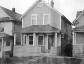
![[View of one-storey house at 718 Pender Street]](/uploads/r/null/d/4/d42a1d4807beab8a8a2b47b83b8bf18ffb5ff0a459ee43046ea1281ca77b66d8/1ac796a9-4129-43b0-9a1c-e4c5832a01f3-A47161_142.jpg)
![[View of one-storey gabled house (ca 1910) at 426 Union Street]](/uploads/r/null/7/c/7c2aac9e8e5d90262ef44d7ec5a27489bddf673849302f46cc49d0900a8c95a3/46b25e2d-e1fd-4106-a52c-b6d447bd5e77-A47158_142.jpg)
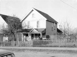
![[View of "old" (ca 1909?) one-and-one-half storey house at 724-726 East 7th Avenue]](/uploads/r/null/8/f/8fc6a7fa0037a4e74303bdd3340afa351151dc98bbfdd72c6ad7f09bb637372a/cb5b00b6-04ed-4ded-b464-dd75d3ebac12-A47154_142.jpg)
![[View of "old" (ca 1909?) one-and-one-half storey house at 1521 Salsbury]](/uploads/r/null/3/f/3fd3490cb8ef2a94c7780fb6ca471d706a9b64fbbc3371a0d8a7238254cdf91d/208e10b8-4bd5-4a14-b2ff-ebc8036377e5-A47155_142.jpg)
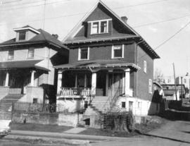
![[View of "old" (ca 1909?) one-and-one-half storey house at 1437 East 10th Avenue]](/uploads/r/null/a/3/a3e213950ffd1528e512ce1b9921baccc2aa693b5ce31a03bdef139cc994396b/ffceb552-071c-45d4-b429-61a0979bad9b-A47153_142.jpg)


![[View of "old" (ca 1904?) one storey house at 436 Union Street]](/uploads/r/null/7/e/7e4cc99f56f2209f1ea12a8a43b4d9aa0414c0fc51f0f10ee95e10da3cccc24d/d798aeee-7a4f-4d6a-8931-a0891829c9eb-A47157_142.jpg)
![[View of "old" (1904?) one storey house at 2264 Eton Street]](/uploads/r/null/6/d/6ddccc4299051cf65d4a9eb490a18cca0ed93419f677e9c0d79285705eb8d33b/f2a69844-ee5f-4ae1-81bb-6616549b6d76-A47156_142.jpg)
![[View of Malkin Wholesale Cash & Carry (750 Malkin Avenue) from Prior Street]](/uploads/r/null/9/6/969f1e392eb3b1659e86774eb23e7d89836d15addfa1d69db55c222db28a2e2c/29d7ac7a-e2fa-4d42-8b7e-5349721aa0a5-A59072_142.jpg)
![[View of group of "old" houses at 1145, 1147 and 1149 Semlin Street]](/uploads/r/null/8/b/8bb8852928532be10dd6d90f7f199363da51dd1c4939ce022d354231cef716ba/0ae0fa63-9aca-48b2-8419-d5652e159b2c-A47152_142.jpg)
![[View of] Georgia St[reet]](/uploads/r/null/2/d/2de55776fa0a7eebca8462b869ccbf0ec668aed52ea363de73733f1ffa5c2674/1478fe0e-a4f1-4cb4-b9ad-175861aa84e2-A59200_142.jpg)
![[View of East Pender Street at night]](/uploads/r/null/7/4/74ecbde63e3b15ee111f752cc895b59d5ee6630cac77ae06770c70d47789c874/f5ee10f4-9215-4ece-8efc-26a986c27303-A59340_142.jpg)
![[View of East Pender Street at night]](/uploads/r/null/4/5/4567057890860c08ba1bd0789387e24d2f94dd1dbf88cdd5f58182807913d83a/ae901d04-cea5-46c8-978c-acfe01af9c6e-A59341_142.jpg)
![[View of an empty lot for sale]](/uploads/r/null/b/4/b43b1de76785e6d345ac7e91155ddba0311c02187632364d154debbb50e102e0/1c8deeba-d41a-4bed-8bea-a795a3e37ed6-A59222_142.jpg)
![[View of a street in Strathcona]](/uploads/r/null/f/9/f9a82414056787d34cf3f48c2f135e245fd89735ed9231125a7264ae29ec110a/bc2acd49-d390-47bc-8298-e34fd55ae901-A59221_142.jpg)
![[View of a doorway]](/uploads/r/null/e/9/e9d15d2e9d8b768a0e783789bccadecb4dad21912c826d364655b15c1f06f30f/51c0286e-7b00-478e-9368-83de8170bf5d-A59176_142.jpg)

![[Via] CN [Rail] Station at 1150 Station [Street]](/uploads/r/null/5/0/50ecd4eaf968d7d628d9cbe4517e4920dbb8a35d94260a656b45087299a206fb/780b3429-50e7-42fd-95ef-7d26c3a750dd-A59240_142.jpg)
![Vancouver, B.C. from Mt. Pleasant (Panorama view) [from Scotia Street and Sixth Avenue]](/uploads/r/null/7/2/72b78a8eafd51df2fbf51d5827543e2e56d582516dc35b844563392b9d5f2ca4/605b2909-96fb-483b-b5b7-d3665dd80ae3-A26630_142.jpg)

