![[Aerial survey view of First Narrows, Stanley Park, the West End, Downtown and North Vancouver]](/uploads/r/null/f/8/f875c0a639388b4936ef86faafb227a0fcad6478409cc8c2ff64fa2c06296ca5/94a6f99f-1ce3-4c9b-9e48-894735d096e9-A23486_142.jpg)
[Aerial survey view of First Narrows, Stanley Park, the West End, Downtown and North Vancouver]
![[Aerial view looking east over Stanley Park, Coal Harbour and Burrard Inlet]](/uploads/r/null/d/0/d02fee694c486ac2accdeefb505d0dae5fcb42789ef16de49322d845e3c04b44/be8c34ce-7c09-4c0e-a395-f083c9134080-A43248_142.jpg)
[Aerial view looking east over Stanley Park, Coal Harbour and Burrard Inlet]
![[Aerial view looking west south-west of the] District of North Vancouver](/uploads/r/null/e/c/ec241a495ce73acb4df544a3511e33bf47855c3f9780f6fdf330d5e1998b35f4/4b33b03c-3b2c-434d-877d-de90ed039d2a-A23500_142.jpg)
[Aerial view looking west south-west of the] District of North Vancouver
![[Aerial view of Burrard Inlet, Hastings-Sunrise, Burnaby and the District of North Vancouver]](/uploads/r/null/d/f/df7e11c97173ce0473c454f0a01569b641972f6efdc12bf192edbc42119542d6/6d72f89b-9b55-48c4-bef6-04eb2137f1d3-A66600_142.jpg)
[Aerial view of Burrard Inlet, Hastings-Sunrise, Burnaby and the District of North Vancouver]
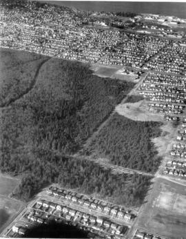
Aerial view of Camosun Park
Aerial view of Camosun Park
Aerial view of Camosun Park

Aerial view of Camosun Park
Aerial view of Memorial West Park
Aerial view of Memorial West Park

Aerial view of Memorial West Park
![[Aerial view of Mount Pleasant, South Strathcona and Kensington-Cedar Cottage]](/uploads/r/null/7/5/75ea991fe8319eaffda79b314cbf20e281e35eb2cd8a89eaa898b492242d6282/05f856f3-0a45-41eb-94dc-46cb9d2f7ecf-A63348_142.jpg)
[Aerial view of Mount Pleasant, South Strathcona and Kensington-Cedar Cottage]
Aerial view of Musqueam Park
Aerial view of Musqueam Park

Aerial view of Musqueam Park

Aerial view of New Brighton Park site, looking east from Renfrew Street

Aerial view of New Brighton Park site, looking west along waterfront toward foot of Renfrew Street
![[Aerial view of Stanley Park from downtown, 1 of 2]](/uploads/r/null/e/a/2/ea2fa7aeab8d090954336d4db69c725ba8abe57666d3be52009dbd001144c31e/c53aa37e-5123-4247-bfcf-31b31651977f-CVA1095-07042_142.jpg)
[Aerial view of Stanley Park from downtown, 1 of 2]
![[Aerial view of Stanley Park from downtown, 2 of 2]](/uploads/r/null/8/d/f/8dfcdae0f34fc74635d4083942eb671c0ef2a5ac52c683008bafec1a8ee3e3ec/c8facdb8-84fd-459b-935a-f90e79b7a972-CVA1095-07043_142.jpg)
[Aerial view of Stanley Park from downtown, 2 of 2]
![[Aerial view of the West End showing the increase of apartment buildings west of Cardero Street]](/uploads/r/null/9/4/9410444a29ad3e6e13228ba5ad44b40986af7ad70945337641000d03b991a529/ee9fb9e8-21b9-4ca5-a5b6-d28e6d51046e-A25977_142.jpg)
[Aerial view of the West End showing the increase of apartment buildings west of Cardero Street]
![[Aerial view of Vancouver]](/uploads/r/null/b/9/b973b9a4143a5316b02e728c35d99e383f27a3db21d8e20aa7bbb459780243bc/3ff38b56-6b36-4c17-bce1-329c97459d29-A66598_142.jpg)
[Aerial view of Vancouver]
![[Aerial view of Vancouver Harbour from Stanley Park looking east to Indian Arm]](/uploads/r/null/c/b/cb066fdc626d69001bfb4c896937f586737298cc09ee0de3cc7fdd0bca8df09e/93414b9d-edd5-4e76-a79d-fb7a26360472-A31831_142.jpg)
[Aerial view of Vancouver Harbour from Stanley Park looking east to Indian Arm]
![[Aerial view of West Point Grey, Kitsilano, Dunbar - Southlands and University Endowment Lands]](/uploads/r/null/0/8/089d213e9a81ca689130a244122a86972e068c9b01ab994922a88072ac881121/1ed71859-c157-4686-82db-e3483cd4b877-A66599_142.jpg)
[Aerial view of West Point Grey, Kitsilano, Dunbar - Southlands and University Endowment Lands]

Aerial view, Brockton Point Lighthouse and part of waterfront, Vancouver, B.C.
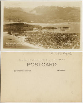
Aeroplane view of the North Shore - Stanley Park - West End and English Bay - Vancouver B.C.
Aldergrove Lake regional park
Aldergrove Lake regional park
![[Alexandra Park]](/uploads/r/null/a/a/aa5a43bde770806111c0ea2763e09c8c4c0f2e7d7f83b4c4e6390acf8746b454/a68477f1-afa8-422b-940e-99edad20867e-A59294_142.jpg)
[Alexandra Park]
Alexandra Park
Alexandra Park

Alexandra Park - Joe Fortes Memorial drinking fountain, back

Alexandra Park - Joe Fortes Memorial drinking fountain, front (bandstand behind)
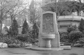
Alexandra Park - Joe Fortes Memorial drinking fountain, front (bandstand behind)

Alexandra Park - Red Oak (Cardero Street and Beach Avenue)

Alexandra Park, bandstand

Allscreen - Vancouver - reel #2
Allscreen - Vancouver - reel #4
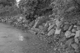
Almond Park dry rock wall and cut granite steps
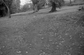
Almond Park path on bank (not well articulated)
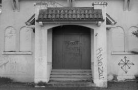
Almond Park Substation
Almond Park Substation

Almond Park, looking west - Copper Beach
Almond Park, West 13th Avenue, street end

Along Tatlow Walk, Stanley Park, Vancouver, B.C.

Alpine and Montane : Hurricane Ridge- view from ridge to west

Alpine and Montane : sub-alpine meadow, Hurricane Ridge
Ambleside, West Vancouver
Ambleside, West Vancouver

And home : Leaving the park

Angus Park trees

Angus Park trees
![[Anniversary Quarry Garden plaque, Queen Elizabeth Park]](/uploads/r/null/7/1/d/71d32d280794582b861f96a73e6f8dd5a8d1997c38bbe9c743b6685ae24dfa0f/3d0a0259-63f2-47c7-94ca-07c3a54ae532-CVA1095-01090_142.jpg)
[Anniversary Quarry Garden plaque, Queen Elizabeth Park]
![[Apodaca Park (D.L. 4974) and Cove from the water]](/uploads/r/null/f/a/faba6e0b8b4c25db985f0ca724b2a9fedce0624d266f732170d6186c4ab3e826/8d74a0d3-3836-4f71-ab01-50ff1ee8b9d5-A59989_142.jpg)
[Apodaca Park (D.L. 4974) and Cove from the water]
![[Apodaca Park (D.L. 4974) and Cove from the water]](/uploads/r/null/8/3/1/831e92f91dc63f1a13b6ac1d30818605131d79cd305173eae5b335537206cc75/a949b3da-0421-4e99-8ab9-dd0b5103947c-CVA371-215_142.jpg)
[Apodaca Park (D.L. 4974) and Cove from the water]
Application for amendment to Zoning and development by-law no. 3576
Application for amendment to Zoning and development by-law no. 3576
Appreciation for plan of development : Queen Elizabeth Arboretum, September, 1949
Appreciation for plan of development : Queen Elizabeth Arboretum, September, 1949