B.C. Electric guide to Greater Vancouver : Richmond transit system, downtown Vancouver transit system, street index, and general information
B.C. Electric guide to Greater Vancouver : Richmond transit system, downtown Vancouver transit system, street index, and general information
Chinatown
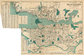
City of Vancouver surrounding [sic] and municipalities including City of New Westminster
City of Vancouver, B.C. area map : Camosun Street to Granville Street and King Edward Avenue to 49th Avenue
City of Vancouver, B.C. area map : Cartier Street to Inverness Street and 57th Avenue to the North Fork of the North Arm of the Fraser River
City of Vancouver, B.C. area map : Discovery Street to Granville Street and English Bay to King Edward Avenue
City of Vancouver, B.C. area map : Granville Street to Inverness Street and 37th Avenue to 57th Avenue
City of Vancouver, B.C. area map : Granville Street to Inverness Street and 6th Avenue to 37th Avenue
City of Vancouver, B.C. area map : Heatley Avenue to Boundary Road and Burrard Inlet to 2nd Avenue/5th Avenue
City of Vancouver, B.C. area map : Inverness Street to Boundary Road 54th Avenue to the North Arm of the Fraser River
City of Vancouver, B.C. area map : Inverness Street to Boundary Road and 2nd Avenue/5th Avenue to 32nd Avenue
City of Vancouver, B.C. area map : Inverness Street to Boundary Road and 32nd Avenue to 54th Avenue
City of Vancouver, B.C. area map : Maple Street to Heatley Avenue and Burrard Inlet to 6th Avenue
City of Vancouver, B.C. area map : Wallace Street to Cartier Street and 49th Avenue to the North Arm of the Fraser River
City of Vancouver, B.C. area map : western boundary with University Endowment Lands to Camosun Street and English Bay to 16th Avenue; Musqueam Indian Reserve no. 2
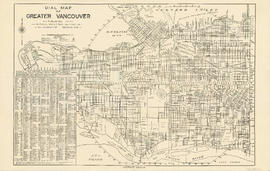
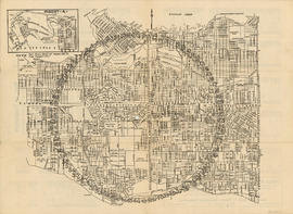
Dial map of Greater Vancouver
Dial map of Greater Vancouver
Dial map of Greater Vancouver
Dial map of Greater Vancouver
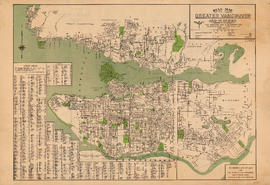
Dial map of Greater Vancouver and suburbs
Dial map of Greater Vancouver and suburbs
Dial map of Greater Vancouver and suburbs
Dial map of Greater Vancouver and suburbs
Dial map of Greater Vancouver and suburbs
Dial map of Greater Vancouver and suburbs
Dial map of Greater Vancouver and suburbs
Dial map of New Westminster and Burnaby
Dial map of Vancouver and suburbs
District lot index and street index (1st Avenue to Campbell Avenue)
Georgia Street
Guide map : Vancouver, New Westminster, Burnaby and North Shore municipalities
Guide map : Vancouver, New Westminster, Burnaby and North Shore municipalities : street index
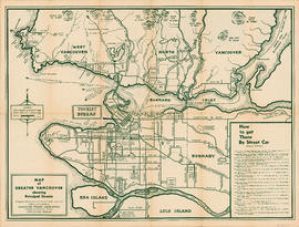
Indexed map of Greater Vancouver showing distances from Bekins building
Map of Burnaby and New Westminster, British Columbia
Map of City of Vancouver, British Columbia
Map of down-town retail business section
Map of downtown section of Vancouver ; Diagram of New Westminster, B.C., downtown section
Map of Fraser Valley
Map of Fraser Valley
Map of Fraser Valley ; Street map of New Westminster ; Map of Greater Vancouver transit lines
Map of Greater Vancouver
Map of Greater Vancouver showing principal streets
Map of Lulu Island and Sea Island ; Municipality of Delta ; Municipality of Surrey ; Municipality of Langley ; Map of Maillardville
Map of Lulu Island and Sea Island ; Municipality of Delta ; Municipality of Surrey ; Municipality of Langley ; Map of Maillardville
Map of Lulu Island and Sea Island ; Municipality of Surrey ; Map of Maillardville ; University Endowment Lands
Map of Lulu Island and Sea Island ; Municipality of Surrey ; Map of Maillardville ; University Endowment Lands
Map of New Westminster and Burnaby with street directory indicated by dial : map cover and street index
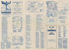
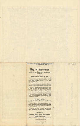
Map of Vancouver with street directory indicated by dial : map
Map of Vancouver with street directory indicated by dial : Map cover


![City of Vancouver surrounding [sic] and municipalities including City of New Westminster](/uploads/r/null/8/9/1/8919931915a624a5abd2e5d2953118fdd853654343ce31193f00d341d482bf39/fd6eb299-3e6a-498e-bfd9-62a3279a8861-LEG1329_142.jpg)