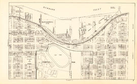
Map of the city of Vancouver, British Columbia
Sectional map and street directory of Vancouver : Dial map of the city of Vancouver including adjacent municipalities
Sectional map and street directory of Vancouver : Dial map of the city of Vancouver including adjacent municipalities
Vancouver, B.C. city map
Vancouver, B.C. city map

Plan of Point Grey Municipality
Vancouver, B.C., the Pacific coast terminus of the C.P.R. [Canadian Pacific Railway]
Vancouver, B.C., the Pacific coast terminus of the C.P.R. [Canadian Pacific Railway]
Map of Vancouver, Burnaby, New Westminster, British Columbia
Map of Vancouver, Burnaby, New Westminster, British Columbia
Indexed map of Greater Vancouver
Indexed map of Greater Vancouver
Map of Vancouver and Lower Mainland : avenue guide
Map of Vancouver and Lower Mainland : avenue guide

Guide map: Vancouver - New Westminster, Burnaby and North Shore municipalities

City of Vancouver : east half

City of Vancouver : west half

City of Vancouver

City of Vancouver
New Westminster, British Columbia
New Westminster, British Columbia

Vancouver harbour
![Vancouver, B.C. Plan showing location of water pipes, hydrants, etc. [Hastings Sunrise]](/uploads/r/null/b/c/bc8cb6a6f5ac5df0dd88a65e8a29ecceca242bde2c1b605533ad17eb835cc450/b2741291-73c5-4a98-9f41-db7fdc46fe83-MAP72_142.jpg)
Vancouver, B.C. Plan showing location of water pipes, hydrants, etc. [Hastings Sunrise]
D.L. 301 - Ward 8 [water pipes and hydrants]
D.L. 301 - Ward 8 [water pipes and hydrants]
![Proposed Raymur Ave. [Avenue] Trunk Sewer diverting sewage from False Creek reclaimed area](/uploads/r/null/c/d/cddf61ac60b97b6fc54309ecbf8d1aea8e9aac3c672576fbd9953a05b82d42fc/14951fa4-0fd0-480c-a1f3-b7c2ef158398-MAP761_142.jpg)
Proposed Raymur Ave. [Avenue] Trunk Sewer diverting sewage from False Creek reclaimed area
![Proposed Raymur Ave. [Avenue] Trunk Sewer diverting sewage from False Creek reclaimed area](/uploads/r/null/5/2/5260099e92441f23442086ea3a8b5f7512bb5b4b4b5cbf554c9f13450bf4d37f/b5165f5d-bd82-46b5-9beb-0f969f7755ef-MAP761_142.jpg)
Proposed Raymur Ave. [Avenue] Trunk Sewer diverting sewage from False Creek reclaimed area
![Proposed Raymur Ave. [Avenue] Trunk Sewer diverting sewage from False Creek reclaimed area](/uploads/r/null/a/8/a8edd70876832fb32ffa8add8b5e261fe78b0e6efcb26d07a6fe1c74bf545b57/ac62eada-955d-4eee-8508-6bf4b71a21e5-MAP761_142.jpg)
Proposed Raymur Ave. [Avenue] Trunk Sewer diverting sewage from False Creek reclaimed area
Vancouver and Victoria street and vicinity maps
Vancouver and Victoria street and vicinity maps
Greater Vancouver road map
Greater Vancouver road map
Automobile road map of Greater Vancouver and environs
Automobile road map of Greater Vancouver and environs
Greater Vancouver and New Westminster : Wrigley's official arrow city map
Greater Vancouver and New Westminster : Wrigley's official arrow city map

Greater Vancouver, British Columbia : regional major street plan

Vancouver, British Columbia : northerly portion, former City of Vancouver : major street plan

Vancouver, British Columbia, south-easterly portion, formerly South Vancouver : major street plan

Vancouver, British Columbia : south-westerly portion, formerly Point Grey : major street plan

City and District of North Vancouver
Vancouver, B.C. and vicinity road map
Vancouver, B.C. and vicinity road map
Map of Greater Vancouver
Map of Greater Vancouver
Metropolitan areas of Vancouver and Victoria, B.C. road map
Metropolitan areas of Vancouver and Victoria, B.C. road map
Sectional map and street directory of Vancouver : Dial map of the city of Vancouver
Sectional map and street directory of Vancouver : Dial map of the city of Vancouver
Sectional map and street directory of Vancouver : Dial map of the city of Vancouver including adjacent municipalities
Sectional map and street directory of Vancouver : Dial map of the city of Vancouver including adjacent municipalities
Dial map of the city of Vancouver including the adjacent municipalities
Dial map of the city of Vancouver including the adjacent municipalities
Indexed map of Greater Vancouver
Indexed map of Greater Vancouver
Street map of Greater Vancouver
Street map of Greater Vancouver
Map of Greater Vancouver including streets, districts, schools, churches, shopping centres, parks, etc.
Map of Greater Vancouver including streets, districts, schools, churches, shopping centres, parks, etc.

Map and guide of Greater Vancouver
Shell map of Vancouver, B.C. and Victoria, B.C.
Shell map of Vancouver, B.C. and Victoria, B.C.

Town-site of Hastings
Victoria and Vancouver street and vicinity maps
Victoria and Vancouver street and vicinity maps
Street map of Vancouver, Burnaby, New Westminster, British Columbia
Street map of Vancouver, Burnaby, New Westminster, British Columbia

Sheet 1 : Slocan Street to Boundary Road and Triumph Street to Burrard Inlet

Sheet 2 : Slocan Street to Boundary Road and Charles Street to Triumph Street

Sheet 3 : Slocan Street to Boundary Road and Seventh Avenue to Charles Street

Sheet 4 : Slocan Street to Boundary Road and Broadway to Seventeenth Avenue

Sheet 5 : Slocan Street to Boundary Road and Seventeenth Avenue to Twenty-ninth Avenue

Sheet 6 : Knight Street to Slocan Street and Eighteenth Avenue to Twenty-ninth Avenue

Sheet 7 : Clark Drive to Slocan Street and Seventh Avenue to Eighteenth Avenue


![Vancouver, B.C. Plan showing location of water pipes, hydrants, etc. [Hastings Sunrise]](/uploads/r/null/b/c/bc8cb6a6f5ac5df0dd88a65e8a29ecceca242bde2c1b605533ad17eb835cc450/b2741291-73c5-4a98-9f41-db7fdc46fe83-MAP72_142.jpg)
![Proposed Raymur Ave. [Avenue] Trunk Sewer diverting sewage from False Creek reclaimed area](/uploads/r/null/c/d/cddf61ac60b97b6fc54309ecbf8d1aea8e9aac3c672576fbd9953a05b82d42fc/14951fa4-0fd0-480c-a1f3-b7c2ef158398-MAP761_142.jpg)
![Proposed Raymur Ave. [Avenue] Trunk Sewer diverting sewage from False Creek reclaimed area](/uploads/r/null/5/2/5260099e92441f23442086ea3a8b5f7512bb5b4b4b5cbf554c9f13450bf4d37f/b5165f5d-bd82-46b5-9beb-0f969f7755ef-MAP761_142.jpg)
![Proposed Raymur Ave. [Avenue] Trunk Sewer diverting sewage from False Creek reclaimed area](/uploads/r/null/a/8/a8edd70876832fb32ffa8add8b5e261fe78b0e6efcb26d07a6fe1c74bf545b57/ac62eada-955d-4eee-8508-6bf4b71a21e5-MAP761_142.jpg)


