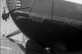
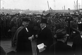
Victoria - Government House, royal visit footage, and soldiers departing
Bapco promotional film, Hong Kong footage
China (dogs, horses, people)
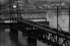
Flowers, horses, painting Pattullo Bridge
Far East Aviation Co.
General plan - sheet 8 [West Boulevard to Forty-first Avenue to Musqueam Reserve to Forty-eighth Avenue]
General plan - sheet 9 [Arbutus Street to Forty-seventh Avenue to Musqueam Reserve to Fifty-third Avenue]
General plan - sheet 11 [Arbutus Street to Celtic Avenue to Fraser River]
General plan - sheet 13 [Cambie Street to Twenty-third Avenue to East Boulevard to Twenty-ninth Avenue]
General plan - sheet 17 [Cambie Street to Forty-seventh Avenue to Arbutus Street to Fifty-third Avenue]
[Fireboat J.H. Carlisle docked at the north side of False Creek in foreground with view of downtown skyline]
Aerial view of Mount Pleasant and False Creek, at Main Street and 2nd Avenue, with Canadian Central Station and Opsal Steel
Aerial view of Vancouver City Hall and residential housing, at Cambie Street and 12th Avenue, with Model and Normal School (City Square Mall) and Blessed Sacrament Parish
Aerial view of False Creek at Terminal Avenue and Quebec Street, with Georgia Viaduct, Main Street and Canadian Western Cooperage sawmill
Aerial view of False Creek, at Quebec Street and Terminal Avenue, with Georgia Viaduct, Main Street, Murrin Substation, and log booms
Aerial view of Downtown Vancouver, Stanley Park and False Creek, North Shore Mountains, North Vancouver, West Vancouver, Lions Gate Bridge, Cambie Street Bridge, and law courts under construction
Zoning [and sectional plan of Vancouver] : supplementary information for sheet 1
Zoning [and sectional plan of Vancouver] : [Boundary Road to Burrard Inlet to Slocan Street to Triumph Street]
Zoning [and sectional plan of Vancouver] : [Boundary Road to Triumph Street to Slocan Street to Charles Street]
Zoning [and sectional plan of Vancouver] : [Slocan Street to Eighteenth Avenue to Knight Street to Twenty-ninth Avenue]
Zoning [and sectional plan of Vancouver] : supplementary information for sheet 7
Zoning [and sectional plan of Vancouver] : supplementary information for sheet 8
Zoning [and sectional plan of Vancouver] : [Clark Drive to Burrard Inlet to Carrall Street to Keefer Street]
Zoning [and sectional plan of Vancouver] : supplementary information for sheet 13
Zoning [and sectional plan of Vancouver] : supplementary information for sheet 14
Zoning [and sectional plan of Vancouver] : supplementary information for sheet 15
Zoning [and sectional plan of Vancouver] : [Oak Street to Fourth Avenue to Maple Street to Sixteenth Avenue]
Zoning [and sectional plan of Vancouver] : [Trafalgar Street to Sixteenth Avenue to Wallace Street to Twenty-seventh Avenue]
Zoning [and sectional plan of Vancouver] : [Cambie Street to Fifteenth Avenue to Granville Street to Twenty-seventh Avenue]
Zoning [and sectional plan of Vancouver] : [Wallace Street to Twenty-ninth Avenue to the University Endowment Lands to Marine Drive]
Zoning [and sectional plan of Vancouver] : [Macdonald Street to Forty-ninth Avenue to Wallace Street to Celtic Avenue]
Zoning [and sectional plan of Vancouver] : supplementary information for sheet X
Zoning [and sectional plan of Vancouver] : [Ash Street to Fifty-ninth Avenue to Cornish Street to Seventy-first Avenue]
Zoning [and sectional plan of Vancouver] : supplementary information for sheet Z
Zoning [and sectional plan of Vancouver] : supplementary information for South Vancouver section sheet 1
Zoning [and sectional plan of Vancouver] : [Bruce Street to King Edward Avenue to Prince Edward Street to Thirty-sixth Avenue]


![General plan - sheet 11 [Arbutus Street to Celtic Avenue to Fraser River]](/uploads/r/null/3/f/d/3fd9a37e7d563f1ab5ea2d9d72418a55895d86310b0a78eab48407b8b835b701/136e3b9b-509e-4f21-94e7-d53135afd227-LEG1153_142.jpg)


![Zoning [and sectional plan of Vancouver] : supplementary information for sheet 1](/uploads/r/null/1/5/d/15df26b8db6e8b8e67bda7138640fbae6cb21d51022fd1ab76864f56dc74af56/471c151f-eeca-4878-9a4b-e412f7f36b5e-LEG1319_142.jpg)
![Zoning [and sectional plan of Vancouver] : [Boundary Road to Burrard Inlet to Slocan Street to Tr...](/uploads/r/null/3/f/b/3fb71b15f36af671916516be0d1960b01cda0c8d93ea0e65d6d12fa3800f1b34/0cc6de25-668e-4d35-a558-59c07ae76905-LEG1319_142.jpg)
![Zoning [and sectional plan of Vancouver] : [Boundary Road to Triumph Street to Slocan Street to C...](/uploads/r/null/6/1/1/611306d71d5389b090e2a6db2f164506db822fab5adc56e43bceb5d810d550e6/235e2070-7e08-4bd6-9fa6-e9a268eeb925-LEG1319_142.jpg)
![Zoning [and sectional plan of Vancouver] : [Slocan Street to Eighteenth Avenue to Knight Street t...](/uploads/r/null/c/3/7/c370aa4081a5e8439e0ff91f67426cd3dbff113f196299063d997fed8e4f975f/2aa98b14-2348-45b8-8d98-ffe2d1792e49-LEG1319_142.jpg)
![Zoning [and sectional plan of Vancouver] : supplementary information for sheet 7](/uploads/r/null/c/5/d/c5d1ce97048cd576e241c40ba7cafd4121efe3f81e2d64115faf75ea3ba6a71b/e2e127d0-af55-4c88-be07-1fcf4e27f94f-LEG1319_142.jpg)
![Zoning [and sectional plan of Vancouver] : supplementary information for sheet 8](/uploads/r/null/2/1/9/21994b4d1731b88a93eab05595cbb4c6feaa9244d95410764154a17ca77176ec/4415afed-c3e6-4543-84fc-99971dc76f97-LEG1319_142.jpg)
![Zoning [and sectional plan of Vancouver] : [Clark Drive to Burrard Inlet to Carrall Street to Kee...](/uploads/r/null/0/7/3/07343150b80da66a67dc09ec8f384ea40250f04a90135f49d168a251d4e4a629/2ad806b1-231b-47bc-ba5e-971d90b28287-LEG1319_142.jpg)
![Zoning [and sectional plan of Vancouver] : supplementary information for sheet 13](/uploads/r/null/8/1/5/8159acedc9381f501a3828674f6454d7c8f52c04b6864743b8c525638e5252a2/08785813-5a5b-47ac-a0b3-bab25c589cb2-LEG1319_142.jpg)
![Zoning [and sectional plan of Vancouver] : supplementary information for sheet 14](/uploads/r/null/5/2/c/52cfd574e3f7c211b6e91a88937c14cc0a831e5e7461c7fb206f374041137720/53de5983-114f-4d08-a4e6-86bbd08e7d6c-LEG1319_142.jpg)
![Zoning [and sectional plan of Vancouver] : supplementary information for sheet 15](/uploads/r/null/0/2/8/0284fa4f53fd690adc878ed7b0e00e6b164ce209e81e4242b02d718f7b0dff90/05e042bf-7a8c-499e-8f9c-b6914257f21f-LEG1319_142.jpg)
![Zoning [and sectional plan of Vancouver] : [Oak Street to Fourth Avenue to Maple Street to Sixtee...](/uploads/r/null/d/8/3/d83c503d6c6b2b5f31c09989a2de72abd18ec92c458b10211a2a2eaad488e478/fac24afc-05ae-4115-bcf5-1dd4c02c434b-LEG1319_142.jpg)
![Zoning [and sectional plan of Vancouver] : [Trafalgar Street to Sixteenth Avenue to Wallace Stree...](/uploads/r/null/6/d/e/6dea1a52ef90573edd751280e053d4bb2e6efbeac6251e0539c425f185942bb2/aef1e547-299c-45ca-adf4-cb54fc664cb6-LEG1319_142.jpg)
![Zoning [and sectional plan of Vancouver] : [Cambie Street to Fifteenth Avenue to Granville Street...](/uploads/r/null/c/e/8/ce89e627ac11a5d1595a6c5a5a4d6db1f0e33553a61efb18ab23add4aabd6a4e/9e9c4b5e-4f8a-47ac-9e39-646ae2d2816b-LEG1319_142.jpg)
![Zoning [and sectional plan of Vancouver] : [Wallace Street to Twenty-ninth Avenue to the Universi...](/uploads/r/null/4/6/1/46142fbbcb2eb5915bdb38c2a8f829ff05452ad54ad196115900fd739bf9f852/ff233104-5fda-49f3-9e62-79b70104a194-LEG1319_142.jpg)
![Zoning [and sectional plan of Vancouver] : [Macdonald Street to Forty-ninth Avenue to Wallace Str...](/uploads/r/null/9/b/e/9be793b7dee726af3512f1e5c54f8fb9336563e8f67b72993d5ee8f1edbf148e/0e4a2fb8-ad2e-469c-a9a2-dbccd8d99418-LEG1319_142.jpg)
![Zoning [and sectional plan of Vancouver] : supplementary information for sheet X](/uploads/r/null/d/a/9/da971cdec9733f9cd02db256192709035525a3d1dcbf7345138db784eefedd4e/00589e53-3b43-4bb1-983d-533a60521184-LEG1319_142.jpg)
![Zoning [and sectional plan of Vancouver] : [Ash Street to Fifty-ninth Avenue to Cornish Street to...](/uploads/r/null/4/7/d/47dffc9b481f5b2587fab7e715a81624e47ed6e22a0f8924748e7f4863ed335f/039085c5-3dd0-4789-9c76-5ab1038157a7-LEG1319_142.jpg)
![Zoning [and sectional plan of Vancouver] : supplementary information for sheet Z](/uploads/r/null/1/b/7/1b731c46965252a73a05ea6ae6fde5d7bee3edd2ce6918f3145fd196fdb192c0/2108bc3f-ca24-4cd7-abaf-98d4d01a8296-LEG1319_142.jpg)
![Zoning [and sectional plan of Vancouver] : supplementary information for South Vancouver section ...](/uploads/r/null/f/c/c/fccaf1995bf5af8f2255b8b674742f568490c9345cb33aa45e01975dd57dc485/605b2c7d-cd66-4d7f-97e3-271b1fda7f72-LEG1319_142.jpg)
![Zoning [and sectional plan of Vancouver] : [Bruce Street to King Edward Avenue to Prince Edward S...](/uploads/r/null/d/d/2/dd2ed325848d3ac32bd219882aa73a93579dc4d8fe65cdfffe816830ebed3973/7edc1ef3-4043-4ccb-8e4c-32773cdd9ffc-LEG1319_142.jpg)