Showing 105 results

Archival description
Item Surveys With digital objects
Print preview View:

Canadian Pacific Railway. Plan of part of branch line from Port Moody. A point on main line C.P.R. to English Bay, B.C.

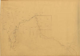
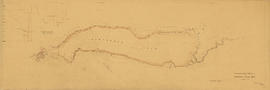
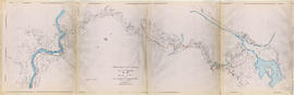
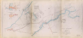
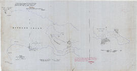
Map shows a survey conducted by the Canadian Pacific Railway of English Bay, Burrard Inlet and Coal Harbour, including a rough outline of area and lots. Note on map reads "Certified as a correct plan showing the land required for right of way Burrard Inlet B.C., February 22, 1886. H.J. Cambie, Engineer in Charge." Map is certified as correct and signed by various C.P.R. officials, including W.C. Van Horne.
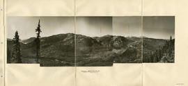
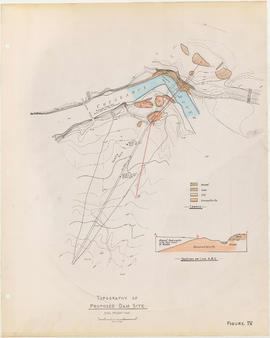
Garibaldi Lake, Daisy Lake and Cheakamus River

Item is a sheet containing the following survey photographs: Stillwater below Daisy Lake; Looking up Cheakamus River from canyon dam site; Leakage from Garibaldi Lake through lava into Garibaldi Creek; Looking up-stream from near Cheakamus Canyon power station; Looking up Cheakamus River from P.G.E. Rlwy. bridge Mile 19.1; Looking up Cheakamus River to Daisy Lake dam site; Looking down Cheakamus river from canyon dam site.

Topography of proposed dam site

Item is a sheet with two maps depicting a possible dam site on the Cheakamus River: a topographical map of the site with the dam location annotated, and a cross-section depicting the geology of the dam site.

Cheakamus River with proposed dam site at McGuire

Item is a sheet with three maps depicting a possible dam site on the Cheakamus River near McGuire: a topographical map of the site with the dam location annotated, and a cross-section depicting the geology of the dam site.

Cheakamus River valley with possible dam location

Item is a sheet with three maps depicting a possible dam site on the Cheakamus River: a topographical map of the site with the dam location annotated, a cross-section depicting the geology of the dam site, and a profile of the tentative location of a tunnel.

Topographical map of Garibaldi Park

Item is a copy of a Government of British Columbia Lands Department map which has been used as a base map to depict elements of the proposed development. Annotations depict routes of pipleines and tunnels; locations of powerhouses, dams and shafts; and acreages of affected areas.

Cheakamus power survey for City of Vancouver 1930-1931. Plan showing proposed development for McGuire & Brandywine [Creek]

Item is a map sheet containing three topographical maps, depicting the Cheakamus River and Brandywine Creek, the dam site at Brandywine Creek ,and the proposed dam site near McGuire. The sheet also includes sectional drawing of the McGuire dam site, as well as charts of pondage at McGuire and Brandywine.

Two maps of Burrard Inlet

Item consists of a tracing of two maps on one sheet, of a map most likely originally drawn in 1859 or 1860. Based on the copied annotations, this tracing appears to be at least a second (or possibly third) generation tracing from the original map created as a result of the H.M.S. Plumper surveys of the area at that time.

One map shows Burrard Inlet, Point Grey, Spanish Bank [sic], Point Atkinson, English Bay, Downtown Peninsula, Coal Peninsula, Brockton Point, First Narrows and False Creek, and proposed government land reserves in these areas. The second map shows Burrard Inlet and Port Moody and proposed government land reserves in this area.

Plan and profile from Cultus Lake to Vedder Crossing

Item is a map sheet that contains one main map showing the area between Cultus Lake and Vedder Crossing. The sheet also contains four cross-sections of the Chilliwack River. MAP 1117 appears to be a draft version in the hand of the surveyor, H. Idsardi.

Results 1 to 50 of 105