Vancouver Town Planning Commission display at P.N.E.
![News #2 [community forum on transportation and planning]](/images/generic-icons/audio.png)
News #2 [community forum on transportation and planning]

City of North Vancouver zone map showing "use" and "set-back" restrictions
![Commercial map of Greater Vancouver and district [assessment districts]](/uploads/r/null/0/9/2/0928add1a06ab55bc236f8bebb87712b7e6ad4422db32cc3065efe7c9da96c04/b5b4129d-f9ba-49b9-a863-2ab6e954897e-MAP102_142.jpg)
Commercial map of Greater Vancouver and district [assessment districts]

City of Vancouver, British Columbia

City of Vancouver, British Columbia : zoning diagram

A student to-day, a citizen tomorrow

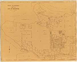
Map of City of Vancouver, British Columbia

Vancouver - the third largest city of the dominion, and Canada's chief Pacific port

Plan of government subdivision at Point Grey, B.C.

Vancouver, British Columbia

Plan of the town of Newcastle, English Bay
![Stanley Park [Golden Jubilee]](/uploads/r/null/2/4/24135e2d726e60ffbc74f0d81c3a53d51a38fe9ea1e86ecda92708249adac23b/1b46df5d-6871-41b2-b1dd-91a0c1d5ad02-MAP624_142.jpg)
Stanley Park [Golden Jubilee]

Point Grey, B.C. : district map

Development in the western portion of the Lower Mainland region, 1968

Plan of Cambie St. grounds

Redevelopment plan for Jericho Department of National Defence lands

False Creek interim harbour headline

Greater Vancouver, British Columbia : regional major street plan

Vancouver, British Columbia : northerly portion, former City of Vancouver : major street plan

Vancouver, British Columbia, south-easterly portion, formerly South Vancouver : major street plan

Vancouver, British Columbia : south-westerly portion, formerly Point Grey : major street plan

Rezoning application map (Point Grey Road)

A preliminary proposal for development of Jericho Park

Vancouver, British Columbia

False Creek development survey occupation plan
![Legend [for colour coding land use]](/uploads/r/null/3/1/2/3120f4f71566883ae774f5f08ae6795bc55fcd40d9f4bdd29f8f25dc782e0a9f/89bc7dbc-376d-43ba-bc88-a0fda629d99a-LEG1153_142.jpg)
Legend [for colour coding land use]

Vancouver British Columbia. Major street plan

Plan of District Lot boundaries. City of Vancouver, B.C.

Plan to accompany report on proposed bridge at Marpole across North Arm of Fraser River

City of Vancouver, British Columbia

The official street name map of the City of Vancouver

Proposed system of drainage and sewerage for False Creek and marginal areas

Plan of sea wall site, Main Street, and surrounding properties
District lot boundaries within the City of Vancouver

Proposed development of Vancouver City Yard, 49th Avenue at Ross Street, South Vancouver

Plan showing parcels 'A', 'B' & 'C' : Kitsilano Indian Reserve, No. 6 of the Squamish band, Vancouver, B.C.

Properties from Victoria Drive to Nanaimo Street and Burrard Inlet to Triumph Street

Proposed zoning : comprehensive redevelopment areas

Key map showing proposed areas for partial and comprehensive redevelopment

Interim harbour headline
![Map showing City of Vancouver, British Columbia [index map]](/uploads/r/null/a/f/b/afbf0b3832ff37e3af2c10d63547517135bca50be83ddddfcd25914b3c7b8f1d/6903af1e-3c6e-4577-9c0a-0967550524a7-LEG1153_142.jpg)
Map showing City of Vancouver, British Columbia [index map]

Area bounded by Kaslo St., 14th Ave., Renfrew St. and 18th Ave. : lands affected by proposed filling of Still Creek

Proposed industrial subdivision - Joyce and Vanness

Project 2, area "h" and part of "b" : proposed property acquisitions project 2

Project 2 : generalized plan of redevelopment

Project 2, part of area "a" : aerial photograph

Project 2, part of area "a" : condition of buildings

Project 2, part of area "a" : pavements, curbs and sidewalks

Project 2, part of area "a" : existing utilities, water and sewer