Part is a section depicting the area bounded by Imperial Street to English Bay to the University Endowment Lands to Fifth Avenue. The sheet has been extensively annotated, with colour coded areas to depict land use, status of lots as tax sale properties for sale, sewer and water lines, as well as other colour codes that are not noted on the legend at the front of the volume.
Part is a section depicting the area bounded by Trutch Street to English Bay to Imperial Street to Fifth Avenue. The sheet has been extensively annotated, with colour coded areas to depict land use, status of lots as tax sale properties for sale, sewer and water lines, as well as other colour codes that are not noted on the legend at the front of the volume.
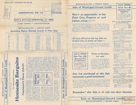
Part is a sheet showing assessment and other information relevant to Point Grey section C. The sheet also includes a detail map of the area bounded by [Balaclava Street?] to 16th Avenue to Puget Drive to 19th Avenue
Part is a section depicting the area bounded by Trafalgar Street to Sixteenth Avenue to Wallace Street to Twenty-seventh Avenue. The sheet has been extensively annotated, with colour coded areas to depict land use, status of lots as tax sale properties for sale, sewer and water lines, as well as other colour codes that are not noted on the legend at the front of the volume.
Part is a section depicting the area bounded by Cambie Street to Sixteenth Avenue to Granville Street to Twenty-seventh Avenue. The sheet has been extensively annotated, with colour coded areas to depict land use, status of lots as tax sale properties for sale, sewer and water lines, as well as other colour codes that are not noted on the legend at the front of the volume.
Part is a sheet with supplementary information in the form of a revised block plan for the are bounded by Crown Street to 27th Avenue to Camosun Street to 29th Avenue.
Part is a section depicting the area bounded by Trafalgar Street to Twenty-seventh Avenue to Wallace Street to Thirty-eighth Avenue. The sheet has been extensively annotated, with colour coded areas to depict land use, status of lots as tax sale properties for sale, sewer and water lines, as well as other colour codes that are not noted on the legend at the front of the volume.
Part is a section depicting the area bounded by Queen Elizabeth Park to Twenty-seventh Avenue to Granville Street to Thirty-eighth Avenue. The sheet has been extensively annotated, with colour coded areas to depict land use, status of lots as tax sale properties for sale, sewer and water lines, as well as other colour codes that are not noted on the legend at the front of the volume.
Part is a section depicting the area bounded by Granville Street to Forty-ninth Avenue to Marine Crescent to Sixty-first Avenue. The sheet has been extensively annotated, with colour coded areas to depict land use, status of lots as tax sale properties for sale, sewer and water lines, as well as other colour codes that are not noted on the legend at the front of the volume.
Part is a section depicting the area bounded by Granville Street to Thirty-seventh Avenue to Trafalgar Street to Forty-ninth Avenue. The sheet has been extensively annotated, with colour coded areas to depict land use, status of lots as tax sale properties for sale, sewer and water lines, as well as other colour codes that are not noted on the legend at the front of the volume.


![Week of May 17-21 Habitat Forum [2 of 104]](/uploads/r/null/8/3/c/83ca5e15ce9e67fd92174e2bcdb4ef345deb1d757cdc7d448cc03d9e79851f28/b3c0baa0-cf38-4b77-ad59-82a9d6105180-CVA395-09040_142.jpg)
![Week of May 17-21 Habitat Forum [3 of 104]](/uploads/r/null/a/e/d/aedc1541beef3c8da8fcf309ea0e7018520893088b41bac57f3449adfe5c1906/1c72defb-4038-438f-b770-0f4d9886d657-CVA395-09041_142.jpg)
![Week of May 17-21 Habitat Forum [8 of 104]](/uploads/r/null/7/1/0/7100dbd988a7973c6d62304a8107b4a765363a19176cde6a4d6c3e45af89df14/3824a1aa-cafd-43d5-b89e-c148ba6c25bc-CVA395-09046_142.jpg)
![Week of May 17-21 Habitat Forum [9 of 104]](/uploads/r/null/e/b/b/ebbeb94f725fcc6dc4c5949503399d58e96c9265fa54517eddd2eb618c57c543/e35a1ad8-bd55-4885-9dba-97a09a0254c0-CVA395-09047_142.jpg)
![Week of May 17-21 Habitat Forum [12 of 104]](/uploads/r/null/c/0/7/c07714e5f1f16877a57b01534cd539c4312cddf2e7039466f844d6bb6980ff12/11e53f4a-6c51-479a-b3eb-bef549e3a06e-CVA395-09050_142.jpg)
![Week of May 17-21 Habitat Forum [16 of 104]](/uploads/r/null/2/a/9/2a9bab02b67eacd6056b5ca73dca62ed85207b239292ae2bd42adefc3f69ed8d/66ad8601-e34c-499a-bd4d-5bc876ea676c-CVA395-09054_142.jpg)
![Week of May 17-21 Habitat Forum [21 of 104]](/uploads/r/null/2/f/0/2f0ee92300e1148dbe7bfe743314aff01e61a5736c5c43d43ce9d0ec6574ea04/6cd137e9-cff6-4273-a52f-0909411c032f-CVA395-09059_142.jpg)
![Week of May 17-21 Habitat Forum [22 of 104]](/uploads/r/null/4/1/2/412e4f6299ca56ae3deffacb30877d3e0d2c0d1ba9d34486daf68ff5e1267142/b6af604f-2a5c-4aa4-91e3-b97b88f0a1fa-CVA395-09060_142.jpg)
![Week of May 17-21 Habitat Forum [24 of 104]](/uploads/r/null/d/8/c/d8c5932857cd0252c5daab73a012ee2f5d83d15715d3400b433d3345d30ca59d/432a58af-ffa9-48d2-922d-402003d4a746-CVA395-09062_142.jpg)
![Week of May 17-21 Habitat Forum [25 of 104]](/uploads/r/null/a/2/0/a206a9427d0d1152fd61cd6af1066e52de4fac784a050b0febf87dc6357a1cb5/26c96b28-a2a7-4c37-8d84-e3a8d9d3460c-CVA395-09063_142.jpg)
![Week of May 17-21 Habitat Forum [33 of 104]](/uploads/r/null/8/7/a/87aa73f6ad813033885b742dcfb42a05d603c2ae7c399d36f6b5bfdbc331e3cf/12532f41-d55f-4506-98fb-7fee381d08dd-CVA395-09071_142.jpg)
![Week of May 17-21 Habitat Forum [36 of 104]](/uploads/r/null/6/6/e/66e0d2f73015e74cf121e8aa6cc8e54e2f117de24b979b7764b0e294bd69369c/02ba1d59-e0ab-45bc-9824-315dcfdc80b1-CVA395-09074_142.jpg)
![Week of May 17-21 Habitat Forum [48 of 104]](/uploads/r/null/d/9/5/d952e6c46fc8dbbf8ae731be08daa58ac83270a9fa9440e1f450b2eef4a6115f/d670a415-0214-4f99-9770-f6bf9958d20b-CVA395-09086_142.jpg)
![Week of May 17-21 Habitat Forum [49 of 104]](/uploads/r/null/b/2/2/b22e20bef21753ffc862447a68f74a5342b77489cd5bb4b9285ec63fe35de702/ea41f0b8-578c-4254-ae50-0b47053fd8d5-CVA395-09087_142.jpg)
![Week of May 17-21 Habitat Forum [50 of 104]](/uploads/r/null/f/b/7/fb7ed5a892139f0aeb28ba0d5799ee2f9e917fded0867d2fc67a87d5b658eac8/9bc35638-4e6b-4a56-a121-5008d6d9b29d-CVA395-09088_142.jpg)
![Week of May 17-21 Habitat Forum [54 of 104]](/uploads/r/null/d/1/a/d1a0dae2b0da5b1acd935ce5d3c87744b6126e9549ac0f872fb6cd7b741e8bdd/d6159e02-3af5-4f26-9a41-ccb1c1ca1b98-CVA395-09092_142.jpg)
![Week of May 17-21 Habitat Forum [57 of 104]](/uploads/r/null/b/c/1/bc112b47dacb92df4686f0eeb3a0d317ca3134c8f66d970cfec558c22cde142c/d35995c0-f41a-4a58-9783-b0658b2ed12f-CVA395-09095_142.jpg)
![Week of May 17-21 Habitat Forum [58 of 104]](/uploads/r/null/c/0/d/c0d91eb424f90adaea6a2b5221f0d77e9842c41878283040410106cf8c39791e/d5fb9c89-23a0-483e-b3df-5fd1892b93ce-CVA395-09096_142.jpg)
![Week of May 17-21 Habitat Forum [62 of 104]](/uploads/r/null/6/5/6/656e84fcb65bb3fb618823ca4a5149525a23eb1cef08fa0f50ad20db074ef784/fed28dae-ff4e-4475-89a8-fbe0008e9bc0-CVA395-09100_142.jpg)
![Week of May 17-21 Habitat Forum [63 of 104]](/uploads/r/null/6/0/a/60a55470238017a23d625392d56d2dc38ee040460d5c797351f639b9cf2eaf26/445b969f-1d6b-458b-a9b3-6d8426131ab4-CVA395-09101_142.jpg)
![Week of May 17-21 Habitat Forum [69 of 104]](/uploads/r/null/f/6/1/f615df4b080d142449a94ddfa0deaf004a6ee41723a80c1ff9d2a09713ba0b23/0fb48800-81c3-4175-b5cd-4a8845ee3ab2-CVA395-09107_142.jpg)
![Week of May 17-21 Habitat Forum [80 of 104]](/uploads/r/null/a/2/3/a2322033c78435595b0bfc9ddc19240800a7d37da57e19d6aa47c528377351ed/f8d712c6-c2be-42f0-9f6d-2c454a58b4c4-CVA395-09118_142.jpg)
![Week of May 17-21 Habitat Forum [82 of 104]](/uploads/r/null/c/8/a/c8aff0a24173e6d8125d6d29295ebca57f6527f7976764d12184328442251eec/d4700282-7e08-4a5a-8d1f-6e7e7d3c3e06-CVA395-09120_142.jpg)
![Week of May 17-21 Habitat Forum [83 of 104]](/uploads/r/null/c/4/8/c48a380cd796874d41782342b80d343a9635bba0d66dd4ac976c66e1b2709a3e/a263a604-c7f1-4609-8b7c-75bc88ef31dc-CVA395-09121_142.jpg)
![Week of May 17-21 Habitat Forum [85 of 104]](/uploads/r/null/b/0/6/b06935870605ac868894bc736b87a6edd8a9e08dc9c9c0d0dee9f8aa06170b40/4b705dfc-dce2-45d2-8ef0-896771d70fee-CVA395-09123_142.jpg)
![Week of May 17-21 Habitat Forum [89 of 104]](/uploads/r/null/5/d/d/5dde0c6507dbeeb88177983a93e613a36f58de452eb862ec7c95707001516fda/275e41db-a65b-4b51-8860-31498a5fc02c-CVA395-09127_142.jpg)
![Week of May 17-21 Habitat Forum [103 of 104]](/uploads/r/null/2/3/8/2384b04aed9fd14f099d71fb6b2161b039e73e959595af0aed2b99383bd3507c/a5b10433-98b8-4b37-9ddf-1861a639ad5d-CVA395-09141_142.jpg)


![Week of May 17-21 Habitat Forum [1 of 104]](/uploads/r/null/8/8/e/88e488a1a4050051cac59ef811774c19fc04bbd9c39327d865cf73a47b8761ce/ed165652-e1d7-4264-a020-7225e90d7029-CVA395-09039_142.jpg)
![Week of May 17-21 Habitat Forum [18 of 104]](/uploads/r/null/6/5/7/657750bc1627f7404ef87d1d5b492c720ae98df78b675b06b8cf95855d83edf4/8f865597-f8d1-4de3-900c-2c657fac8547-CVA395-09056_142.jpg)
![Week of May 17-21 Habitat Forum [29 of 104]](/uploads/r/null/a/e/4/ae43f02c4b32bd121ef023bbbe05c9459e82a94fcff1b09b05ddb38b900c50e0/2ccfb601-5c0b-433d-a7fe-91c72607ed50-CVA395-09067_142.jpg)
![Week of May 17-21 Habitat Forum [34 of 104]](/uploads/r/null/0/3/e/03e75fd63cc53a90fc2591e47dc0497aef02f390b09a9ace4f80eea854c6929d/06bbd954-003c-42ee-8f6d-d30cbd7ac7eb-CVA395-09072_142.jpg)
![Week of May 17-21 Habitat Forum [35 of 104]](/uploads/r/null/0/b/2/0b27b7df5963bfd226e152d11b3c45c20661112774df105a3ada335e0f647971/c15298e3-f20e-4273-9a86-6c626b0b3454-CVA395-09073_142.jpg)
![Week of May 17-21 Habitat Forum [41 of 104]](/uploads/r/null/4/2/6/426ab6db3498756795388c2108da69696ae7c6d7609b2521af40dce19f2b30dc/f06580a3-b3e3-4332-b55c-b2048182a444-CVA395-09079_142.jpg)
![Week of May 17-21 Habitat Forum [46 of 104]](/uploads/r/null/4/1/6/416c0e9140b8322dd4c1785332382f35d95601eab3b4622a3d92a6d85806bdbf/2fd92999-76c1-424a-94ea-15ae540d3e6e-CVA395-09084_142.jpg)
![Week of May 17-21 Habitat Forum [53 of 104]](/uploads/r/null/8/c/6/8c6e6048739253944a52ea9b82c161619a146ebfae53465c6c02800affe916f6/a66f10b1-c630-4e94-b83a-29cd8705e3cf-CVA395-09091_142.jpg)