City Engineer's Office manuals, reports and publications collection
Sheet G : Trafalgar Street to Granville Street and Sixteenth Avenue to Nanton Avenue
Plan of district lot boundaries, City of Vancouver, B.C. [index map]
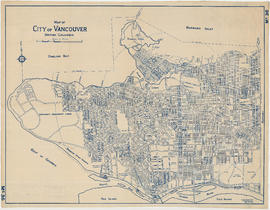
Map of City of Vancouver. British Columbia
Map of City of Vancouver. British Columbia
Plan of district lot boundaries, City of Vancouver, B.C.
Sectional map City of Vancouver, B.C.
Plan of District Lot boundaries. City of Vancouver, B.C.
Sheet 8 : McLean Drive to Slocan Street and William Street to Seventh Avenue
Sheet 5 : Slocan Street to Boundary Road and Seventeenth Avenue to Twenty-ninth Avenue
Sheet 7 : Clark Drive to Slocan Street and Seventh Avenue to Eighteenth Avenue
Sheet 13 : Ontario Street to Clark Drive and First Avenue to Sixteenth Avenue
Sheet 14 : Main Street to Knight Street and Fifteenth Avenue to King Edward Street
Sheet B : Imperial Street to Trutch Street and waterfront to Fourth Avenue
Sheet C : University Endowment Lands to Imperial Street and Fourth Avenue to Sixteenth Avenue
Sheet D : Imperial Street to Trutch Street and Fourth Avenue to Sixteenth Avenue
Sheet F : Wallace Street to Trafalgar Street and Sixteenth Avenue to Twenty-seventh Avenue
Sheet J : University Endowment Lands to Wallace Street and Twenty-ninth Avenue to Thirty-eighth Avenue
Sheet S : Musqueam Reserve to Macdonald Street and Forty-ninth Avenue to Fraser River
Sheet U : Churchill Street to Cambie Street and Forty-ninth Avenue to Park Drive
Sheet W : Fraser River to French Street and Fifty-ninth Avenue to Seventy-first Avenue
Sheet Z : Milton Street to Heather Street and Seventy-second Avenue to Fraser River ; Angus Drive to Granville Street and South West Marine Drive to Fraser River
Sheet 1 : Cambie Street to Carolina Street and Sixteenth Avenue to Twenty-eighth Avenue
Sheet 7 : Cambie Street to St. George Street and Thirty-seventh Avenue to Forty-eighth Avenue
Sheet 9 : Fleming Street to Carlton Street and Thirty-seventh Avenue to Forty-eighth Avenue
Sheet 11 : Cambie Street to St. George Street and Forty-seventh Avenue to Fifty-eighth Avenue
Sheet 18 : Vivian Street to Boundary Road and Sixty-fifth Avenue to Fraser River
Sheet 13 : Fleming Street to Carlton Street and Forty-seventh Avenue to Fifty-ninth Avenue
Sheet 19 : Maple Street to Richards Street and Drake Street to Third Avenue


![City of Vancouver, British Columbia [index map]](/uploads/r/null/d/4/d4fc7ef393680c6515927aa960de863e6fd9e846c3fac12499691549673dc4b7/eed36b0b-2e63-48f2-a7ee-02ed3de937b9-MAP682_142.jpg)
![Map of City of Vancouver, British Columbia [index map]](/uploads/r/null/b/e/be22a39bcaa01b0f0dd6d2209e1cb4ee3e1df2f15c6c663490403764c2eba017/98bf421f-34d4-4017-9cfd-a46b85bfefa8-MAP343_142.jpg)
![Map of City of Vancouver, British Columbia [index map]](/uploads/r/null/b/4/b4070d13913e90841a24384f7c94ab9f22595ff9bde62429edb46fd5ed60a75a/f4bb676f-1639-4811-82bf-2a0d4defd87e-MAP779_142.jpg)


![Plan of district lot boundaries, City of Vancouver, B.C. [index map]](/uploads/r/null/9/4/9469805f0ad98fa8c476e2fa1bd641a165448bbfe6840da2ca337894637001a4/9199ff56-1884-4c1f-8d1c-1a513de71a3d-MAP779_142.jpg)