Engineering Department old policy files
Engineering Department old policy files
Granville Street Bridge construction photographs by Lew Parry Film Productions
Granville Street Bridge construction photographs by Lew Parry Film Productions
Killarney boulevard construction photographs
Killarney boulevard construction photographs
Main Street sea wall construction photographs
Main Street sea wall construction photographs
Profile of C.N.R. and B.N.R. : proposed crossings of Glen Drive at mile 130-35, Yale subdivision, C.N. Railway and at B.N.I. Wye track
Profile of C.N.R. and B.N.R. : proposed crossings of Glen Drive at mile 130-35, Yale subdivision, C.N. Railway and at B.N.I. Wye track

Redevelopment plan for Jericho Department of National Defence lands

Sheet 61 : Cypress Street to Oak Street and Forty-first Avenue to Thirty-third Avenue

Sheet 62 : Cypress Street to Oak Street and Forty-ninth Avenue to Forty-first Avenue

Index to 400 ft. scale section maps, City of Vancouver, British Columbia

Sheet 10 : Clark Drive to Nanaimo Street and Frances Street to Burrard Inlet

Sheet 12 : Nanaimo Street to Cassiar Street and Pender Street to McGill Street

Sheet 14 : Cassiar Street to Boundary Road and Pender Street to Eton Street

Sheet 20 : Main Street to Clark Drive and Great Northern Way to Prior Street

Sheet 25 : Blanca Street to Jericho Beach and Fourth Avenue to Locarno Beach

Sheet 26 : University Endowment Lands to Blanca Street and Fourth Avenue to Spanish Banks Beach

Sheet 29 : Balaclava Street to Maple Street and Fourteenth Avenue to Third Avenue

Sheet 31 : Oak Street to Main Street and Sixteenth Avenue to Fourth Avenue and False Creek

Sheet 35 : Rupert Street to Ardley Avenue and Grandview Highway to Fifth Avenue

Sheet 38 : Nanaimo Street to Rupert Street and Twenty-second Avenue to Grandview Highway

Sheet 41 : Ontario Street to Inverness Street and Twenty-eighth Avenue to Sixteenth Avenue

Sheet 42 : Oak Street to Ontario Street and Twenty-eighth Avenue to Sixteenth Avenue

Sheet 49 : Arbutus Street to Oak Street and Thirty-third Avenue to Laurier Avenue

Sheet 57 : Nanaimo Street to Doman Street and Joyce Street and Forty-ninth Avenue to Forty-first Avenue

Sheet 59 : Quebec Street to Inverness Street and Forty-seventh Avenue to Thirty-seventh Avenue
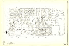
Sheet 77 : Kerr Street to Greenall Avenue and Southeast Marine Drive to Asquith Avenue

Sheet 79 : Gladstone Street to Kerr Street and North Arm of Fraser River to Bobolink Avenue

Sheet 89 : North Arm of Fraser River to Southwest Marine Drive and Barnard Street
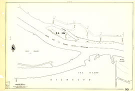
Sheet 90 : Carrington Street to Macdonald Street and Richmond to Celtic Avenue

Plan of block occupied by University of British Columbia, Vancouver B.C.
Vancouver bridge records
Vancouver bridge records
Engineering Department contract register
Engineering Department contract register
Water works distributing journals
Water works distributing journals

Open Data Catalogue : False Creek navigable channel : May 2013
Open Data Catalogue : film office work areas : May 2013
Open Data Catalogue : garbage collection schedule zone data : May 2013
Open Data Catalogue : disability parking : May 2013
Open Data Catalogue : Olympic sites and transportation data package : May 2013
Open Data Catalogue : right-of-way widths : May 2013
Open Data Catalogue : apartment recycling areas : May 2013
Open Data Catalogue : snow removal routes : May 2013
Open Data Catalogue : bike racks : May 2013
Open Data Catalogue : building lines : August 2013
Open Data Catalogue : city boundary data : August 2013
Open Data Catalogue : facet grid boundaries : August 2013
Open Data Catalogue : garbage collection schedule zone data : August 2013
Open Data Catalogue : motorcycle parking data : August 2013
Open Data Catalogue : parking meters : August 2013
Open Data Catalogue : rapid transit data package : August 2013
Open Data Catalogue : right-of-way widths : August 2013
Open Data Catalogue : sewer network data package : August 2013