Series consists of a variety of records relating to the planning, designing, and opening of Vancouver's bridges. Included are plans for the Connaught Bridge (1910) and the Burrard Street Bridge (1930-1931), Granville Street Bridge (1952), photographs of the Granville Street Bridge (1954), and motion picture films on the building of the Granville Street Bridge (1954) and the Cambie Street Bridge (1986). Filing units arranged chronologically by start date.
Series consists of a record of work contracted to private businesses by the City. The majority of these contracts are for paving streets and sidewalks, but there are also a number of contracts for the construction of public buildings and the installation of utilities. The contracts are divided into two sections, "Current" and "Completed" and indexed by contract name (e.g. Charles Dickens School, Heating) and name of contractor. Each register sheet lists type of work, location, fund, date, contractor, and expenditure.
Series consists of consulting engineer Grant's private files (not City files) containing correspondence, plans, news clippings, maps, and notebooks relating to the design and construction of bridges in Vancouver, Victoria, Portland, Seattle, and San Francisco. Arranged alphabetically by subject.
Series comprises records from the 1975-1980 Central Registry Files of the Engineering Department, relating to its administration, general services and involvement in community planning. The documents include minutes and related materials of meetings of the Engineering Department and committees, organizational charts, reports, correspondence and notes to the file. The files are arranged in their original order.
Series consists of a register listing all instances of roadwork, drainwork, etc. It is possible to determine the date of the work, the portion of a street for which work was completed, and the cost of the work by looking up a street name. The date sequence appears complete. Arranged alphabetically by street name.
Series consists of accounting records of the Waterworks Dept., including administrative and operational expenses. 1929-1933 records are missing. After 1933 the record is called "Distributing Journal". Arranged chronologically.
Series consists of correspondence, informal reports, City reports, consultants' reports, notes to file, minutes of the Transportation Working Group and the Expo Traffic Operations Group, and architectural drawings of sites, relating to transportation and traffic planning activities of committees of Provincial, Expo, and City officials for Expo 86. Textual records arranged chronologically; oversize maps and architectural drawings are a separate chronological sequence.
Series consists of glass negatives on a variety of subjects pertaining to City Engineering Services. These include building, road and railway construction; Vancouver street scenes; damage to roads and structures; scenes of the city after heavy snowfalls; the 1914 Labour Day Parade; pipelines (probably sewerage pipelines); and a blasting accident and fire at Hastings Townsite. Series also includes some negatives taken outside Vancouver, including views of Capilano River and North and West Vancouver Ferry docks.
Series consists of index cards containing compiled information about fatal traffic accidents in the City of Vancouver. Information recorded on the cards includes date, time, location and type of accident. Some cards also mention persons involved in the accident. There are two sets of cards, one organized chronologically, and one organized by street name.
Series relates to the construction of the Main Street sea wall which was "partially completed under terms of contract with Canadian National Railways (cost to C.N.R. $243,103)" (ref case file). The work took place 11 Nov. 1915 until 17 Oct. 1917. Images show C.N.R. wharf and surroundings (some show closeups). Includes key map which documents vantage points of all the photographs.
Series consists of technical drawings, maps and plans for a variety of building and engineering projects. While some of these drawings originated with the Engineering Department, others were created by transportation, communication, or utility companies and approved by the Engineering Department. Arranged in no apparent order.
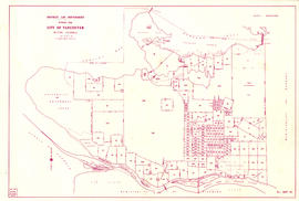
File consists of a sectional map of Vancouver, and two accompanying index maps. Maps show streets and roads, blocks, lots, legal descriptions, railways, parks, schools, hospital, cemetery, golf courses, retirement homes, and some businesses.
Item is a map showing the City of Vancouver covered with annotations to represent the numbers of men in particular areas receiving assistance by mail. Map is a copy of the original and it is not possible to determine the original colour coding.
Item is a map showing the City of Vancouver covered with annotations to represent the numbers of women in particular areas receiving assistance by mail. Map is a copy of the original and it is not possible to determine the original colour coding.
Series relates to documenting major City projects in progress and completed. Contained are the following photographs. CVA 216-1 (88 photographs): 1 album documenting the Georgia Viaduct replacement carried out by Phillips, Barratt, Hiller, Jones and Partners (photographers Campbell Studio, 25 Apr. 1969 - 18 Oct. 1971) - in this album is a photograph of Vie's Chicken & Steak House at 209 Union Street (item number CVA 216-1.23); CVA 216-2 (44 photographs): 1 scrapbook showing new Granville Street Bridge construction (photographer title page Commercial Illustrators, remaining 43 photographs Parry Films Ltd., ca. 1951-1954), includes specifications for the Granville Street Bridge; CVA 216-3 to CVA 216-6: miscellaneous photographs dated ca. 1920-1924 (photographers unknown); CVA 216-7 to CVA 216-35: photographs documenting demolition of "Old" Georgia Viaduct (photographer A. J. Ingram, employee of the Engineering Department).
Item is a section showing the area from Oak Street to Main Street and Sixteenth Avenue to Fourth Avenue and False Creek. Includes streets, blocks, lots and legal descriptions, and the locations of parks, schools and railways.
File consists of datasets showing locations of installed bicycle racks on City property and years racks were installed. File also contains Open Data Catalogue html pages that described the datasets; pages include data attributes and data accuracy and currency information. Datasets are as they appeared on April 1, 2016.
File consists of datasets showing the City's dedicated bikeways. File also contains Open Data Catalogue html page that described the datasets; page includes data attributes and data accuracy and currency information. Datasets are as they appeared on April 1, 2016.
File consists of datasets showing building lines (lines regulating building placement on a given lot). File also contains Open Data Catalogue html page that described the datasets; page includes data attributes and data accuracy and currency information. Datasets are as they appeared on April 1, 2016.
File consists of datasets showing the boundaries of the City of Vancouver's legal jurisdiction.File also contains Open Data Catalogue html page that described the datasets; page includes data attributes and data accuracy and currency information. Datasets are as they appeared on April 1, 2016.
File consists of datasets showing non-City streets, public streets, one-way streets, alleyways, and intersections. File also contains Open Data Catalogue html page that described the datasets; page includes data attributes and data accuracy and currency information. Datasets are as they appeared on April 1, 2016.
File consists of datasets showing the location of the Downtown Historic Railway. File also contains Open Data Catalogue html page that described the datasets; page includes data attributes and data accuracy and currency information. Datasets are as they appeared on April 1, 2016.
File consists of datasets showing boundaries of 500 metre by 800 metre rectangles forming a facet grid over Vancouver and the University Endowment Lands. File also contains Open Data Catalogue html page that described the datasets; page includes data attributes and data accuracy and currency information. Datasets are as they appeared on April 1, 2016.
File consists of datasets showing the location of the navigable portion of False Creek where no anchoring is allowed. File also contains Open Data Catalogue html page that described the datasets; page includes data attributes and data accuracy and currency information. Datasets are as they appeared on April 1, 2016.
File consists of datasets showing colour-coded groups of community neighbourhoods used by the Film and Special Event Office to track and monitor filming and special event activities. File also contains Open Data Catalogue html page that described the datasets; page includes data attributes and data accuracy and currency information. Datasets are as they appeared on April 1, 2016.
File consists of datasets showing locations and attributes of street food vendors. File also contains Open Data Catalogue html page that described the datasets; page includes data attributes and data accuracy and currency information. Datasets are as they appeared on April 1, 2016.
File consists of datasets showing boundaries of garbage collection zones. File also contains Open Data Catalogue html page that described the datasets; page includes data attributes and data accuracy and currency information. Datasets are as they appeared on April 1, 2016.
File consists of datasets showing dedicated greenways. File also contains Open Data Catalogue html page that described the datasets; page includes data attributes and data accuracy and currency information. Datasets are as they appeared on April 1, 2016.
File consists of datasets showing locations of on-street parking for motorcycles. File also contains Open Data Catalogue html page that described the datasets; page includes data attributes and data accuracy and currency information. Datasets are as they appeared on April 1, 2016.
File consists of datasets showing locations of designated disability parking zones and meter spaces. File also contains Open Data Catalogue html page that described the datasets; page includes data attributes and data accuracy and currency information. Datasets are as they appeared on April 1, 2016.
File consists of datasets showing boundaries of areas where noise levels are limited by City by-laws. File also contains Open Data Catalogue html page that described the datasets; page includes data attributes and data accuracy and currency information. Datasets are as they appeared on April 1, 2016.
File consists of datasets containing information on locations of Olympic sites and venues as well as the areas included in the Olympic Transportation Plan. File also contains Open Data Catalogue html page that described the datasets; page includes data attributes and data accuracy and currency information. Datasets are as they appeared on April 1, 2016.
File consists of datasets showing locations of parking meters and their rates and time limits. File also contains Open Data Catalogue html page that described the datasets; page includes data attributes and data accuracy and currency information. Datasets are as they appeared on April 1, 2016.
File consists of datasets showing the alignments of railway tracks including Crane Container, Burlington Northern, Canadian National, Canadian Pacific, Downtown Historical, VIA, and Wisconsin Central Railways. File also contains Open Data Catalogue html page that described the datasets; page includes data attributes and data accuracy and currency information. Datasets are as they appeared on April 1, 2016.
File consists of datasets showing Vancouver's rapid transit lines and their stations. File also contains Open Data Catalogue html page that described the datasets; page includes data attributes and data accuracy and currency information. Datasets are as they appeared on April 1, 2016.
File consists of datasets showing the widths of City rights-of-way. File also contains Open Data Catalogue html page that described the datasets; page includes data attributes and data accuracy and currency information. Datasets are as they appeared on April 1, 2016.
File consists of datasets showing construction activity and projects affecting traffic flow. Projects currently under construction, current road closures, and upcoming projects are represented in separate layers. File also contains Open Data Catalogue html page that described the datasets; page includes data attributes and data accuracy and currency information. Datasets are as they appeared on April 1, 2016.
File consists of datasets showing Vancouver's sewer mains, sewer manholes, sewer catch basins, and Metro Vancouver's trunk sewers. File also contains Open Data Catalogue html page that described the datasets; page includes data attributes and data accuracy and currency information. Datasets are as they appeared on April 1, 2016.
File consists of datasets showing boundaries of apartment recycling areas. File also contains Open Data Catalogue html page that described the datasets; page includes data attributes and data accuracy and currency information. Datasets are as they appeared on April 1, 2016.
File consists of datasets showing locations of routes that are focused on during snow events. File also contains Open Data Catalogue html page that described the datasets; page includes data attributes and data accuracy and currency information. Datasets are as they appeared on April 1, 2016.
File consists of datasets showing locations of street lighting poles, conduits, abandoned conduits, junction boxes, and service panels. File also contains Open Data Catalogue html page that described the datasets; page includes data attributes and data accuracy and currency information. Datasets are as they appeared on April 1, 2016.
File consists of datasets showing boundaries of administrative areas for managing street operations. File also contains Open Data Catalogue html page that described the datasets; page includes data attributes and data accuracy and currency information. Datasets are as they appeared on April 1, 2016.