![Legend [for colour coding land use]](/uploads/r/null/3/1/2/3120f4f71566883ae774f5f08ae6795bc55fcd40d9f4bdd29f8f25dc782e0a9f/89bc7dbc-376d-43ba-bc88-a0fda629d99a-LEG1153_142.jpg)
Legend [for colour coding land use]
- COV-S167---: LEG1153.453
- Item
- [1946?]
Part of City of Vancouver fonds
Legend [for colour coding land use]
Part of City of Vancouver fonds

Vancouver British Columbia. Major street plan
Part of City of Vancouver fonds
Vancouver (B.C.). Town Planning Commission

Plan of District Lot boundaries. City of Vancouver, B.C.
Part of City of Vancouver fonds
Vancouver (B.C.). Office of the City Engineer

Plan to accompany report on proposed bridge at Marpole across North Arm of Fraser River
Part of City of Vancouver fonds
Item is a map showing five possible locations for a bridge across the North Arm of the Fraser River from the city of Vancouver to either Sea Island or Lulu Island.

City of Vancouver, British Columbia
Part of City of Vancouver fonds
Item is a map showing city streets and address block numbers.

The official street name map of the City of Vancouver
Part of City of Vancouver fonds
Item is an annotated version of the Official street name map of the City of Vancouver adopted under By-law no. 4054. Annotations mark out eight areas in the city; four of these marked areas include additional streets not included on the base map.

Proposed system of drainage and sewerage for False Creek and marginal areas
Part of City of Vancouver fonds
Item is a map showing sewers and storm drains in the area from Alexander Street in the north to Seventh Avenue in the south and from Clark Drive in the east to Main Street in the west.

Plan of sea wall site, Main Street, and surrounding properties
Part of City of Vancouver fonds
Item is a map showing sewers, pier headlines, land ownership, streets, parks and rail lines in the area east of False Creek at Main Street and Terminal Avenue.
District lot boundaries within the City of Vancouver
Part of City of Vancouver fonds

Proposed development of Vancouver City Yard, 49th Avenue at Ross Street, South Vancouver
Part of City of Vancouver fonds
Item is a site plan showing existing and proposed storage, accommodation, and work buildings, landscaping, and proposed re-zoning.

Part of City of Vancouver fonds
Item is a land survey plan showing locations of survey posts, boundaries between reserve and non-reserve lands, streets, rights of way, and high water marks.

Properties from Victoria Drive to Nanaimo Street and Burrard Inlet to Triumph Street
Part of City of Vancouver fonds
Item is a map annotated with colour on some properties, though the significance of the colour is unclear. Base map shows streets, legal addresses, and waterfront businesses in the area from Clark Drive to Slocan Street and Burrard Inlet to Powell Street/Triumph Street.

Proposed zoning : comprehensive redevelopment areas
Part of City of Vancouver fonds
Item is a map showing proposed zoning for two comprehensive redevelopment areas according to the following district types: residential, commercial (suburban), commercial (medium density), industrial (light) and industrial (heavy). Map also shows the boundaries of the comprehensive redevelopment areas. These two areas lie roughly between Burrard Inlet in the north and 10th Avenue in the south and between Semlin Drive in the east and Burrard Street in the west.

Key map showing proposed areas for partial and comprehensive redevelopment
Part of City of Vancouver fonds
Item is a map showing the boundaries of the redevelopment study area, comprehensive redevelopment areas, limited redevelopment areas and the East End study area. The boundary of the study area lies roughly between Burrard Inlet in the north and 33rd Avenue in the south and between Nanaimo Street in the east and Carnarvon Street in the west.

Part of City of Vancouver fonds
Item is a map prepared as part of the Harbour Headline project of the False Creek Development Study. Map shows existing, interim and ultimate harbour headlines, existing water areas, ownership boundaries, other property lines and lease boundaries in and around False Creek.
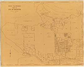
![Map showing City of Vancouver, British Columbia [index map]](/uploads/r/null/a/f/b/afbf0b3832ff37e3af2c10d63547517135bca50be83ddddfcd25914b3c7b8f1d/6903af1e-3c6e-4577-9c0a-0967550524a7-LEG1153_142.jpg)
Map showing City of Vancouver, British Columbia [index map]
Part of City of Vancouver fonds

Part of City of Vancouver fonds
Item is a map showing the layout of the proposed fill of Still Creek, existing ground elevations and proposed design elevations. Base map was prepared by the Engineering Department and shows streets, lot numbers, and building footprints.

Proposed industrial subdivision - Joyce and Vanness
Part of City of Vancouver fonds

Project 2, area "h" and part of "b" : proposed property acquisitions project 2
Part of City of Vancouver fonds
Item is a map showing boundaries of project in area a, property to be acquired, proposed street widening and city owned property included. Annotations show boundaries of project areas, property too be acquired, proposed street widening and properties already owned by the City. Map has been noted as Preliminary.

Project 2 : generalized plan of redevelopment
Part of City of Vancouver fonds
Item is a map showing the boundaries of redevelopment areas ("comprehensive" and "limited"), the boundaries of clearance areas for project 1, the boundaries of clearance areas for project 2, the proposed street system and the proposed land use for the city of Vancouver from Burrard Inlet in the north to 16th Avenue in the south and from Nanaimo Street in the east to Arbutus Street in the west.
Attached label indicates that the map was approved by Council Sept. 17, 1963.

Project 2, part of area "a" : aerial photograph
Part of City of Vancouver fonds
Item is a map in the form of an aerial photograph, which depicting the part of the city covered by the project: from Railway Street in the north to Prior Street in the south and from Clark Drive in the east to Main Street in the west.
Attached label indicates that the map was approved by Council Sept. 17, 1963.

Project 2, part of area "a" : condition of buildings
Part of City of Vancouver fonds
Item is a map showing the condition of buildings (ranging from very good to very poor), the boundaries of project 2 clearance, the boundaries of project 1 clearance and the realignment of Raymur Avenue in the area from Burrard Inlet in the north to Atlantic Street in the south and from Clark Drive in the east to Main Street in the west.
Attached label indicates that the map was approved by Council Sept. 17, 1963.

Project 2, part of area "a" : pavements, curbs and sidewalks
Part of City of Vancouver fonds
Item is a map showing the types of pavement, the curbs and gutters, the sidewalks, the boundaries of project 2 clearance, the boundaries of project 1 clearance and the realignment of Raymur Avenue from Railway Street in the north to Atlantic Street in the south and from Clark Drive in the east to Main Street in the west.
Attached label indicates that the map was approved by Council Sept. 17, 1963.

Project 2, part of area "a" : existing utilities, water and sewer
Part of City of Vancouver fonds
Item is a map showing the water pipes (10" and over), the sewers (15" and over), the direction of sewer flow, the boundaries of project 2 clearance, the boundaries of project 1 clearance and the realignment of Raymur Avenue in the area from Burrard Inlet in the north to Atlantic Street in the south and from Clark Drive in the east to Main Street in the west.
Attached label indicates that the map was approved by Council Sept. 17, 1963.

Project 2, part of area "a" : existing utilities, gas, electricity and telephone
Part of City of Vancouver fonds
Item is a map showing the gas lines, the overhead and underground electricity lines, the overhead and underground telephone lines, the fire alarms underground, the boundaries of project 2 clearance, the boundaries of project 1 clearance and the realignment of Raymur Avenue in the area from Railway Street in the north to Atlantic Street in the south and from Clark Drive in the east to Main Street in the west.
Attached label indicates that the map was approved by Council Sept. 17, 1963.

Project 2, part of area "a" : plan of redevelopment
Part of City of Vancouver fonds
Item is a map showing the boundaries of clearance areas for projects 1 and 2, the proposed land use (residential, commercial, industrial or school and park sites), the proposed ultimate street system, the new streets and lanes in projects 1 and 2, the easements in projects 1 and 2, the sites in project 2 not to be acquired and the buildings in projects 1 and 2 to be retained in the area from Burrard Inlet in the north to Atlantic Street in the south and from Clark Drive in the east to Main Street in the west.
Attached label indicates that the map was approved by Council Sept. 17, 1963.

Project 2, part of area "a" : utility diversions and rearrangements
Part of City of Vancouver fonds
Item is a map showing boundaries of clearance areas for project 2 (areas 5 (part), 6 and 7) and project 1 (area 3). Maps also show sewers to remain, sewers to be abandoned, water lines to remain, water lines to be abandoned, gas lines to remain, gas lines to be abandoned, power lines existing underground, proposed diversions of power lines, power lines existing overhead, proposed overhead power lines and long distance telephone lines existing underground. Larger map shows area from Hastings Street in the north to Union Street in the south and from Heatley Avenue in the east to Gore Avenue in the west. Smaller map shows area from Powell Street in the north to Hastings Street in the south and from Clark Drive in the east to Glen Drive in the west. Item also shows estimates of costs for utility diversions and rearrangements for areas 5, 6 and 7.
Attached label indicates that the map was approved by Council Sept. 17, 1963.

Project 2, part of area "a" : identification plan
Part of City of Vancouver fonds
Item is a map showing city owned property, adjacent lots in same ownership, non-adjacent lots in same ownership, property to be acquired, streets and lanes to be acquired, the boundaries for project 2 clearance, the boundaries for project 1 clearance and the realignment of Raymur Ave for the area from Railway Street in the north to Atlantic Street in the south and from Clarke Drive in the east to Main Street in the west.
Attached label indicates that the map was approved by Council Sept. 17, 1963.

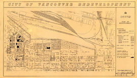
Redevelopment Project No. 2 Plan No. 1
Part of City of Vancouver fonds
Item is an index plan showing the various area sub-projects for redevelopment project no. 2, and designates comprehensive vs. limited re-development areas. Area A-6 is highlighted in red.

Part of area "a" : plan of redevelopment, Strathcona
Part of City of Vancouver fonds
Item is a map showing the boundaries of project 1, project 2 and scheme 3, the proposed land use, the propsed ultimate street system, the new streets and lanes in projects 1 and 2, the easements in projects 1 and 2, the sites in project 2 not to be acquired, the buildings in projects 1 and 2 to be retained and the area a-6 (north) in the area from Railway Street in the north to Atlantic Street in the south and from Clark Drive in the east to Main Street in the west.

Part of City of Vancouver fonds
Item is a map created to depict utilities in the proposed project 2 area 6. The map shows fire alarms, sewer lines, water lines, gas lines, underground telephone lines, underground power lines, underground vaults, and curbs. Also noted are existing buildings which may be cleared in future projects, existing buildings in immediate vicinity of area a-6 which may remain, existing subdivisions to be cancelled, easement boundaries, approximate elevations at street intersections, approximate locations at contours and areas for disposal ("private development" and "public housing").

Project 2 : generalized plan of redevelopment
Part of City of Vancouver fonds
Item is the index map showing the boundaries of the various sub-areas of redevelopment project no. 2. The map shows the boundaries of clearance and redevelopment areas, the proposed street system and the proposed land use for the area from Burrard Inlet in the north to 16th Avenue in the south and from Nanaimo Street in the east to Arbutus Street in the west.

Project 2, part of area "a" : aerial photograph
Part of City of Vancouver fonds
Item is a map showing the boundaries of clearance areas for project 1 (sub areas 1, 2 & 3) and project 2 (sub areas 5, 6 & 7). These areas have been outlined in yellow.

Project 2, part of area "a" : condition of buildings
Part of City of Vancouver fonds
Item is a map showing the condition of buildings (ranging from very good to very poor) within the boundaries of project 2, area "a". The map also shows the boundaries of project 2 clearance, the boundaries of project 1 clearance and the realignment of Raymur Avenue.

Project 2, part of area "a" : pavements, curbs and sidewalks
Part of City of Vancouver fonds
Item is a map showing the types of pavements, curbs, gutters and sidewalks in project 2 area "a'".

Project 2, part of area "a" : existing utilities, water and sewer
Part of City of Vancouver fonds
Item is a map showing the configuration of water and sewer services in project 2 area "a". The map depicts the water pipes (10" and over), the sewers (15" and over), and the direction of sewer flow.

Project 2, part of area "a" : existing gas, electricity and telephone
Part of City of Vancouver fonds
Item is a map showing the gas lines, overhead and underground electricity lines, overhead and underground telephone lines, and fire alarms underground in project 2 area "a".

Project 2, part of area "a" : plan of redevelopment
Part of City of Vancouver fonds
Item is a map showing the boundaries of clearance areas for projects 1 and 2, the proposed land use (residential, commercial, industrial or school and park sites), the proposed ultimate street system, the new streets and lanes in projects 1 and 2, the easements in projects 1 and 2, the sites in project 2 not to be acquired and the buildings in projects 1 and 2 to be retained.

Project 2, part of area "a" : identification plan
Part of City of Vancouver fonds
Item is a map showing property status for properties in project areas 1 and 2. The map shows city owned property, adjacent lots in same ownership, non-adjacent lots in same ownership, and property to be acquired.

Project 2, area "h" and part of "b" : condition of buildings
Part of City of Vancouver fonds
Item is a map showing the condition of buildings (ranging from very good to very poor), the boundaries of redevelopment for areas "b" and "h" and the boundaries of project clearance for areas 8 and 9 for redevelopment proct 2.

Project 2, area "h" and part of "b" : pavements, curbs and sidewalks
Part of City of Vancouver fonds
Item is a map showing the types of pavement, the curbs and gutters, the sidewalks, the boundaries of redevelopment for areas "b" and "h" and the boundaries of project clearance for areas 8 and 9 for redevelopment project 2.

Project 2, area "h" and part of "b" : existing utilities, water and sewer
Part of City of Vancouver fonds
Item is a map showing the water lines, the sewer lines, the direction of sewer flow, the boundaries of redevelopment for areas "b" and "h" and the boundaries of project clearance for areas 8 and 9 in redevelopment project 2.

Project 2, area "h" and part of "b" : existing gas, electricity and telephone
Part of City of Vancouver fonds
Item is a map showing the gas lines, the electricity lines, the telephone lines, the boundaries of redevelopment for areas "b" and "h" and the boundaries of project clearance for areas 8 and 9 in redevelopment project 2.

Project 2, area "h" and part of "b" : plan of redevelopment
Part of City of Vancouver fonds
Item is a map showing boundaries of redevelopment areas "b" and "h", boundaries of project 2 clearance for areas 8 and 9, in project 2, proposed land use, new streets and lanes, sites in project 2 not to be acquired and buildings in project 2 to be retained.

Project 2, area "h" and part of "b" : condition of buildings
Part of City of Vancouver fonds
Item is a map showing the conditions of buildings (ranging from very good to very poor) in area "a" and part of area "b" in project 2. The map has been annotated to highlite part of the boundary around sub-area 9, as well as the southern portion of the sub-area. The significance of these annotations is not known.

Project 2, area a-2 : condition of buildings
Part of City of Vancouver fonds
Item is a map showing condition of buildings (ranging from very good to very poor) and sites without buildings in use for storage or parking in the area from Railway Street in the north to Atlantic Street in the south and from Clark Drive in the east to Main Street in the west.

Project 2: identification plan
Part of City of Vancouver fonds
Item is a map showing city owned property, adjacent lots in same ownership, non-adjacent lots in same ownership, property to be acquired, streets and lanes to be acquired, the boundaries of project 2 clearance, the boundaries of project 1 clearance and the realignment of Raymur Avenue in the area from Railway Street in the north to Atlantic Street in the south and from Clark Drive in the east to Main Steet in the west.

Project 2 : generalized plan of redevelopment
Part of City of Vancouver fonds
Item is a map showing the boundaries of redevelopment (both "comprehensive" and "limited"), the boundaries of clearance areas for project 1, the boundaries of clearance areas for project 2, the proposed street system and the proposed land use for the city of Vancouver from Burrard Inlet in the north to 16th Avenue in the south and from Nanaimo Street in the east to Arbutus Street in the west.
Project 2, area "h" and part of "b" : plan of redevelopment
Part of City of Vancouver fonds
Item is a map showing the boundaries of redevelopment areas "b" and "h", the boundaries of project 2 clearance areas 8 and 9, proposed land use, new streets and lanes, easements, sites in project 2 not to be acquired and buildings in project 2 to be retained in the area from Terminal Avenue in the north to Broadway in the south and from Clark Drive in the east to Main Street in the west.

Project 2, area a-2 : proposed property acquisitions project 2
Part of City of Vancouver fonds
Item is a map showing boundaries of project in area a, property to be acquired, proposed street widening and city owned property included. Annotations show boundaries of project areas, property too be acquired, proposed street widening and properties already owned by the City. Map has been noted as Preliminary.