Building of Burrard Viaduct with Coal Harbour in the background, including part of Deadman's Island and a floating fuel station on the left and the mountains beyond.
Building of Burrard Viaduct with Coal Harbour in the background, including part of Deadman's Island and a floating fuel station on the left and the mountains beyond.
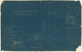
Item is a map prepared as part of the Harbour Headline project of the False Creek Development Study. Map shows existing, interim and ultimate harbour headlines, existing water areas, ownership boundaries, other property lines and lease boundaries in and around False Creek.
Item shows Point Grey harbour facilities and industrial lands, the Jericho naval reserve and golf links through a combination of a map and illustrations. A smaller key plan shows the location of the Vancouver Terminals Company's harbour properties in relation to the rest of Point Grey and Vancouver.
![Burrard Viaduct Construction [1 of 10]](/uploads/r/null/2/7/2788a9638050d7cbfc021e29977d956f423fe6048bb7c29c035ea57bda6dd66c/5df17b4f-3ebf-4f8d-ac21-de11bd89033f-A66652_142.jpg)
![Burrard Viaduct Construction [2 of 10]](/uploads/r/null/5/7/57426101abc66a2ab407c951565e28bb07f8f27238a35bb05d7478ded4e540b1/8b87415b-c4bc-4c5c-bf5c-89e3546722c2-A66653_142.jpg)
![[Coal Harbour]](/uploads/r/null/8/3/83bd003a993aaa90a0c6aea33d3521bf9163833f067d66579783658045125695/447583bd-7a62-4edd-9558-f0bcaf009c90-A16626_142.jpg)
![[Coal Harbour?]](/uploads/r/null/f/b/fb269570031b2a3828f329c97b9db78a5236f47cf4286fb78bf3c2058c53b0de/626b353c-ab4a-4c40-bcaf-41aaec70fe04-A16630_142.jpg)
![[Coal Harbour?]](/uploads/r/null/b/4/b488b986b859b20d49e5b4d6f59cb320223b0da4668774c67790e46f15e737a7/ea0b239a-5c45-449d-80f0-04a4483b3cd5-A16627_142.jpg)
![[Coal Harbour?]](/uploads/r/null/1/c/1c43ca1c74017572cccbbeb20b07dae64a1d3dc2d6ed6573e3555df279535121/dee93f4d-4cde-4f0b-b504-dfb863bfa77d-A16629_142.jpg)
![[Coal Harbour]](/uploads/r/null/e/6/e641a81bbc0d7d8adfb51e6e32ecb57659f5dccdce517fb88dd14160144e3e52/c67b13d2-e877-4fb3-8b2f-0de875c9280a-A16625_142.jpg)
![[Coal Harbour?]](/uploads/r/null/d/b/db2de6c93437b31527635deddfa2d1b0228f1dfd0d78c0bf6d754fd685fc663b/dccf9129-e23d-46e6-8e3f-0adde1d833b8-A16628_142.jpg)
![[Coal Harbour?]](/uploads/r/null/1/0/10b1e3b62444e17b20e5c87b9cb37773568bcad1eb9f6ef2efd8c228b7f06408/5aa04f62-7a7b-4a73-a8bf-7920b9573446-A16631_142.jpg)
![[Coal Harbour view from Denman Street]](/uploads/r/null/f/4/f4ee6b5b8d147b8a774a97a7b59f6f8c29bb8792a52da1695f47dce307742555/f90773a4-4b21-478d-bd42-505e1d441b47-A16624_142.jpg)
![[English Bay after heavy snowfall]](/uploads/r/null/9/8/98d57e6aa43d81b764d660589019a9777086ef8ffa1ac5d9463a527dee1dbf26/46e3a80b-3931-459d-9c09-b1bd42694079-A16571_142.jpg)

![[North facing cityscape view of the West End showing the] Sheraton-Landmark](/uploads/r/null/7/d/7db38a96995179fe1118994e0c35380cbd8d1bc5909f43a9cb352ba83ea17b88/9e677767-fb6d-4420-91d8-8152f5d4ede1-A59252_142.jpg)
![[Northwest facing cityscape view of the West End]](/uploads/r/null/8/1/8144b464121d2d606915a295fe4bfea95b903893f4ac909e59d22d27b3a6c7db/c58f4286-e96d-4189-ad75-9885f1b17ff7-A59249_142.jpg)
![[Southwest facing cityscape view of the West End]](/uploads/r/null/4/b/4b50b8139a75294378d4e28c633eb1a7201b7a1ffba30b79f1cf631026c1a7bd/4f7badb7-4d85-4c22-8780-a7311c11a932-A59250_142.jpg)