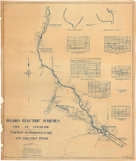
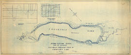
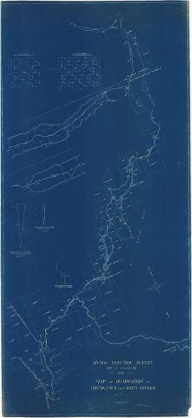
Item is a map which shows a proposed hydro electric development of the Cheakamus River system from the Squamish River to Green Lake. The map includes proposed tunnel routes, diversions, storage reservoirs, dams, power houses, canals, and pipelines. Also shown are areas of suggested future development and the Pacific Great Eastern railway line. Included in the area surveyed are Garibaldi Lake, Starvation Lake, Deadman's Lake, Daisy Lake, Stoney Lake, Cheakamus Lake, Alta Lake, Nita Lake, Alpha Lake, and Green Lake, as well as the Squamish River, Pilchuk River, Cheakamus River, Soo River, Green River, and various creeks. Map is hand coloured with pencil annotations concerning watersheds, land height and creeks not included on the original map design.