Showing 4 results

Archival description
City of Vancouver fonds Lower Mainland (B.C.)
Print preview View:

4 results with digital objects Show results with digital objects

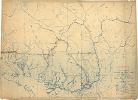
Hydro electric surveys. Plan showing location of water powers investigated by City of Vancouver

Item is a map which functions as a visual index to the locations of various hydro electric surveys carried out by the City of Vancouver along the following rivers: Squamish River, Cheakamus River, Green River, Lillooet River, Eagle River, Indian River, Pitt River, Chehalis River, Harrison River, Chilliwack River, the Fraser and Thompson Rivers, and Bridge River. The map lists the names of the surveyors responsible and the areas covered by each survey. Annotations include the locations and the dates of use of "gauging stations established" and "city gauging stations still in use."

Metropolitan area, Lower Mainland, British Columbia [Analysis of major suburban commercial centres - 1976]

Item is a map of the Lower Mainland showing metropolitan, suburban, and district commercial centres, primary population catchment areas, and 1955 and projected 1976 populations for areas within a three-mile radius from a suburban commercial centre. The base map is a topographical map compiled by the Technical Committee for Metropolitan Highway Planning in 1955 and shows property divisions, roads, and buildings.