South Vancouver section 12 supplementary information
- COV-S167---: LEG1153.456-: LEG1153.456.107
- Part
- 1947
Part of City of Vancouver fonds
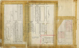
Part is a sheet showing assessment and other information relevant to South Vancouver section 12.
351 results with digital objects Show results with digital objects
South Vancouver section 12 supplementary information
Part of City of Vancouver fonds
Part is a sheet showing assessment and other information relevant to South Vancouver section 12.

Part of City of Vancouver fonds
Part is a section depicting the area bounded by Argyle Street to Forty-seventh Avenue to Prince Edward Street to Fifty-eighth Avenue. The sheet has been extensively annotated, with colour coded areas to depict land use, status of lots as tax sale properties for sale, sewer and water lines, as well as other colour codes that are not noted on the legend at the front of the volume.

South Vancouver section 11 supplementary information
Part of City of Vancouver fonds
Part is a sheet showing assessment and other information relevant to South Vancouver section 11.

Part of City of Vancouver fonds
Part is a section depicting the area bounded by St. George Street to Forty-seventh Avenue to Cambie Street to Fifty-eighth Avenue. The sheet has been extensively annotated, with colour coded areas to depict land use, status of lots as tax sale properties for sale, sewer and water lines, as well as other colour codes that are not noted on the legend at the front of the volume.

South Vancouver section 10 supplementary information
Part of City of Vancouver fonds
Part is a sheet showing assessment and other information relevant to South Vancouver section 10.

Part of City of Vancouver fonds
Part is a section depicting the area bounded by Boundary Road to Foster Avenue to Earles Street to Fiftieth Avenue. The sheet has been extensively annotated, with colour coded areas to depict land use, status of lots as tax sale properties for sale, sewer and water lines, as well as other colour codes that are not noted on the legend at the front of the volume.

South Vancouver section 1 supplementary information
Part of City of Vancouver fonds
Part is a sheet showing assessment and other information relevant to South Vancouver section 1.

Part of City of Vancouver fonds
Part is a section depicting the area bounded by Carolina Street to 16th Avenue to Cambie Street to 28th Avenue. The sheet has been extensively annotated, with colour coded areas to depict land use, status of lots as tax sale properties for sale, sewer and water lines, as well as other colour codes that are not noted on the legend at the front of the volume.

Part of City of Vancouver fonds
Part is the southern half of a map of the Capilano River, depciting the area of the Capilano River valley from the river's mouth at Burrard Inlet north to District Lot 596.
![Sheet No. 9 [George Street to Thirtieth Avenue to Ontario Street to Thirty-eighth Avenue]](/uploads/r/null/c/8/c/c8c223273de73dd975de4d45feac09eec2dcfde8226aaa0e1b8f1426493a4389/bc29ee5f-42d7-4859-990c-c55084703959-LEG1153_142.jpg)
Sheet No. 9 [George Street to Thirtieth Avenue to Ontario Street to Thirty-eighth Avenue]
Part of City of Vancouver fonds
![Sheet No. 8 [George Street to King Edward Avenue to Ontario Street to Thirtieth Avenue]](/uploads/r/null/f/0/7/f077d1dfb6f6da927e00bd6cd4e3944aba3ea7a93b1c2076a280a8e003fb7b59/c0c04996-4ae8-4163-bab7-7398e0b0942a-LEG1153_142.jpg)
Sheet No. 8 [George Street to King Edward Avenue to Ontario Street to Thirtieth Avenue]
Part of City of Vancouver fonds
![Sheet No. 7 [Main Street to Sixteenth Avenue to Ontario Street to Twenty-third Avenue]](/uploads/r/null/7/8/f/78f5936553469a42d02b6d7d884c0ccface8e869efb00ea32ea24de3add7c302/86390abc-e710-4642-b04a-85890b9ce574-LEG1153_142.jpg)
Sheet No. 7 [Main Street to Sixteenth Avenue to Ontario Street to Twenty-third Avenue]
Part of City of Vancouver fonds
![Sheet No. 6 [Ontario Street to Fifty-ninth Avenue to Ash Street to SW Marine Drive]](/uploads/r/null/6/3/0/6307241d025a7bdcfa15c0fbc20a7e50a0e5c0574df2c760028188c3ffaccd3f/781e01dc-197b-4c60-8c1f-0ed145e92003-LEG1153_142.jpg)
Sheet No. 6 [Ontario Street to Fifty-ninth Avenue to Ash Street to SW Marine Drive]
Part of City of Vancouver fonds
![Sheet No. 56 [Ontario Street to SW Marine Drive to Ash Street to Fraser River]](/uploads/r/null/1/9/8/19805cc3ca1a36e79b75812124f4d19bc1cba5d9c9a5cbfda7eb2e5d00efe39d/792d979d-2b3f-44fb-8739-651d77bbef08-LEG1153_142.jpg)
Sheet No. 56 [Ontario Street to SW Marine Drive to Ash Street to Fraser River]
Part of City of Vancouver fonds
![Sheet No. 55 [Boundary Road to Sixty-sixth Avenue to ca. Tyne Street to Fraser River]](/uploads/r/null/3/a/c/3ac8590cc5a2246cce9796841569265201d54e629168c61ff788739a6da3a3d7/87ee0a66-62dc-4480-a8a7-583ba87ea320-LEG1153_142.jpg)
Sheet No. 55 [Boundary Road to Sixty-sixth Avenue to ca. Tyne Street to Fraser River]
Part of City of Vancouver fonds
![Sheet No. 54 [Boundary Road to Fifty-eighth Avenue to Tyne Street to Sixty-sixth Avenue]](/uploads/r/null/4/9/2/4925e281903d682f1a68e9722289d297d3b67f69de4977aca839c40d77ac6c47/d1cab1e4-ba00-4e71-a0b0-055f4b10f9bb-LEG1153_142.jpg)
Sheet No. 54 [Boundary Road to Fifty-eighth Avenue to Tyne Street to Sixty-sixth Avenue]
Part of City of Vancouver fonds
![Sheet No. 53 [Boundary Road to Forty-seventh Avenue to Tyne Street to Fifty-fifth Avenue]](/uploads/r/null/b/7/3/b738974ae4282e40f18c767c7add7909d5db6c15a03431d6482d0335fc8b7f1a/cac7c189-dcac-4f56-84f9-d36f083feb73-LEG1153_142.jpg)
Sheet No. 53 [Boundary Road to Forty-seventh Avenue to Tyne Street to Fifty-fifth Avenue]
Part of City of Vancouver fonds
![Sheet No. 52 [Boundary Road to Kingsway Avenue to Latta/Tyne Street to Forty-seventh Avenue]](/uploads/r/null/c/9/7/c9787c126bdd66e5fc93cd8e14abf9607c95b53c53ee51abfd56c5c1a3e1ff34/96e57a2c-bfc4-4471-8028-0f0277ff2039-LEG1153_142.jpg)
Sheet No. 52 [Boundary Road to Kingsway Avenue to Latta/Tyne Street to Forty-seventh Avenue]
Part of City of Vancouver fonds
![Sheet No. 51 [Boundary Road to Wellington Avenue to Joyce Street to Kingsway Avenue]](/uploads/r/null/0/8/9/089ba7d6dc97c2ea4343f6b95d25598d2dcbe135f9e1a39fceb3f0adc8b046fb/5a9b9f26-50d0-4a58-89c6-49c394b4947b-LEG1153_142.jpg)
Sheet No. 51 [Boundary Road to Wellington Avenue to Joyce Street to Kingsway Avenue]
Part of City of Vancouver fonds
![Sheet No. 50 [Boundary Road to Twenty-ninth Avenue to Rupert Street to Austrey/Vanness Avenue]](/uploads/r/null/5/2/9/52934c0a1ba6dd8c80559e3eeb8424dd638f7ee32fb05e5e51366bc0871c77b8/b9b3b18a-094e-4fab-bf6c-26680026d8e9-LEG1153_142.jpg)
Sheet No. 50 [Boundary Road to Twenty-ninth Avenue to Rupert Street to Austrey/Vanness Avenue]
Part of City of Vancouver fonds
![Sheet No. 5 [Ontario Street to Forty-fifth Avenue to Cambie Street to Forty-ninth Avenue]](/uploads/r/null/1/f/1/1f17e485ff8505c9ad9b4316c404cfff72e76d3f9918a678f98247b5281f765e/dd6f5950-270a-4467-b83f-26a0bc4752f4-LEG1153_142.jpg)
Sheet No. 5 [Ontario Street to Forty-fifth Avenue to Cambie Street to Forty-ninth Avenue]
Part of City of Vancouver fonds
![Sheet No. 49 [Tyne Street to Sixty-third Avenue to Carlton Street to Fraser River]](/uploads/r/null/7/b/7/7b781c0eb1728d147d6b43104b88ede85b451ab4dd87a8cd6e48bbc8c2620897/2b41070d-7d73-42b7-9111-a4e302573fe1-LEG1153_142.jpg)
Sheet No. 49 [Tyne Street to Sixty-third Avenue to Carlton Street to Fraser River]
Part of City of Vancouver fonds
![Sheet No. 48 [Tyne Street to Fifty-fifth Avenue to Carlton Street to Sixty-fourth Avenue]](/uploads/r/null/f/b/3/fb3b99f3c4012f98adfd3626254e61dc507170d72f08abc8122e4a4bca973e22/f9fb5f40-d7ae-4820-9beb-cf412855a2a1-LEG1153_142.jpg)
Sheet No. 48 [Tyne Street to Fifty-fifth Avenue to Carlton Street to Sixty-fourth Avenue]
Part of City of Vancouver fonds
![Sheet No. 47 [Tyne Street to Waverley Avenue to Carlton Street to Fifty-fifth Avenue]](/uploads/r/null/0/2/d/02d2ea6dd58f76cb1dea69e2e248d07d34d83ace41aaf53673576a79d3434798/dd8d0471-5263-4163-b660-ffa7aad783f9-LEG1153_142.jpg)
Sheet No. 47 [Tyne Street to Waverley Avenue to Carlton Street to Fifty-fifth Avenue]
Part of City of Vancouver fonds
![Sheet No. 46 [Latta Street to School Road to Carlton Street to Waverley Avenue]](/uploads/r/null/3/6/f/36f5f844e9ea290b57847087296d896d5a12daf000d786ac01e881e0499c5510/28507a18-a9f9-4492-bd9a-2ddfa8ede098-LEG1153_142.jpg)
Sheet No. 46 [Latta Street to School Road to Carlton Street to Waverley Avenue]
Part of City of Vancouver fonds
![Sheet No. 45 [Wessex/Joyce Street to Austrey/Euclid Avenue to Dundee Street to Forty-first Avenue]](/uploads/r/null/7/c/f/7cf9f762e9c215503c62d537372c957a9c5fe447703761c2c7a7c44cd0ed7540/8febd995-e66b-4dd3-a147-3ccad6cb2e8a-LEG1153_142.jpg)
Sheet No. 45 [Wessex/Joyce Street to Austrey/Euclid Avenue to Dundee Street to Forty-first Avenue]
Part of City of Vancouver fonds
![Sheet No. 44 [McHardy Street to Twenty-ninth Avenue to Moss Street to Horley Street]](/uploads/r/null/d/6/a/d6a3dc99a6b3f692c3fe9b210801b14df90ac6e9b951db09a961de7c7339c058/cb39b884-ce77-4369-b117-9c92e8ece5c6-LEG1153_142.jpg)
Sheet No. 44 [McHardy Street to Twenty-ninth Avenue to Moss Street to Horley Street]
Part of City of Vancouver fonds
![Sheet No. 43 [Moss Street to Twenty-ninth Avenue to Clarendon Street to Kingsway Avenue]](/uploads/r/null/2/f/e/2fed326a9408f52a6de451db8803f3ca1188e78d05a8232190e3902890c62b9c/fc9322a5-4780-49f8-8405-d209103ce7f0-LEG1153_142.jpg)
Sheet No. 43 [Moss Street to Twenty-ninth Avenue to Clarendon Street to Kingsway Avenue]
Part of City of Vancouver fonds
![Sheet No. 42 [Carlton Street to Sixty-fifth Avenue to Nanaimo Street to Fraser River]](/uploads/r/null/c/0/f/c0f25974b8cca0a9e6f1e4c1214f703f6abd3815da448a70c658b3c96348b904/cc4651ef-1513-4f8b-a413-bf5022a25c83-LEG1153_142.jpg)
Sheet No. 42 [Carlton Street to Sixty-fifth Avenue to Nanaimo Street to Fraser River]
Part of City of Vancouver fonds
![Sheet No. 41 [Carlton Street to Fifty-seventh Avenue to Nanaimo Street to Sixty-fifth Avenue]](/uploads/r/null/4/a/5/4a51356de1ddb79cb9aa5c6fc573bbbcf9640d4469550b5080b5981b049eace0/0ba2e77f-80d3-4101-84f9-df784bee297c-LEG1153_142.jpg)
Sheet No. 41 [Carlton Street to Fifty-seventh Avenue to Nanaimo Street to Sixty-fifth Avenue]
Part of City of Vancouver fonds
![Sheet No. 40 [Carlton Street to Forty-eighth Avenue to Nanaimo Street to Fifty-seventh Avenue]](/uploads/r/null/3/9/c/39c1f6a2674fda099f176d8500afe7bbadf4c2a8c241368656998837f098c9b6/7d092c70-6d84-4079-80f4-dd352813f3f1-LEG1153_142.jpg)
Sheet No. 40 [Carlton Street to Forty-eighth Avenue to Nanaimo Street to Fifty-seventh Avenue]
Part of City of Vancouver fonds
![Sheet No. 4 [Ontario Street to Thirty-eighth Avenue to Cambie Street to Forty-fifth Avenue]](/uploads/r/null/b/8/c/b8c7af16df3c770f11c0a155c3ba9134ca5f19e367c575723031f91befaa91d7/e1447111-79bb-45a0-98f4-fa349ed27d09-LEG1153_142.jpg)
Sheet No. 4 [Ontario Street to Thirty-eighth Avenue to Cambie Street to Forty-fifth Avenue]
Part of City of Vancouver fonds
![Sheet No. 39 [Carlton Street to Forty-first Avenue to Nanaimo Street to Forty-eighth Avenue]](/uploads/r/null/d/5/e/d5e393f2166d9b7af78a6d4e999cc8e2574558679d5be4506435016449640c50/af107c2d-81ff-4512-8506-f4be16caafd4-LEG1153_142.jpg)
Sheet No. 39 [Carlton Street to Forty-first Avenue to Nanaimo Street to Forty-eighth Avenue]
Part of City of Vancouver fonds
![Sheet No. 38 [Dundee Street to Kingsway Avenue to Nanaimo Street to Forty-first Avenue]](/uploads/r/null/5/2/9/52963d94b3d53640e63b18df48d3cf38d6a4e213048f0b41c02a1dcfd1695ec0/955b099b-ddfb-4694-b03f-0954f0b7b4df-LEG1153_142.jpg)
Sheet No. 38 [Dundee Street to Kingsway Avenue to Nanaimo Street to Forty-first Avenue]
Part of City of Vancouver fonds
![Sheet No. 37 [Clarendon Street to Twenty-ninth Avenue to Victoria Drive to Thirty-fourth Avenue]](/uploads/r/null/a/b/6/ab6efd7a6bec72799096363dfc7969a55894ca128e07675ca394f1ca94b22127/bbdcfcaf-3e5b-4324-ac44-281237a8ab0d-LEG1153_142.jpg)
Sheet No. 37 [Clarendon Street to Twenty-ninth Avenue to Victoria Drive to Thirty-fourth Avenue]
Part of City of Vancouver fonds
![Sheet No. 36 [Nanaimo Street to Vanness Avenue to Victoria Drive to Twenty-ninth Avenue]](/uploads/r/null/f/8/7/f876ce80d3d7719835f1740ffd5ec24e39293234d35e1fdd02b34dacc10fd167/6ebdf698-b423-4a30-8ab8-8a1e88e5a0da-LEG1153_142.jpg)
Sheet No. 36 [Nanaimo Street to Vanness Avenue to Victoria Drive to Twenty-ninth Avenue]
Part of City of Vancouver fonds
![Sheet No. 35 [Nanaimo Street to Sixteenth Avenue to Hull Street to Vanness Avenue]](/uploads/r/null/6/8/1/681f22c0529af4757ca252e416474a12ac016f3e57bd04c57d99fcd77d23c66e/840c8d95-974e-4552-a959-904ea3e79db4-LEG1153_142.jpg)
Sheet No. 35 [Nanaimo Street to Sixteenth Avenue to Hull Street to Vanness Avenue]
Part of City of Vancouver fonds
![Sheet No. 34 [Nanaimo Street to Sixty-seventh Avenue to Argyle Street to Fraser River]](/uploads/r/null/4/c/e/4cea52478f5099520495a787924b11f0ff477b8b48574b8e8905d63a98366708/56538ddf-f8b2-4cea-8988-cc060ec6cbee-LEG1153_142.jpg)
Sheet No. 34 [Nanaimo Street to Sixty-seventh Avenue to Argyle Street to Fraser River]
Part of City of Vancouver fonds
![Sheet No. 33 [Nanaimo Street to Fifty-ninth Avenue to Argyle Street to SE Marine Drive]](/uploads/r/null/1/f/a/1fadb50e0328ff5a5cdb22e049550f8bc6741c172d879888cdacf80132a66d0d/b730dccb-b953-40c8-b960-934fdfa8f476-LEG1153_142.jpg)
Sheet No. 33 [Nanaimo Street to Fifty-ninth Avenue to Argyle Street to SE Marine Drive]
Part of City of Vancouver fonds
![Sheet No. 32 [Nanaimo Street to Fifty-first Avenue to Argyle Street to Fifty-ninth Avenue]](/uploads/r/null/5/8/6/586ccfe3e78aa195aec1125840004dca9cdad39ff21423ae7ae38411d4ff1c91/ae917ac2-eda7-473b-9ffd-277203da6027-LEG1153_142.jpg)
Sheet No. 32 [Nanaimo Street to Fifty-first Avenue to Argyle Street to Fifty-ninth Avenue]
Part of City of Vancouver fonds
![Sheet No. 31 [Nanaimo Street to Forty-fourth Avenue to Argyle Street to Fifty-second Avenue]](/uploads/r/null/4/8/f/48f36eed341fe71f50f9b4074d459ea64b1a49ab764ed157afeb63415c573ec1/ad7fbffd-b136-4956-b224-91c82cb90d0a-LEG1153_142.jpg)
Sheet No. 31 [Nanaimo Street to Forty-fourth Avenue to Argyle Street to Fifty-second Avenue]
Part of City of Vancouver fonds
![Sheet No. 30 [Nanaimo Street to Thirty-eighth Avenue to Argyle Street to Forty-fourth Avenue]](/uploads/r/null/0/4/c/04c81fa78038ea8e9afe60c42a48709118e464bd7169040f912fa001d4a2ac5f/9677b04c-f76b-442a-a233-54772c02084d-LEG1153_142.jpg)
Sheet No. 30 [Nanaimo Street to Thirty-eighth Avenue to Argyle Street to Forty-fourth Avenue]
Part of City of Vancouver fonds
![Sheet No. 3 [Little Mountain south to Thirty-seventy Avenue]](/uploads/r/null/8/0/7/80763848604372ba093e892df667bdddf5e9d21d755078b87e7ba0adceaeac38/c55f1a1e-c5ea-4a50-9e59-35902c1092e4-LEG1153_142.jpg)
Sheet No. 3 [Little Mountain south to Thirty-seventy Avenue]
Part of City of Vancouver fonds
![Sheet No. 29 [Nanaimo Street to Thirty-fourth/31st Avenue to Argyle Street to Thirty-eighth Avenue]](/uploads/r/null/6/b/b/6bbc93f2896876c45ae4cf50563502c9649b43167ceb9b4b38ebefcba979e562/718873b2-7d20-435d-b887-48915a235875-LEG1153_142.jpg)
Sheet No. 29 [Nanaimo Street to Thirty-fourth/31st Avenue to Argyle Street to Thirty-eighth Avenue]
Part of City of Vancouver fonds
![Sheet No. 28 [Victoria Drive to Twenty-second Avenue to Knight Street to Thirty-first Avenue]](/uploads/r/null/0/9/1/09173e21fa4080b1ed8efbcb4d2ca44494e94902c203c138ccf5e85e51f39aa8/617d15f4-5e8d-41cc-b7ff-555b4ea61337-LEG1153_142.jpg)
Sheet No. 28 [Victoria Drive to Twenty-second Avenue to Knight Street to Thirty-first Avenue]
Part of City of Vancouver fonds
![Sheet No. 27 [Victoria Drive to Fifteenth Avenue to Knight Street to Twenty-second Avenue]](/uploads/r/null/4/7/f/47f6d3060e6a52bd251a12090de447894b096c07ce6a5d2131a8a5bd6fd12968/f8a0dd0d-2691-4c7b-82e0-bab193380a27-LEG1153_142.jpg)
Sheet No. 27 [Victoria Drive to Fifteenth Avenue to Knight Street to Twenty-second Avenue]
Part of City of Vancouver fonds
![Sheet No. 26 [Argyle Street to Sixty-first Avenue to Ross Street to Fraser River]](/uploads/r/null/d/8/5/d85899ed4866e6864ca8c8685292167d48ba2555e0908db68dc75c7b8647c258/2f5594d4-3328-447e-80b4-00d6c79954d5-LEG1153_142.jpg)
Sheet No. 26 [Argyle Street to Sixty-first Avenue to Ross Street to Fraser River]
Part of City of Vancouver fonds
![Sheet No. 25 [Argyle Street to Fifty-third Avenue to Ross Street to Sixty-first Avenue]](/uploads/r/null/6/5/0/65079e93d7b8bfcd4f3d1604d96852cef0622e47dcdf127a13b4c1ba2768d35d/6f645e45-6989-4173-a77e-db173af5ea15-LEG1153_142.jpg)
Sheet No. 25 [Argyle Street to Fifty-third Avenue to Ross Street to Sixty-first Avenue]
Part of City of Vancouver fonds
![Sheet No. 24 [Argyle Street to Forty-fifth Avenue to Ross Street to Fifty-third Avenue]](/uploads/r/null/4/2/3/4234b0fc05be0a1c8439cd4c1f31e6037a68ada5bb2c7301c16108831b897ad9/2465a3e3-da31-4f96-91de-8617e753e844-LEG1153_142.jpg)
Sheet No. 24 [Argyle Street to Forty-fifth Avenue to Ross Street to Fifty-third Avenue]
Part of City of Vancouver fonds
![Sheet No. 23 [Argyle Street to Thirty-seventh Avenue to Ross Street to Forty-fifth Avenue]](/uploads/r/null/4/3/e/43e5f94bb5e159f8bf7b9e4058c7c8b1ef6f55f02ca2c1000747f1d987c8d8fe/a062912e-c409-4433-86ce-dc0b286d06e7-LEG1153_142.jpg)
Sheet No. 23 [Argyle Street to Thirty-seventh Avenue to Ross Street to Forty-fifth Avenue]
Part of City of Vancouver fonds