
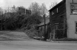
Intersection at Burrard St. and 3rd Ave.
- AM757-S2-F2-: CVA 798-1.1
- Item
- 1978
Intersection at Burrard St. and 3rd Ave.

Showing former mouth of Mackie Creek
Photograph shows parking lot and appartmant buildings near Heather Street and 6th Avenue, taken facing east north-east.

Showing former mouth of Mackie Creek
Photograph shows parking lot and apartmant buildings near Heather Street and 6th Avenue, taken facing east north-east.
Photograph taken near former mouth of Mackie Creek, near Heather Street and 6th Avenue

Showing vegetation by railroad track
Photograph taken facing south, near former mouth of Mackie Creek at Heather Street and 6th Avenue. Building in background is Vulcan Automotive Equipment Ltd.
Lot beneath south side of Cambie St. Bridge
Photograph taken facing south-west.
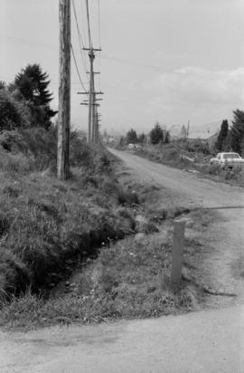
Photograph taken near former mouth of Brewery Creek at 1st Avenue, near Scotia Street
Photograph shows dip in road where creek bed formerly existed
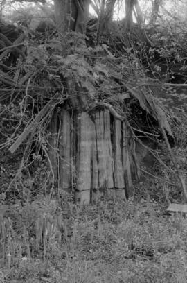
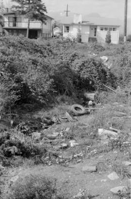
Parking lot beside the Brake and Drum building
Photograph shows lot at the base of the remnant of Brewery Creek Ravine

Parking lot beside the Brake and Drum building
Photograph shows lot at the base of the remnant of Brewery Creek Ravine

Water seeping through ground near former Brewery Creek mouth
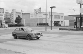
Intersection at Burrard St. and 3rd Ave.

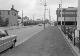
5th Ave. at Brunswick St., facing west
House shown on left of photo is 324 E. 5th Ave.

5th Ave. at Brunswick St., facing west

Railroad tracks and vegetation near Hemlock St.


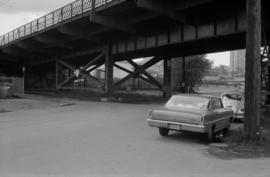
South end of Granville St. bridge
Photograph taken facing west, showing Granville Street bridge and area beneath. Part of Granville Island visible on right side of photograph. Apartment complex visible in background
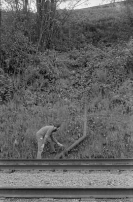
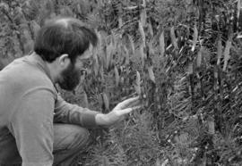
David Rodger inspecting pipe by railroad track

South end of Granville St. bridge
Photo shows Granville Strret bridge passing over 6th Avenue intersection on south side of False Creek
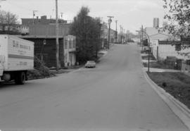
Looking south on Hemlock St. from 6th Ave.

Intersection at Cambie St. and Broadway
Photograph taken facing north-west. Royal Bank building visible on right side of photograph

Photograph belived taken at or near China Creek Park, located at Broadway and Glen Drive. Semi-industrial buildings, residences and S.P.C.A. building are visible in the background.
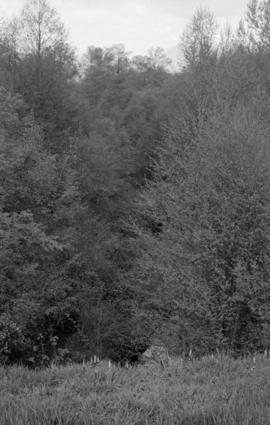
Still Creek ravine, looking north

Photograph shows Safeway store located at former site of Cedar Cottage Brewery at Kingsway and Knight Street. Photograph shows same site as shown in archives' photograph Dist. P.69 N.63

Manhole on 31st Ave., opposite St. George St.
Photograph shows manhole covering Brewery Creek near Mountain View Cemetery
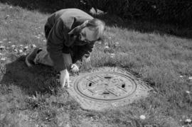
David Rodger by manhole on 31st Ave., opposite St. George St.
Photograph shows manhole covering Brewery Creek near Mountain View Cemetery

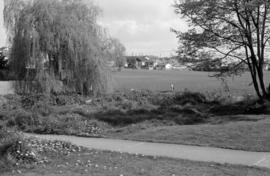
Mountain View Cemetery, looking south-east

Mountain View Cemetery, looking south-east
Photograph taken looking south from 28th Avenue, between Nanaimo Street and Gladstone Street.
Photograph taken looking south from 28th Avenue, between Nanaimo Street and Gladstone Street. General Brock Park is visible in the background

Still Creek near Renfrew Community Centre and Park

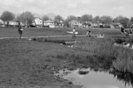
Vivian Creek at Fraserview Golf Club, looking north
Photograph shows source of China Creek at Trout Lake


Trout Lake taken from East 19th Ave. and Hull St.
Photograph taken facing north, showing Trout Lake and surrounding area

Trout Lake taken from East 19th Ave. and Hull St.
Photograph taken facing north, showing Trout Lake and surrounding area
Creek near Slocan St. and East 28th Ave.
Photograph taken facing north-west of creek that feeds into Trout Lake. Photograph shows unpaved alley behind houses

Creek near Slocan St. and East 28th Ave.
Photograph taken facing south-west of creek that feeds into Trout Lake. Photograph shows unpaved alley behind houses

Photograph taken near Atlin Street and East 29th Avenue

Photograph taken near Atlin Street and East 29th Avenue

Photograph taken on Fraserview Golf Course, facing north

Stream on Langara College campus
Photograph taken near corner of East 49th Avenue and Ontario Street. College building visible in background of photograph. Note that this is not the same stream as depicted in CVA 798-3.11 to CVA 798-3.12

Stream from Langara Golf Club near Children's Hospital, south side of 58th Ave.
Photograph shows stream flowing through wooded area. Note that this is not the same stream as depicted in CVA 798-3.9 to CVA 798-3.10

Stream from Langara Golf Club near Children's Hospital, south side of 58th Ave.
Photograph shows stream bed beside buildings. Note that this is not the same stream as depicted in CVA 798-3.9 to CVA 798-3.10
Photograph shows area where stream believed to flow

Photograph shows depression adjacent to fairway where stream flows

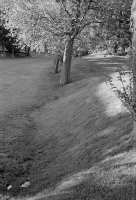
Quilchena Park, near West 33rd Ave. and Pine Crescent
Photograph shows view of park near where Macdonald Creek believed to originate

Baseball field near Arbutus St. and 33rd Ave.
Photograph taken facing north-west