Showing 39 results
Archival description![[Aerial view of trenches]](/uploads/r/null/1/4/1412ec9fe969731713369ec9f9082c5ad393f43a9b97137edb15af5f607dd27b/4060a12f-671a-4481-9556-42bcbadeeba0-A26231_142.jpg)
[Aerial view of trenches]
![[Aerial view of trenches]](/uploads/r/null/b/4/b4802aada5897f7e4ea62522da35c140e1c029d5463429348078581f82d112f8/a8970deb-dd40-4064-bc22-e3e5ccbc6e99-A26234_142.jpg)
[Aerial view of trenches]
![[Aerial view of trenches]](/uploads/r/null/1/5/1554e5c9b4079115e27293fe9340562083c31b31f747e4cc03e48cdc8950cea0/bda4221a-a4ab-4e08-bb81-9101fc6b06bf-A26235_142.jpg)
[Aerial view of trenches]
![[Aerial view of trenches]](/uploads/r/null/d/5/d5f22749ec7d563bfde2708fdd5de41bcc6fe5a04f8632ed7d3e089aea3470d9/c91bbbd4-0531-433d-b17f-e5fbd68c0ef7-A26236_142.jpg)
[Aerial view of trenches]
![[Aerial view of trenches]](/uploads/r/null/6/4/64f843e33ed5333fad079749b3b9edf4d17fb6127acb95933f427bb24f9ef798/07e56ec8-9859-4840-9e38-0b3c56a78a68-A26246_142.jpg)
[Aerial view of trenches]
![[Aerial view of trenches]](/uploads/r/null/d/0/d0d84062b765bab4eb9d7d8f497995fd8c026bde008ce30d105a198643019508/f91f84b3-4698-4da2-a3d8-e91c5c277da8-A26238_142.jpg)
[Aerial view of trenches]
![[Aerial view of trenches]](/uploads/r/null/a/b/ab8d15616a36d1b141018b1abb24bc9b7633af04528c9213c0d85d2ddc95d304/cf8ccd80-1a4e-49ea-9179-23ddad2b2b3c-A26242_142.jpg)
[Aerial view of trenches]
![[Aerial view of trenches]](/uploads/r/null/4/2/423790085a91a1ed9095020c8e3e24fecfadb5b3ac6e7db08e414c60caab916d/7ede1b50-7185-472d-80a7-9c75d535da83-A26233_142.jpg)
[Aerial view of trenches]
![[Aerial view of trenches]](/uploads/r/null/a/f/af4c5acf8ea4536180fd04c2322d2406f05de7e1eb0a66aaef5a482b0b5e2957/46ddfda5-55aa-4f13-a17d-48d642f165e4-A26241_142.jpg)
[Aerial view of trenches]
![[Aerial view of trenches]](/uploads/r/null/7/e/7e1e0572e83e1c37850ae8f99036195eea95a7666e800292ca62df39f0582a4a/88f76938-e679-4213-a898-cd8ca1aaaf97-A26232_142.jpg)
[Aerial view of trenches]
![[Aerial view of trenches]](/uploads/r/null/2/1/21b724a00b11465d29183236dd65a1b0666c8755b5bb019c680aa6728e01eedf/684e4c32-dc9c-4510-8b3d-36e193803d1f-A26237_142.jpg)
[Aerial view of trenches]
![[Aerial view of trenches]](/uploads/r/null/a/8/a82c8dccb3dbe15526692875b17d865fba4a8eada9859bf50fd9639432588883/f74b75fd-1318-4ca0-87a3-1d91a2264bcb-A26239_142.jpg)
[Aerial view of trenches]
![[Aerial view of trenches]](/uploads/r/null/d/8/d83b7662a9fc609515032d4a90ac4ec0d1ca5d3daa61f678c8b8d2fe5c3239f5/54cb7763-62b7-4d5b-b689-4f74b3702b15-A26240_142.jpg)
[Aerial view of trenches]
![[Aerial view of trenches]](/uploads/r/null/9/8/98e4d3d3322d050897616f897aa84e10566918736bd286a4a3e0f68210d50d27/218b73f6-7bfd-4bb7-9db1-f4f6b59acd0e-A26243_142.jpg)
[Aerial view of trenches]
![[Aerial view of trenches]](/uploads/r/null/e/2/e2a88aad6aada2d2871660f35735bb321f2b998fb9337c64e768d90544c8695f/d09b2c67-1102-4081-94a3-26ed65c1618c-A26244_142.jpg)
[Aerial view of trenches]
![[Aerial view of trenches]](/uploads/r/null/5/8/584843258ead325890ff73cd413aac068aba6f20635b0bdcd20da0e3d63777be/e02e8216-9601-4b7a-a44a-96fccda0826a-A26245_142.jpg)
[Aerial view of trenches]

City of Vancouver Waterworks Department. Profile of Capilano and Seymour Creek water mains
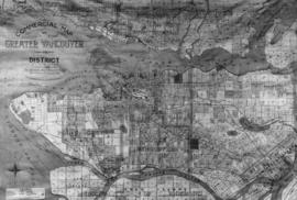
Commercial Map of Greater Vancouver and District

False Creek reclamation. Suggested treatment in front of C.N.R. and Gt.N.R. passenger stations

Lady Willingdon at B.C. Chamber of Mines

Map of the southwestern part of British Columbia
![[Map of Vancouver showing photographs of school buildings and their locations]](/uploads/r/null/5/2/8/5280488e1782e266d246f9ca56c073c54f56ff4bf3ccb72ba1081c606b7ad527/ede59cdc-62a0-4282-a668-c0edab9301e2-CVA371-2976_142.jpg)
[Map of Vancouver showing photographs of school buildings and their locations]

Map showing Klondyke and Indian River mining divisions of the Yukon

Pictorial Map of British Columbia, The Mineral Empire

Plan of Burrard Peninsula - distribution of population estimated for 1950

Plan of highway paralleling V.V. and E. Railway through D.L. 264A. City of Vancouver, B.C.
![[Plan of Okanagan Falls, Osoyoos Division, Yale District, B.C.]](/uploads/r/null/1/4/14f7ff1b44b8fd9998e06253c5bac0abff2ea4d9c62fdc769513da44cfbe537c/60dd23b5-52cc-455f-aa16-4d4cc49252b2-A04137_142.jpg)
[Plan of Okanagan Falls, Osoyoos Division, Yale District, B.C.]

The East Kootenay Power and Light Co. Ltd. Triangulation survey of portions of East Kootenay. Plan showing position of mineral monuments.

Vancouver and suburbs trolley and feeder map

Vancouver and suburbs trolley and feeder map

Vancouver Power Company Limited - Coquitlam Tunnel

Vancouver Waterworks Dept. Capilano and Seymour water sheds
![[View of northern France]](/uploads/r/null/1/9/195ad3c10a7ef65dd8ea2fb1da84894c8736ea2bec978133c9bab6b4b768c922/cc9aa259-d232-4509-a50d-c1f6e2ffe1fa-A26249_142.jpg)
[View of northern France]
![[View of northern France]](/uploads/r/null/8/0/808907a96d9e9d5e424a6bea321ab056f97b787466fc83c324c7f0475cd4aaf3/f4b7bb69-b685-47c4-85a6-09b3e9e5e27c-A26250_142.jpg)
[View of northern France]
![[View of northern France]](/uploads/r/null/5/c/5cd7e53d89d1e99a5384f438b04e944447c24b28ef1551995b5c06062d161bfd/6c41c4e0-1845-46d5-80eb-d82876bf9feb-A26253_142.jpg)
[View of northern France]
![[View of northern France]](/uploads/r/null/7/d/7d4b49d8d7062adedd50d8f7b29130de1917ab3d46e7f82b36ebc5723a6f6a8b/86d67be6-543f-421f-ad73-acd1a2b1a36c-A26247_142.jpg)
[View of northern France]
![[View of northern France]](/uploads/r/null/9/1/9156113a38c3ba5ae0a1d5e11a7c785e3aaea40116f34bebee34510b1119e2a3/cb964654-f1c1-490d-8eae-4a010113eb25-A26252_142.jpg)
[View of northern France]
![[View of northern France]](/uploads/r/null/8/5/8544c51272d22c8f31381536866537fb2bf18204c2c0612a8081aa8f41a841ae/85081300-ba09-4eef-b59e-87c6ce4a1ad6-A26248_142.jpg)
[View of northern France]
![[View of northern France]](/uploads/r/null/a/f/af0f463af21ddd787e6c23f938bc00f60919997e8c0c1d048ab0a65ceb17ea78/f30ba0c2-0958-4216-85cb-1d6203884766-A26251_142.jpg)
[View of northern France]