Item is a portion of a road map published by the Whatcom County Road Department, used as a base map by J.S. Matthews to show place names given by Narvaez.
Item is a print of a map by Major James Skitt Matthews, City Archivist, showing villages, landmarks and rivers of Howe Sound and Burrard Inlet using their indigenous names. The map also shows elevations and wildlife populating the area. It was compiled between 1931 and 1937, with the assistance of August Jack Haatsalano (Khahtsahlano), whose attestation is included on the map. Notes on the map explain the map's nomenclature.
Item is a map of the Lower Mainland, with place names as given n Narvaez's exploration maps and locations of First Nations villages, between Boundary Bay and Gambier Island.
Item is a map of the coast from Lummi Island, Washington north to Burrard Inlet, showing the route of Narvaez's explorations, modern and Spanish place names, and location of trails.
Item is a map which shows the geographic area bounded by the north shore of Burrard Inlet, the Fraser River, Point Atkinson, and the Burrard Inlet Second Narrows. Physical features on the map (primarily coastal sites) are labeled using both First Nations and European place names.
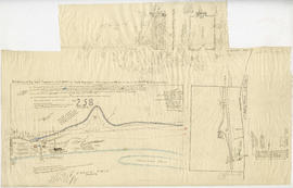
Item is a map showing lot boundaries and numbers, roads, trails, family settlements and reserves along North Arm Road of the North Arm of the Fraser River.