Showing 36 results
Archival description
Call Creek Lumber Co. T.L.s 6467, 7844, 6469, 7845

Cruise of T.L. 8044, 8045, Barclay District, V.I. (Vancouver Island)
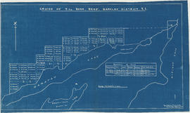
Cruise of T.L. 8044, 8045, Barclay District, V.I. (Vancouver Island)

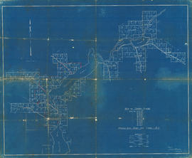
Key Map of Kitimat Valley Timber. Rat Portage Tract

Key Map of Kitimat Valley Timber. Rat Portage Tract

Key plan to TLs cruised around Homitan and Nitinat Lakes

Map of T.L. 8219, north of Lost Lake

Map of T.L. 8221P

Map of T.L. 9434P, south-east of Alta Lake
Phillips Arm - River and Lake
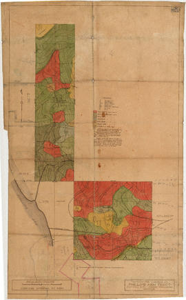
Phillips Arm Tract
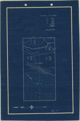
Summary of Lot 4054

Timber and topographic map of T.L.4290P - 4292P and 4296P - Chapman Creek, New Westminster District, B.C.

Tom Brown Lake - Gilford Island, Viner Sound, T.L.6918-19
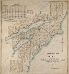
Topographical map of Block 1 containing T.L.s 8043-4-5, 8048, 8054-5-6-8-9 & 8086

Topographical map of Blocks 1, 2 &3. T.B. 590

Topographical map of Lease 919 and T.L.s 10885P-10886P-10887-11775P and 11776P

Topographical map of Lot 919 and T.L.s 10885-86-87

Topographical map of Lots 2638-2639 and 2640

Topographical map of Lots 2638-2639 and 2640

Topographical map of Lots 2642, 2643 and Lot 2314
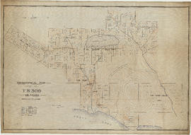
Topographical map of T.B. 309 with estimates

Topographical map of T.B. 590

Topographical map of T.B.507. Coquitlam Lake, Dominion Railway Belt, B.C.

Topographical map of the area around Diane Lake, including T.L.s 11773 and 11774
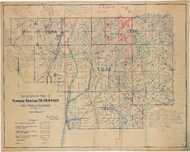
Topographical map of timber berths 36, 58, 94 & 110. Port Moody and Yale District, B.C.

Topographical map of timbered areas situated south of former Merrill-Ring-Moore operation

Topographical map of T.L. 44341

Topographical map of T.L.3723. Phillips River, Phillips Arm, Range 1, Coast District, B.C

Topographical map of T.L.44990 (T.L.12890) - Nelson Island, New Westminster District, B.C.

Topographical map of T.L.7563, 7564, 7566, 13119 and 13120 - McNab Creek, Howe Sound, New Westminster District, B.C

Topographical map of T.L's 12977 and 12889. T.L's 32362 and 40601. Nelson Island-New Westminster District, B.C.

Topographical map of T.L.s 3058 to 3062 (inclusive). Klite River-Toba Inlet, B.C.

Topographical plan of 32 timber licenses. Nos. 7617-7644, 8803-8804 and 10723-10724
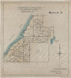
Topographical sketch plan. S.T.L.s 8046-8047 and 8062. Nitinat Lake, B.C.

Topography of T.L.s 8044, 8055, Barclay District