Print preview Close
Showing 221 results
Archival description220 results with digital objects Show results with digital objects

Automobile road map of Vancouver Canada : side 1

Automobile road map of Vancouver Canada : side 2
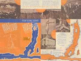
Boat trip up Indian Arm : Indian River Pk, Wigwam Inn : side 1

Boat trip up Indian Arm : Indian River Pk, Wigwam Inn : side 2

City map and points of interest of Vancouver, British Columbia : side 1

City map and points of interest of Vancouver, British Columbia : side 2
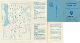
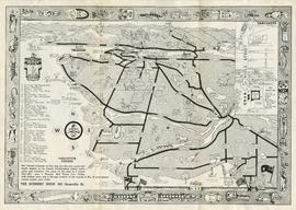
Civil Defence evacuation and survival plan for Greater Vancouver target area : side 1

Civil Defence evacuation and survival plan for Greater Vancouver target area : side 2
Downtown Vancouver Association historical trek: key

Downtown Vancouver Association historical trek: map

Downtown Vancouver map

Experience Downtown and Whistler maps

Highways of Greater Vancouver British Columbia and the Fraser Valley : side 1

Highways of Greater Vancouver British Columbia and the Fraser Valley : side 2

How to see Vancouver, Canada : side 1
How to see Vancouver, Canada : side 2
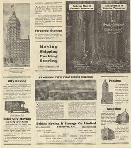
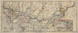
Indexed map of Greater Vancouver : side 1

Indexed map of Greater Vancouver : side 2

Kingsway-Boundary Industrial Centre to light industrial rail customers : side 1

Kingsway-Boundary Industrial Centre to light industrial rail customers : Site Plan of Kingsway-Boundary Industrial Centre

Male Voice Choir of Nanaimo, B.C. Winners of the Eisteddfod Prize, Vancouver, May 22, 1912

Map : Puget Sound Country, Victoria, Vancouver Island and Southern British Columbia Coast : side 1

Map : Puget Sound Country, Victoria, Vancouver Island and Southern British Columbia Coast : side 2

Map of downtown Vancouver, B.C. and sightseeing schedule : side 1

Map of downtown Vancouver, B.C. and sightseeing schedule : side 2

Map of Vancouver, British Columbia : side 1

Map of Vancouver, British Columbia : side 2

Plan of the City of Vancouver

Rothmans guide to picnic sites on British Columbia's Lower Mainland and in the Squamish area : side 1
Rothmans guide to picnic sites on British Columbia's Lower Mainland and in the Squamish area : side 2
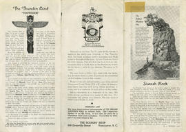
Scenery Shop pamphlet : side 1
Scenery Shop pamphlet : side 2

Sectional map and street directory of Vancouver : [Boundary Road to King Edward Avenue to Nanaimo Street to Seventy-first Avenue]

Sectional map and street directory of Vancouver : [Brunette Road to Avalon Avenue to Griffiths Road to Fraser River]

Sectional map and street directory of Vancouver : [Carrall Street to Lost Lagoon to Beach Avenue to Beatty Street] and [Ontario Street to False Creek to Arbutus Street to King Edward Avenue]

Sectional map and street directory of Vancouver : cover page

Sectional map and street directory of Vancouver : [Griffiths Avenue to Eglinton Street to Joffre Avenue to Jellicoe Street]

Sectional map and street directory of Vancouver : [Imperial Street to N.W. Marine Drive to West Mall to Sixteenth Avenue] and [Arbutus Street to Cornwall Avenue to Imperial Street to King Edward Avenue]

Sectional map and street directory of Vancouver : index to maps
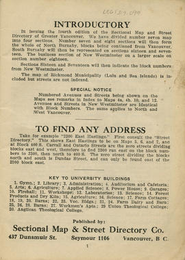
Sectional map and street directory of Vancouver : introduction to map

Sectional map and street directory of Vancouver : key plan

Sectional map and street directory of Vancouver : [King Edward Avenue to Ontario Street to Fraser River to Nanaimo Street]
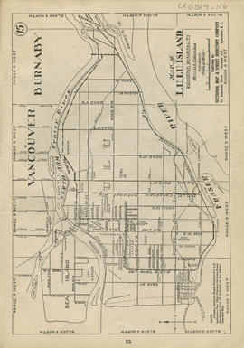
Sectional map and street directory of Vancouver : map of Lulu Island

Sectional map and street directory of Vancouver : map of Stanley Park

Sectional map and street directory of Vancouver : map of West Vancouver
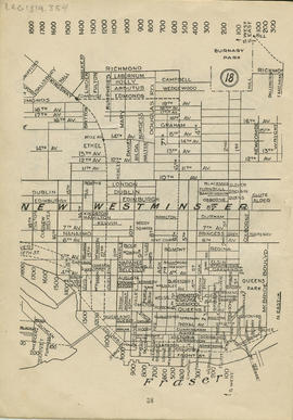
Sectional map and street directory of Vancouver : [McBride Boulevard to Laburnum Street to Eighteenth Avenue to Front Street]

Sectional map and street directory of Vancouver : [Nanaimo Street to Alexander Street to Ontario Street to King Edward Avenue]

Sectional map and street directory of Vancouver : [North Road to Barnet Road to Sperling Avenue to Burnaby Lake]

Sectional map and street directory of Vancouver : [Ontario Street to King Edward Avenue to East Boulevard to Seventy-seventh Avenue]

Sectional map and street directory of Vancouver : [Sperling Avenue to Yale Street to Boundary Road to Gilpin Street]
Results 1 to 50 of 221