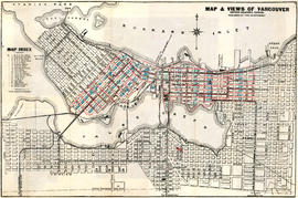
Showing 41 results

Archival description
City of Vancouver Archives technical and cartographic drawing collection Roads
Print preview View:

21 results with digital objects Show results with digital objects

City of Vancouver British Columbia

The map is a positive blueprint of the City of Vancouver with boundaries, streets block numbers & the harbour headline. A detailed compass appears in the top left corner of the map. The legend is also in the top left hand corner depicting City boundaries, Harbour headlines, Postal Blocks, and street numbers. There is a copy of the Map included, Map 71B, and it includes the Geographic Census Tracts.

The westernmost identifiable point on the map is the Straight of Georgia, and the easternmost is Boundary Road. The northernmost point on the map is the Stanley Park, the southernmost is Sea Island and Twiggs Island.

Commercial Map of Greater Vancouver and District [BC]

Commercial map of Greater Vancouver and District depicts railroads, paved streets, streetcar stops, schools, buildings. Uniquely, the map shows the city divided by Postal Block numbers and half mile circles that radiate from City Hall on the corner of Main and Hastings.
The map has large red arrows and clippings of libraries pasted to it that show six proposed library locations and sketch plans. Also included on the map, is an index of all depicted roads in the Hastings, Point Grey, South Vancouver, and Burnaby areas. A legend and compass rose are located in the bottom left hand corner of the map.
The westernmost is road on the map is Marine Drive and the easternmost is North Road while the northernmost is Dempsey Street, and the southernmost is 20th Road.

Commercial Map of Greater Vancouver and District [BC]

The map shows the Greater Vancouver Area and its roads, streets, and residential, commercial, and industrial districts in July 1924. In accordance with the legend, the map shows railroads, electric railways, parks, and buildings. The map uniquely depicts the center of Vancouver which is approximately 5400 feet and spans from Water and Railway Street to Prior Street and Abbott Street to Princess Street. The center circle then concentrically expands outwards with other circles marking every mile outward.
Additionally, there are annotations in black, red, yellow, and green. The black annotations mark topography and contour lines with listed elevations. The red annotations mark water gauges. The yellow annotations indicate the best routes through the City and District as suggested by the Automobile Club of BC. The green annotations appear for an unknown reason.
The Westernmost road on the map is Marine Drive and the Easternmost is Columbia Street and North Road while the Northernmost road on the map is Dempsey St. in North Vancouver and the Southernmost point is No. 20 Road.

Commercial Map of Greater Vancouver and District [BC]

The map shows the Greater Vancouver district, Point Grey, West Vancouver, North Vancouver, South Vancouver, and Burnaby - in 1886. In correspondence, the legend and map display railroads, paved streets, schools, and buildings. Uniquely, the map shows the city divided by Postal Block numbers and half mile circles that radiate from City Hall on the corner of Main and Hastings. The Westernmost road on the map is Marine Drive and the easternmost is Columbia Street. Northernmost road on the map is Dempsey Street, and the Southernmost point is No. 20 Road.

A detailed compass, in the bottom left hand corner of the map, shows Magnetic North. The annotation M.49 appears in the bottom right hand corner and the top left hand corner of the map. Two copies of the map are available, one a blue line the other a linen copy.

Map of New Westminster District, B.C

Item is a map showing District Lots in Vancouver, and township/range designations in other areas. The map also shows False Creek Trail, North Arm Road, False Creek Road, Granville Road from Granville to Hastings, New Westminster and Burrard Inlet Road, North Road, Semiahmoo Road, New Westminster and Yale Wagon Road, and others. Annotated by W. E. Graveley, 1885, to show additional features including Kingsway, Haney, Albion Camp, etc.

Map of the municipalities of New Westminster City and District, British Columbia

Part contains a map of the Lower Mainland and Fraser Valley from the Gulf of Georgia in the west to Harrison Lake in the east. Map shows locations of churches, schools, canneries, sawmills, brickyards, tanneries, woolen mills and hatcheries; existing and proposed railways; and roadways.

Map of Vancouver British Columbia

The map of Vancouver shows streets, bus routes, railways, and postal block numbers. The map?s buildings are quite detailed, and it includes depictions of fire halls, libraries, hospitals, and schools. Red and green annotations show the divisional boundaries of wards and polling stations. One mile circles radiate from City Hall. A Street Index appears at the bottom of the map, and this gives the coordinates of different roads.

The westernmost identifiable point on the map is Marine Drive and the easternmost road is Boundary Road while the northernmost is Stanley Park, and the southernmost is Sea Island and Lulu Island.

Map of Vancouver Unemployment and Relief [BC]

The map shows relief and elevations of Vancouver. It depicts streets, parks, and railways, and residential and industrial areas.
The annotations in black ink trace parts of the map: names, railways, and the coast line. The amendments also show Cases and Persons of Domiciled Residents in the Vancouver Area, in May 1934. The map also lists statistics of approximate Cases and Persons of Transient Families and Single Women, and Single Homeless Men.
Pensions and Compensation statistics are also compiled for: Mothers Pensions, Old Age Pensions, War Pensions, amd Workmen's Compensation as of the population of Vancouver in 1931.
The westernmost boundary of the map is Boundary Road and the easternmost boundary is the University of British Columbia while the northernmost is the Burrard Inlet and the southernmost is Sea Island and Lulu Island.

Metropolitan areas of Vancouver and Victoria, B.C. road map

Item is road map designed to be folded into a pamphlet and containing three maps showing streets in Greater Vancouver, major roads from the North Shore to Bellingham, Washington, and major roads in and around Victoria. Item also includes information about traffic rules in Vancouver and the use of the imperial gallon in British Columbia.

Plan 3

Map shows present and proposed roads of the Lower Mainland and northern Washington State, as well as road repairs. Map covers the area from Point Grey to Hope and from Burrard Inlet to Bellingham Bay. Trails and roads indicated on the map include Telegraph Trail, Waggon Road and Pitt River Waggon Road, as well as several unnamed trails. Major bodies of water indicated on the map are Burrard Inlet, False Creek, Burnaby Lake, Pitt River, Fraser River, Sumas Lake, Sumas River, Chulukweyuk River, Harrison River, Boundary Bay, Semiahmoo Bay and Bellingham Bay. Place names are indicated throughout the map. 11T3 Roads & Trails is printed on the side of the map.

Plan of the City of Vancouver [BC] Western Terminus of the Canadian Pacific Railway

The map shows the city of Vancouver in 1886. The map displays the CPR Railway tracks throughout Vancouver. The bodies of water - False Creek, Burrard Inlet, and Coal Harbour - are emphasized with approximately 5cm of blue pencil outlining the bodies of water. Additionally, streets, parks, and residential lots are also depicted.
The Northernmost point on the map is the Indian Reserve and the intersection of Capilano River and the First Narrows river, and the Southernmost point is the Due West City Boundary (listed at N 89 05 W). The Easternmost is the City Boundary for the townside of Hastings (listed at 55? E) and the Westernmost road on the map is Campbell Street.
A detailed compass, in the middle of the map, shows Astronomic North.

Sketches of the landscape and trails along the Fraser River with notes on wagon road construction

File consists of four photocopies of portions of maps made by the Royal Engineers showing data from surveys of the Fraser River from Boston Bar to Yale, and an unidentified portion of the Fraser River, presumably relating to proposed roadworks.

United Kingdom. Corps of Royal Engineers

Stuart's pocket map of Vancouver, B.C.

Item is an illustrated map of the "old" City of Vancouver. The map shows streets, transportation, and significant businesses (such as C.P.R. wharves, smelter, Hastings Mill, Morse's Mill, C.P.R. Shops, City Hospital, sawmill, slaughter houses, and smallpox hospital). The map includes "Index of Streets, Government Offices, Churches, [etc.], including "Civic and other Principal Buildings", "Places of Amusement or Recreation", "Public Schools", "Principal Mills, Foundries and Manufactories", "Principle Bankers", Principal Hotels", and "Miscellaneous".

The map was designed to be folded into a cover, which is included.

Town-site of Hastings

Map shows Hastings Town-site, Granville Town-site, Burnaby, and the City of New Westminster. Map also shows the Road from Granville and the False Creek Trail, as well as the names of places and soil types found along these roads. Other places and structures noted include Burrard Inlet, Coal Harbour (Coal Harbor on map), False Creek, False Creek Bridge, Burnaby Lake, Fraser River, New Westminster and Burrard Inlet Road, Douglas Road, Edinburgh Street, Columbia Street, Richards Street, and the New Westminster Cemetery. Two notes on map read "Plan to accompany Report of 1st May 1883, Joseph Hunter" and "Memo: Mr. Ross will place [?] this map to the [Engs.] Office Victoria [?]." 14T3 Roads & Trails is printed on the side of the map.

Western Canada

Item is a two-sided road map containing a map of Saskatchewan, Manitoba and the adjoining U.S. states; a map showing Canada and the United States from Labrador and Prince Rupert, B.C. in the north to Richmond, Virginia and San Francisco, California in the south; a map of British Columbia and Alberta; and an illustrated map of Greater Vancouver. The item includes road indexes, a mileage chart for Western Canada, and information on national parks in Western Canada.