Showing 130 results

Archival description
City of Vancouver Archives technical and cartographic drawing collection Vancouver (B.C.). Office of the City Engineer
Print preview View:

128 results with digital objects Show results with digital objects

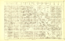
Sheet G : Trafalgar Street to Granville Street and Sixteenth Avenue to Nanton Avenue

Item is a section showing the area from Trafalgar Street to Granville Street and Sixteenth Avenue to Nanton Avenue. Includes streets and roads; blocks, lots and legal descriptions; and parks, schools, railway lines and golf courses.

Vancouver (B.C.). Office of the City Engineer

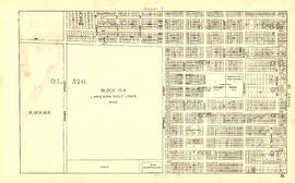
Sheet J : University Endowment Lands to Wallace Street and Twenty-seventh Avenue to Thirty-eighth Avenue

Item is a section showing the area from the University Endowment Lands to Wallace Street and Twenty-seventh Avenue to Thirty-eighth Avenue. Includes streets, roads and sewers; blocks, lots, and legal descriptions; and parks and schools.

Vancouver (B.C.). Office of the City Engineer
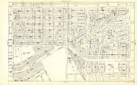
Sheet B : Discovery Street to Trutch Street and waterfront to Fourth Avenue

Item is a section showing the area from Discovery Street to Trutch Street and waterfront to Fourth Avenue. Includes streets, roads and sewers; blocks, lots and legal descriptions; and parks and schools. Map shows Jericho Air Station and crown leases.

Vancouver (B.C.). Office of the City Engineer

Sheet H : Alexandra Street to Cambie Street and Fifteenth Avenue to Twenty-seventh Avenue

Item is a section showing the area from Alexandra Street to Cambie Street and Fifteenth Avenue to Twenty-seventh Avenue.Includes streets and roads; blocks, lots and legal descriptions; as well as parks, schools, hospitals and golf courses.

Vancouver (B.C.). Office of the City Engineer
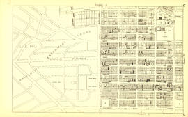
Sheet C : University Endowment Lands to Discovery Street and Fourth Avenue to Sixteenth Avenue

Item is a section showing the area from the University Endowment Lands to Discovery Street and Fourth Avenue to Sixteenth Avenue. Includes streets and roads; blocks, lots and legal descriptions; and parks and schools. Annotations in ink.

Vancouver (B.C.). Office of the City Engineer

Sheet E : University Endowment Lands to Wallace Street and Sixteenth Avenue to Twenty-seventh Avenue

Item is a section showing the area from the University Endowment Lands to Wallace Street and Sixteenth Avenue to Twenty-seventh Avenue. Includes streets and roads; blocks, lots and legal descriptions; and parks and schools.

Vancouver (B.C.). Office of the City Engineer

Sheet F : Wallace Street to Trafalgar Street and Sixteenth Avenue to Twenty-seventh Avenue

Item is a section showing the area from Wallace Street to Trafalgar Street and Sixteenth Avenue to Twenty-seventh Avenue. Includes streets and roads; blocks, lots and legal descriptions; and parks and schools.

Vancouver (B.C.). Office of the City Engineer
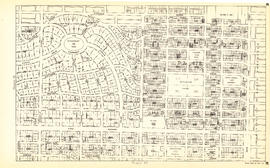
Sheet K : Wallace Street to Trafalgar Street and Twenty-seventh Street to Thirty-eighth Avenue

Item is a section showing the area from Wallace Street to Trafalgar Street and Twenty-seventh Street to Thirty-eighth Avenue. Includes streets, roads and sewers; blocks, lots and legal descriptions; and parks and schools.

Vancouver (B.C.). Office of the City Engineer

Sheet S : Musqueam Reserve to Macdonald Street and Forty-ninth Avenue to Fraser River

Item is a section showing the area from the Musqueam Reserve to Macdonald Street and Forty-ninth Avenue to Fraser River. Includes streets, roads, blocks, lots, and legal descriptions. Map indicates the locations of the Point Grey Golf and Country Club and the Celtic Cannery. Annotations in red ink.

Vancouver (B.C.). Office of the City Engineer

Sheet D : Discovery Street to Trutch Street and Fourth Avenue to Sixteenth Avenue

Item is a section showing the area from Discovery Street to Trutch Street and Fourth Avenue to Sixteenth Avenue. Includes streets and roads; blocks, lots and legal descriptions; and parks and schools.

Vancouver (B.C.). Office of the City Engineer

Sheet S.V. 15 : Dawson Street to Boundary Road and Foster Avenue to Fiftieth Avenue

Item is a section showing the area from Dawson Street to Boundary Road and Foster Avenue to Fiftieth Avenue. Includes streets, roads, blocks, lots, legal descriptions, parks and schools. Annotations in pencil.

Vancouver (B.C.). Office of the City Engineer

City of Vancouver, British Columbia [sectional map]

File consists of three maps of Vancouver: an index map to the sections, an index map to District Lots, and 62 section sheets drawn and revised between ca. 1935 and 1945. Some time between 1946 and 1951 these maps were compiled and reproduced by the City Engineer's Office.

The 62 sectional plates are divided into three groups: the "Old City of Vancouver," Point Grey and South Vancouver. Maps show streets and roads, blocks, lots, legal descriptions, railways, parks, schools, hospital, cemetery, golf courses, retirement homes, and some businesses.

Vancouver (B.C.). Office of the City Engineer

Sheet W : Fraser River to French Street and Fifty-ninth Avenue to Seventy-first Avenue

Item is a section showing the area from the Fraser River to French Street and Fifty-ninth Avenue to Seventy-first Avenue. Includes streets, roads, blocks, lots, legal descriptions, parks and golf courses.

Vancouver (B.C.). Office of the City Engineer

Sheet 8 : Prince Edward Street to Bruce Street and Thirty-fifth Avenue to Forty-seventh Avenue

Item is a section showing the area from Prince Edward Street to Bruce Street and Thirty-fifth Avenue to Forty-seventh Avenue. Includes streets, roads, blocks, lots, legal descriptions, and cemeteries, parks and schools.

Vancouver (B.C.). Office of the City Engineer

Sheet 5 : Dumfries Street to Fairmont Street and Twenty-seventh Avenue to Thirty-seventh Avenue

Item is a section showing the area from Dumfries Street to Fairmont Street and Twenty-seventh Avenue to Thirty-seventh Avenue. Includes streets, roads, blocks, lots, legal descriptions, parks, railway lines and schools.

Vancouver (B.C.). Office of the City Engineer

Sheet 4 : Prince Edward Street to Bruce Street and King Edward Avenue to Thirty-sixth Avenue

Item is a section showing the area from Prince Edward Street to Bruce Street and King Edward Avenue to Thirty-sixth Avenue. Map shows streets, roads, blocks, lots and legal descriptions, and the locations of parks, schools and Mountainview Cemetery.

Vancouver (B.C.). Office of the City Engineer

Sheet S.V. 3 : Cambie Street to St. George Street and Twenty-seventh Avenue to Thirty-eighth Avenue

Item is a section showing the area from Cambie Street to St. George Street and Twenty-seventh Avenue to Thirty-eighth Avenue. Map shows streets, roads, blocks, lots and legal descriptions and the locations of parks, schools, reservoirs and Mountainview Cemetery.

Vancouver (B.C.). Office of the City Engineer

Sheet Z : Milton Street to Heather Street and Seventy-second Avenue to Fraser River ; Angus Drive to Granville Street and South West Marine Drive to Fraser River

Item consists of two sections. One shows the area from Milton Street to Heather Street and Seventy-second Avenue to Fraser River; the other shows Angus Drive to Granville Street and South West Marine Drive to Fraser River. Includes streets, roads, railway lines, blocks, lots and legal descriptions.

Vancouver (B.C.). Office of the City Engineer

Sheet X : Marine Drive to Ash Street and Fifty-ninth Avenue to Seventy-first Avenue

Item is a section showing the area from Marine Drive to Ash Street and Fifty-ninth Avenue to Seventy-first Avenue. Includes streets and roads; blocks, lots and legal descriptions; and parks and schools.

Vancouver (B.C.). Office of the City Engineer

Sheet W : Fraser River to French Street and Fifty-ninth Avenue to Seventy-first Avenue

Item is a section showing the area from Fraser River to French Street and Fifty-ninth Avenue to Seventy-first Avenue. Includes streets and roads; blocks, lots and legal descriptions; and parks and golf courses.

Vancouver (B.C.). Office of the City Engineer

Sheet U : Churchill Street to Cambie Street and Forty-ninth Avenue to Park Drive

Item is a section showing the area from Churchill Street to Cambie Street and Forty-ninth Avenue to Park Drive. Includes streets and roads; blocks, lots and legal descriptions; and parks and golf courses.

Vancouver (B.C.). Office of the City Engineer

Sheet T : Marine Crescent to Granville Street and Forty-ninth Avenue to Sixty-first Avenue

Item is a section showing the area from Marine Crescent to Granville Street and Forty-ninth Avenue to Sixty-first Avenue. Includes streets and roads; blocks, lots and legal descriptions; and parks and golf courses.

Vancouver (B.C.). Office of the City Engineer
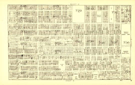
Sheet S : Musqueam Reserve to Macdonald Street and Forty-ninth Avenue to Fraser River

Item is a section showing the area from Musqueam Reserve to Macdonald Street and Forty-ninth Avenue to the Fraser River. Includes streets and roads; blocks, lots and legal descriptions; and parks and golf courses.

Vancouver (B.C.). Office of the City Engineer

Sheet P : Trafalgar Street to Granville Street and Thirty-ninth Avenue to Thirty-seventh Street

Item is a section showing the area from Trafalgar Street to Granville Street and Thirty-ninth Avenue to Thirty-seventh Street. Includes streets and roads; blocks, lots and legal descriptions; and parks and schools.

Vancouver (B.C.). Office of the City Engineer

Sheet O : Holland Street to Elm Street and Thirty-eighth Avenue to Forty-ninth Avenue

Item is a section showing the area from Holland Street to Elm Street and Thirty-eighth Avenue to Forty-ninth Avenue. Includes streets, roads and sewers; blocks, lots and legal descriptions; and golf courses, parks and schools.

Vancouver (B.C.). Office of the City Engineer

Sheet N : Musqueam Reserve to Wallace Street and Thirty-eighth Avenue to Forty-ninth Avenue

Item is a section showing the area from the Musqueam Reserve to Wallace Street and Thirty-eighth Avenue to Forty-ninth Avenue. Includes streets, roads and sewers; blocks, lots and legal descriptions; and parks and schools.

Vancouver (B.C.). Office of the City Engineer

Sheet M : Granville Street to Kersland Drive and Twenty-seventh Avenue to Thirty-eighth Avenue

Item is a section showing the area from Granville Street to Kersland Drive and Twenty-seventh Avenue to Thirty-eighth Avenue. Includes streets and roads; blocks, lots and legal descriptions; and golf courses, parks and government buildings.

Vancouver (B.C.). Office of the City Engineer

Sheet L : Trafalgar Street to Granville Street and Nanton Avenue to Thirty-eighth Avenue

Item is a section showing the area from Trafalgar Street to Granville Street and Nanton Avenue to Thirty-eighth Avenue. Includes streets, roads and sewers; blocks, lots and legal descriptions; and parks, golf courses and schools.

Vancouver (B.C.). Office of the City Engineer

Sheet K : Wallace Street to Trafalgar Street and Twenty-seventh Avenue to Thirty-eighth Avenue

Item is a section showing the area from Wallace Street to Trafalgar Street and Twenty-seventh Avenue to Thirty-eighth Avenue. Includes streets, roads and sewers; blocks, lots and legal descriptions; and parks and schools.

Vancouver (B.C.). Office of the City Engineer

Sheet J : University Endowment Lands to Wallace Street and Twenty-ninth Avenue to Thirty-eighth Avenue

Item is a section showing the area from the University Endowment Lands to Wallace Street and Twenty-ninth Avenue to Thirty-eighth Avenue. Includes streets, roads and sewers; blocks, lots and legal descriptions; and parks and schools.

Vancouver (B.C.). Office of the City Engineer

Sheet H : Alexandra Street to Cambie Street and Fifteenth Avenue to Twenty-seventh Avenue

Item is a section showing the area from Alexandra Street to Cambie Street and Fifteenth Avenue to Twenty-seventh Avenue. Includes streets, roads, blocks, lots, legal descriptions, parks, hospitals and schools.

Vancouver (B.C.). Office of the City Engineer

Sheet G : Trafalgar Street to Granville Street and Sixteenth Avenue to Nanton Avenue

Item is a section showing the area from Trafalgar Street to Granville Street and Sixteenth Avenue to Nanton Avenue. Includes streets, roads and sewers; blocks, lots and legal descriptions; and parks, railway lines and schools.

Vancouver (B.C.). Office of the City Engineer

Sheet F : Wallace Street to Trafalgar Street and Sixteenth Avenue to Twenty-seventh Avenue

Item is a section showing the area from Wallace Street to Trafalgar Street and Sixteenth Avenue to Twenty-seventh Avenue. Includes streets, roads, blocks, lots, legal descriptions, parks and schools.

Vancouver (B.C.). Office of the City Engineer

Sheet E : University Endowment Lands to Wallace Street and Sixteenth Avenue to Twenty-seventh Avenue

Item is a section showing the area from Wallace Street to Trafalgar Street and Sixteenth Avenue to Twenty-seventh Avenue. Includes streets, roads, blocks, lots, legal descriptions, parks and schools.

Vancouver (B.C.). Office of the City Engineer
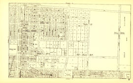
Sheet D : Imperial Street to Trutch Street and Fourth Avenue to Sixteenth Avenue

Item is a section showing the area from Imperial Street to Trutch Street and Fourth Avenue to Sixteenth Avenue. Includes streets and roads; blocks; lots and legal descriptions; and parks, schools and golf courses.

Vancouver (B.C.). Office of the City Engineer

Sheet C : University Endowment Lands to Imperial Street and Fourth Avenue to Sixteenth Avenue

Item is a section showing the area from the University Endowment Lands to Imperial Street and Fourth Avenue to Sixteenth Avenue. Includes streets, roads, blocks, lots, legal descriptions, parks and schools.

Vancouver (B.C.). Office of the City Engineer

Results 1 to 50 of 130