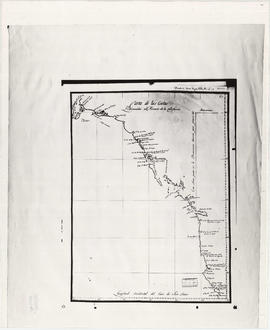
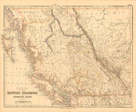
A chart shewing part of the coast of N.W. America
- AM1594-: MAP 668
- Item
- Published 1974
Part of City of Vancouver Archives technical and cartographic drawing collection
Item is a map, which is a coloured reproduction made in 1974 of one of the charts made in 1798 of George Vancouver's surveys of the Pacific coast of North America. The plate depicts the area from Fitzhugh Sound, north to Prince Frederick Sound. The routes taken by Vancouver are marked. Inset map shows a survey of Port Stewart.


![[Aerial map of Greater Vancouver]](/uploads/r/null/5/6/0/560c4a977bf4bd23ded38e3e8d0c471a86a303d135869c5e459d1977eeed33a6/f660f804-da91-422b-9622-82ae60a89bbe-MAP358_142.jpg)

![Americae sive novi orbis, no va descriptio : [the new world, commonly called America]](/uploads/r/null/7/f/9/7f9d7722fd935fbaf645638c66c9dc9500f9c329d254d3c44493af54d80e6483/b93f8b7c-cc81-45d5-b814-14796fa7011e-MAP667_142.jpg)


![Bungalow for C. [Cline] Singleton, Vancouver, B.C.](/uploads/r/null/0/e/8/0e8f1fe401cffa704dd33be7ad6a0d055f7ec516ba1d63dd924193e18c708652/396919ff-1214-495c-861e-1b7aa2dada84-1987-017_142.jpg)


![Canadian Pacific map of Vancouver [west half]](/uploads/r/null/f/a/fa49266d21715d75ce93883012d471657dd058b90843927ec82b44d2bb42b007/f12ea9a5-4914-4db8-bda9-312aa2e2ccef-MAP10_142.jpg)