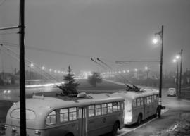
Item is a a video which consists of interviews representing various opinions on the 1970 report on the Greater Vancouver Area Rapid Transit Study and its recommendations. Those participating in interviews in this segment include Dr. Julius Kane, Department of Animal and Resource Ecology, University of British Columbia; Allan Kelly, Chairman of the Greater Vancouver Regional District; and Dennis O. Gorman of the Greater Vancouver Regional Planning Board. It is also possible that some of the voiceover responses to questions are those of Derrick Mallard (founder of the Society for Promoting Environmental Conservation) as he does not appear in the video but is credited on the slate.
In this video, Dr. Julius Kane expresses disappointment with the findings of the transit study report, and over the course of his interview explains why he would rather invest money in increased, toll-free bus service than capital development for rapid transit. Allan Kelly, on the other hand, explains what is meant by "rapid transit," why fees for transit should be paid by users, and why he believes rapid transit may be a good fit for Vancouver. Dennis Gordman is interviewed six months after the release of the report, and comments on how the perspective of the Greater Vancouver Regional Planning Board has changed in that time, and how the Board is approaching rapid transit in the Greater Vancouver Regional District.


![Urban transportation : [excerpt]](/uploads/r/null/7/d/b/7dbbeb3764e6ddda11556a1b33b992d48eba5c586ff79b639195dae07b1083ac/1cda363d-7993-4687-8cdc-126f993c937c-2010-028_142.jpg)


![City Views from City Hall Roof [21 of 24]](/uploads/r/null/c/3/c34c35e24ac2c8f5d5c6fc43cddb04257387480434c726ff893b7323ae867b79/2c7dee02-363e-4796-9faf-fe4b8543bee1-A67866_142.jpg)
![City Views from City Hall Roof [17 of 24]](/uploads/r/null/8/8/88d3bef1c1469ce1cc10bc8fbca23f86c609be30d9831d61a4d50c1b4d64bdf2/81e29215-8eee-48b5-96b4-b0b43141da58-A67862_142.jpg)

![City Views from City Hall Roof [24 of 24]](/uploads/r/null/4/4/444e12857bb80d1fedbb929794bcedc8571ab7a609a02ad6dd94081a07b0ea66/4205ef88-e1a9-4a5f-bcc2-66d0777cd10c-A67869_142.jpg)
![City Views from City Hall Roof [23 of 24]](/uploads/r/null/f/2/f2dfbad8353ca656ed75e536e00db931ea2d9be45ede79635d7589ab692c853b/5dbdaa58-a8ca-4078-ace2-bd8a847c9728-A67868_142.jpg)
![City Views from City Hall Roof [22 of 24]](/uploads/r/null/7/4/74ac32645d3ea944dc95121c4dccd61f2ef4181a471addcbb60c3dc21f4bfeaa/0a04d3f4-ce9a-4ef5-9d43-e8d2107c0a68-A67867_142.jpg)
![City Views from City Hall Roof [20 of 24]](/uploads/r/null/7/8/784278dadc0ec6138ec4911aa512e24be1ec0e4cb73ac4fa98b1f5a6c163fc41/e12df3b0-0ee4-4c46-aad2-5cd2661c5c51-A67865_142.jpg)
![City Views from City Hall Roof [19 of 24]](/uploads/r/null/c/a/ca3d15ba4d81c83975b97928f035237b4425c5a29a6684d52b04ed219a337cd7/a60eb6cc-80da-4e0c-910c-7f061c723c7d-A67864_142.jpg)
![City Views from City Hall Roof [18 of 24]](/uploads/r/null/b/8/b8a7473b4694078665501a45fbb5222c49d42eead5c903c6be96a83aa3b99522/4ea08f7e-1727-4cc4-a055-b869b199d0c4-A67863_142.jpg)
![City Views from City Hall Roof [12 of 24]](/uploads/r/null/f/f/ff69edeeb7418181b4b9d33e095bc7cc21c9af4d0e2554b09c831d3bf1f7bd50/429f6a28-039f-489b-adf6-8ea31d84bd36-A67857_142.jpg)
![City Views from City Hall Roof [16 of 24]](/uploads/r/null/e/1/e1745fc8098274a622f9b7281ad57b9ee2a97b994c22c830e4b4d11c7c90dfdd/1584c896-2000-42e9-bd58-b8b31f531bb8-A67861_142.jpg)
![City Views from City Hall Roof [13 of 24]](/uploads/r/null/4/7/4774b69977e18e03a3c35274aef841f93d72ba20e64820cb1c210e14abf26ad9/84d038bf-fdb0-4c4c-9e62-02a16105f1f9-A67858_142.jpg)