![B.C. Electric Railway trolley truck [near] the corner of Davie Street and Denman Street stringing...](/uploads/r/null/2/6/267e3929fc51e6409e39d71d4cb5bc9d0cad3b6d45b7f19213ab1c339501dc1d/8793cf81-89cb-4646-bb67-d31864688ace-A06482_142.jpg)
- AM1545-S3-: CVA 586-4316
- Item
- May 1946
Photograph shows part of Bayview Grocery
Photograph shows part of Bayview Grocery
![B.C. Electric Railway trolley truck [near] the corner of Davie Street and Denman Street stringing...](/uploads/r/null/9/b/9b565f4def67c3d9a8abdd9d5127f94ec1f2bd854af5c121ac222ac0fc113010/3273452b-fb84-4bc0-bbc3-b44a30a79a46-A06483_142.jpg)
![B.C. Electric Railway trolley truck [near] the corner of Davie Street and Denman Street stringing...](/uploads/r/null/a/b/aba797a19a76bd263cf065e65c5df9e328b030605e0b7f9dcd5dbfcdb6514cec/e4c094bb-7e99-4123-8d60-728d8f50ede2-A06484_142.jpg)
Photograph shows Bayview Variety and the sign for Cunningham's Drugs
![B.C. Electric Railway trolley truck [near] the corner of Davie Street and Denman Street stringing...](/uploads/r/null/4/3/43f77f21a748c2280ecd2f88fe9730edc416e5f76bcfb7dd5ab838e23167a33c/f25d4580-48f3-46e3-8510-b570ba972304-A06485_142.jpg)
Photograph shows the sign for Cunningham's Drugs
![B.C. Electric Railway trolley truck [near] the corner of Davie Street and Denman Street stringing...](/uploads/r/null/7/b/7be2c7c9fe426b520bb11d545c63883a95d4497894f13f9c680fca9e267ff21c/efd5199b-348f-4c13-80b1-5c9191f7e6d6-A06486_142.jpg)
Photograph shows the sign for Cunningham's Drugs
![B.C. Electric Railway window display [promoting business in B.C. and] Canada Kelp Company](/uploads/r/null/c/3/c3caec40adf5a0bd3113526f03dda6df25c2c9d71d952732762bde8023248669/9fc03208-b8a3-434a-af95-e5394dd6b48b-A06670_142.jpg)
B.C. Electric Railway window display [promoting business in B.C. and] Canada Kelp Company
![B.C. Electric Railway window display [promoting the] Community Chest](/uploads/r/null/1/2/12d732f28f88dd60f652d0bb9128687b1317fba83f2e889bf5f83e8dfa637920/e4afd9bd-df54-41a3-be26-876eef17396e-A06672_142.jpg)
B.C. Electric Railway window display [promoting the] Community Chest

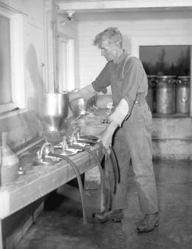
Photograph shows two men planting bulbs
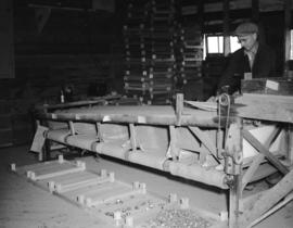
Photograph shows a man sorting bulbs
![Turkey Farm [on] Langley Prairie](/uploads/r/null/4/9/495d010be0a190263198d14a0520bce25dad6c372edc6cf2d3de49ba61d06a0e/c5c1f559-0e76-46d4-b3b3-bc1566bd8c66-A06680_142.jpg)
Turkey Farm [on] Langley Prairie
Photograph shows a sign for Kromhoff Turkey Farms
![O'Brien nut farm [on] Langley Prairie](/uploads/r/null/0/a/0a85727f43450968c4d3222be586de4a7ea697f36c248eb2955365b3b8da10de/9a2755ed-cd2f-487b-be5d-95ea6e3125b2-A06706_142.jpg)
O'Brien nut farm [on] Langley Prairie
![O'Brien nut farm [on] Langley Prairie](/uploads/r/null/3/3/337f399663eed908b755ba7172b24447c3b1bbc39e309fc375bbb20c2e939942/89babbe5-6c8d-44d8-816e-da824357dde7-A06707_142.jpg)
O'Brien nut farm [on] Langley Prairie
![O'Brien nut farm [on] Langley Prairie](/uploads/r/null/7/f/7fcfe190d14fe9dac7420bdcf15156654fdd87455e139eccb14eb0dcacebe56a/044749e4-f6eb-4dae-a717-b73bd6437c6e-A06708_142.jpg)
O'Brien nut farm [on] Langley Prairie

B.C. Electric Railway Public relations' employee
B.C. Electric Railway Public relations' employee


![[Construction of Buntzen Lake Power Plant number one]](/uploads/r/null/a/e/aeb9df2b8b1c737f7a4f29c1542de987029bfa42519c9e624725d9a09f6e0a42/33070dc2-356b-4812-b160-e4b3c439ea0c-A08123_142.jpg)
[Construction of Buntzen Lake Power Plant number one]
Part of Major Matthews collection
![[Partially constructed Coquitlam Dam, showing upstream side of sluice tower]](/uploads/r/null/6/9/69b6f1499d450e95b81f58ecef4a38bd6737b097fc30bd5f55cc20ad28b5d77e/35ee7987-f9a5-4546-a74e-b978eb2fd59c-A08183_142.jpg)
[Partially constructed Coquitlam Dam, showing upstream side of sluice tower]
Part of Major Matthews collection
![[Men turning sod for B.C. Electric Railway Company's Fraser Valley line]](/uploads/r/null/6/1/617305054555a870d5b4c9dd58e02fe88184dac9b064ca47fd326ddba890d999/6e77a937-2ea1-4ccd-a9cb-0a2b2f33396f-A08258_142.jpg)
[Men turning sod for B.C. Electric Railway Company's Fraser Valley line]
Part of Major Matthews collection
![[Silo and barn of Fraser Valley farm, showing wiring and electrical switches]](/uploads/r/null/e/2/e2c4c3275afbd927f4ec286f12b9ed1e6f5959df5b909d5b98d52d669435f61f/2aaefe58-53e1-4dd2-95fd-8e69048ba271-A08418_142.jpg)
[Silo and barn of Fraser Valley farm, showing wiring and electrical switches]
Part of Major Matthews collection

View of settling pond taken from 1200.0 looking to 1400.0 on 24th June 1913
Part of Major Matthews collection
Photograph shows water below flumes of Coquitlam Dam.
![[View of B.C. Electric street cars on Dunbar Street from 41st Avenue]](/uploads/r/null/5/0/50622d7f19e2908c3d3649108d0ffd1242ff80c6b91cb14a538fd2a8816adbd2/2e45884d-ff0e-45d6-a2d6-15c1a0e161a2-A26804_142.jpg)
[View of B.C. Electric street cars on Dunbar Street from 41st Avenue]
Photograph shows the Safeway store and other retail businesses in the 5600 block Dunbar Street.
![[View looking northwest on] Dunbar Diversion [at West 14th Avenue]](/uploads/r/null/e/c/ec58b9c65183977bcf2817472593141d02703e45fb748a44b59b1b2f27ed9b0c/696d76ff-eba5-4c17-9cf8-804a9ba746fa-A26805_142.jpg)
[View looking northwest on] Dunbar Diversion [at West 14th Avenue]
Photograph shows a B.C.E.R. streetcar, a house at 3635 West 14th Avenue and a portion of Almond Park.
![[Electric streetcar at] Dunbar and 16th Avenue](/uploads/r/null/1/d/1d3486a95da064ca769ee23101cf8392b4e96a36b8abcb4a9871024d36d1d14a/c2813286-c566-469d-9478-5fdaae51fe4b-A26806_142.jpg)
[Electric streetcar at] Dunbar and 16th Avenue
Photograph shows Vogue Transfer truck, Dunbar Heating, Apex Blinds and Hillcrest Realty in the 3500 block of West 16th Avenue
![[View of the 3600 block of West Broadway from Alma Street]](/uploads/r/null/5/2/52bce19c6ffacfc74921a44acca9e5d1771538032983ee305c3bbf174f1fbbcc/8afdf619-cd85-4b91-98e3-fe0d71c98eac-A26807_142.jpg)
[View of the 3600 block of West Broadway from Alma Street]
Photograph shows the Alma Academy dance hall and retail stores.
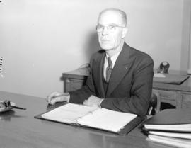
![B.C. Electric Railway Public Relations [Department]](/uploads/r/null/a/3/a32facefafc46f144f042a6debdfa06de19ffd281ac03dc4038955e742ebc3ed/e0081a78-a751-4561-b278-cf4559c0d09b-A06673_142.jpg)
B.C. Electric Railway Public Relations [Department]
Photograph shows Mr. Thomas Ingledew (left) and a unidentified man sitting at a desk.

Enjoyable trips on our interurban lines
Part of City of Vancouver Archives technical and cartographic drawing collection
Part contains text advertising the British Columbia Electric Railway Company's interurban lines.

Free map of Vancouver, New Westminster and surroundings
Part of City of Vancouver Archives technical and cartographic drawing collection
Part contains information about Vancouver parks, promotional text for British Columbia Electric Railway, and advertisements for other businesses.

Map and Guide to Vancouver Street Car and Interurban Lines
Part of City of Vancouver Archives technical and cartographic drawing collection
Part is the front side of an informational pamphlet published by the BC Electric Railway Co. regarding City streetcar routes and interurban lines, golf and country clubs, city trips, interurban trips, motor coach trips, stations, ferries and docks, bathing beaches, public parks, North Shore canyons and parks, athletic and amusement parks.

Map of the Fraser Valley showing railway lines and district lots
Part of City of Vancouver Archives technical and cartographic drawing collection

British Columbia Electric Railway Company Limited : Vancouver Island system and Mainland system
Part of City of Vancouver Archives technical and cartographic drawing collection
Part contains two maps showing city, suburban, and interurban railway lines, transmission lines, generating stations, substations, and transformers.
![City of Vancouver surrounding [sic] and municipalities including City of New Westminster](/uploads/r/null/8/9/1/8919931915a624a5abd2e5d2953118fdd853654343ce31193f00d341d482bf39/fd6eb299-3e6a-498e-bfd9-62a3279a8861-LEG1329_142.jpg)
City of Vancouver surrounding [sic] and municipalities including City of New Westminster
Part of City of Vancouver Archives technical and cartographic drawing collection
Part contains a street map showing distances from a point in downtown Vancouver, waterfront businesses in Burrard Inlet, street car lines, bus lines, parks, golf courses, schools and hospitals.

Part of City of Vancouver Archives technical and cartographic drawing collection
Part contains a map showing street car, interurban, and motor bus lines in from Vancouver to New Westminster, a map showing existing and projected power plants near Alouette and Stave Lakes, and a profile showing the existing and proposed plants.

Bus routes, city of Vancouver, November 26th 1937
Part of City of Vancouver Archives technical and cartographic drawing collection

Page from "The Buzzer," November 26, 1937, showing map of bus routes
Part of City of Vancouver Archives technical and cartographic drawing collection
Part is the verso of a hand-drawn map showing bus routes in Vancouver, and contains a page from the November 26, 1937 edition of "The Buzzer." The page contains information on bus routes in Vancouver and a reproduction of the hand-drawn map.

Vancouver city and suburban lines
Part of City of Vancouver Archives technical and cartographic drawing collection
Part is the back side of an informational pamphlet published by the BC Electric Railway Co. showing street car lines, interurban lines, bus routes and parks.

Part of City of Vancouver Archives technical and cartographic drawing collection
Item is a map showing railway freight lines and stops from North Vancouver in the north through northern Washington in the south, and from Chilliwack in the east to Steveston in the west.
![[B.C. Electric Railway Company parade float, showing Vancouver's first streetcar]](/uploads/r/null/8/c/8c3a431c10ad968bb1d283dc2c9bc7475ee8d17a3a28bcdbaa998cf7f4ebd251/d7198b64-e91a-4e7b-9534-272664af6862-A08317_142.jpg)
[B.C. Electric Railway Company parade float, showing Vancouver's first streetcar]
Part of Major Matthews collection
![[View of Burrard Street, looking south from Hastings Street]](/uploads/r/null/6/0/60740f03c6f6e5aedd9a8071a9772742c2d5ccea7221143428e29352fee58772/ec6e01a1-7cf5-4e4e-b1ee-108dedef2d95-A08319_142.jpg)
[View of Burrard Street, looking south from Hastings Street]
Part of Major Matthews collection
![[View of Burrard Street, looking south from Georgia Street]](/uploads/r/null/8/4/84cde21d57721ded74ea43156a3f970b2f7b121d6414c00666a8acc2c0d04b90/ed9c2c94-2532-4502-adfc-5aa269538430-A08318_142.jpg)
[View of Burrard Street, looking south from Georgia Street]
Part of Major Matthews collection
![[Road construction in front of second C.P.R. station]](/uploads/r/null/e/2/e2a4939f30d19e3407fb791c57208a88225522a981309806b0844092b495a05d/540e6caf-0734-44b7-84b3-db5573a61294-A08328_142.jpg)
[Road construction in front of second C.P.R. station]
Part of Major Matthews collection
![[Men laying streetcar tracks in front of second C.P.R. station]](/uploads/r/null/b/a/ba9fb1ab1222ba8fc2e1eb69d3df90f65f7005c1a3a3690524cdf9d0296b620d/723b48e2-21d4-4d07-b0d1-75c5e6e75edf-A08327_142.jpg)
[Men laying streetcar tracks in front of second C.P.R. station]
Part of Major Matthews collection
J.S. Matthews' notes with print or negative in Archives.
![[Illuminated arches on Hastings Street for visit of Governor General the Duke of Connaught]](/uploads/r/null/d/1/d18a584df89160b0e84bfa87bf2bb8275bb97c15e3bcaf0d346d2a363bfa795e/532842d7-a5aa-4812-add7-20688bc192b0-A08326_142.jpg)
[Illuminated arches on Hastings Street for visit of Governor General the Duke of Connaught]
Part of Major Matthews collection
![[View of illuminated signs on Hastings Street, looking east from Abbott Street]](/uploads/r/null/e/1/e1168656067521c8c500fec8b73f215fb8a8ce869e4ca5cfd82f7496ccd487c4/0898cab7-9c0a-4425-966c-f2e3ee347051-A08325_142.jpg)
[View of illuminated signs on Hastings Street, looking east from Abbott Street]
Part of Major Matthews collection
Signs for "Palace Hotel", "Allen's Cafe", "Stark's Glasgow House Carpets", "Rex Theatre", "Hotel Regent", "Cascade Beer", "Regal Theatre" and "Marshall Optical" are visible.

Part of Major Matthews collection
![[View of railway tracks and cars, buildings, and other structures at east end of Georgia Viaduct]](/uploads/r/null/8/a/8a4ae0c87d5c5c8e582fad2a73d1785c2b0bdf2a8115c74f39a7917fe2f838b9/a288b146-e76d-44cf-9969-39055b535dde-A08323_142.jpg)
[View of railway tracks and cars, buildings, and other structures at east end of Georgia Viaduct]
Part of Major Matthews collection