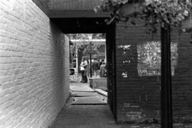
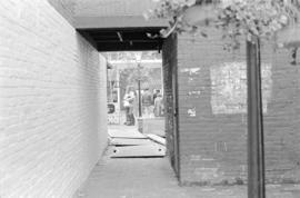
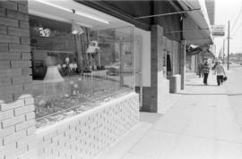
Entrance to Gaolers Mews, Maple Tree Square, Gastown
- COV-S587-: CVA 69-10
- Item
- [between 1972 and 1974]
Part of City of Vancouver fonds
Item is a photograph of a view through an alley entrance to Gaolers Mews, just south of Guenter's Delicatessen (203 Carrall Street), Maple Tree Square, Gastown.


![[Exterior view of the] Rogers Building at 470 Granville [Street]](/uploads/r/null/4/6/46adbf6de86563ba2801897f647aeec25ac060dc7aaec2f768c50b1ef535ff0c/96b3499c-9b58-48ef-bd7b-1103447affaa-A58791_142.jpg)


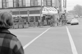


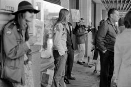
![Granville Mall - Mayor starts work [1 of 14]](/uploads/r/null/d/8/d8de9a60aa7672412e3c32838c09c96eec65ed01c4d402622f3b4a4c5b4d1d0d/ca3359e5-c79a-40c7-9023-c8aac72b8283-A64462_142.jpg)
![Granville Mall - Mayor starts work [10 of 14]](/uploads/r/null/8/7/8717858c3c9f1eebdd2b0789e91726b65cac49f881c3083401f370774a98ac78/7286a08f-f6fc-4761-bfa5-3d06eb02fabc-A64473_142.jpg)
![Granville Mall - Mayor starts work [11 of 14]](/uploads/r/null/6/7/675394d4dc61cb0165a864a84eb04f06086c156ccc51e1c477be4fc06ce40398/1ccf0b23-5eb8-44e9-89f2-367394e14486-A64474_142.jpg)
![Granville Mall - Mayor starts work [12 of 14]](/uploads/r/null/1/7/1718b3a25451eeaeaea3d2ceac894f48af3191c2166a6986af009036b41ca699/33ec04c5-1448-4be5-89c3-bf2dc8804754-A64475_142.jpg)
![Granville Mall - Mayor starts work [13 of 14]](/uploads/r/null/7/8/7813f107379117b1f2c90df5269984af5db88471b51f3137ad91e6553c191a97/5b817885-ff30-4abb-be9d-52740f8d4338-A64476_142.jpg)
![Granville Mall - Mayor starts work [14 of 14]](/uploads/r/null/a/7/a707c43e450e1d31d4cc431831c6254fc8769b3589cf1e585e85bc6d4f3cf3d4/678bb207-16e2-42cb-ad17-004c68883ed3-A64477_142.jpg)
![Granville Mall - Mayor starts work [2 of 14]](/uploads/r/null/8/c/8cd3847950535c79f6cfa0c7482d6694f778afe701a5c7ddaf9d1ddb546c51c6/ecdb62e5-9385-4f4e-aa4d-38c0161ae4aa-A64463_142.jpg)
![Granville Mall - Mayor starts work [3 of 14]](/uploads/r/null/e/0/e0fdebff8e797fe8ef9452fdd6b28dce8531d8669dc671f6ec83c7295c5a7e35/a2557990-da90-490d-8cf1-cb27682a872a-A64464_142.jpg)
![Granville Mall - Mayor starts work [4 of 14]](/uploads/r/null/5/9/5962df82933df5de5eb9cdc143821a61c96762326b7512ad780172af0692fb03/15aa9735-61b9-44ed-b27b-b64846159620-A64465_142.jpg)
![Granville Mall - Mayor starts work [5 of 14]](/uploads/r/null/3/c/3c9a043e6f60a7b3724ef695f0574f3b8bf792faf7f6c6673140bc90a4f42135/2282fdb4-8659-4285-b6da-a75b2028242f-A64466_142.jpg)
![Granville Mall - Mayor starts work [6 of 14]](/uploads/r/null/6/7/678cbeb94f552d8afb2fc5b07950ec1f5a804de89edc664c3ccbda418bdb244e/a29ff4df-09fc-4cb4-8e08-ad36e26df13b-A64469_142.jpg)
![Granville Mall - Mayor starts work [7 of 14]](/uploads/r/null/a/e/aebc9b53603051d51cbfe4f864f67450401cc34084c8f1191140224036a06974/7c09a171-9073-4e04-adc9-390d5d5c88d5-A64470_142.jpg)
![Granville Mall - Mayor starts work [8 of 14]](/uploads/r/null/3/3/33896597dc109502e1814356582fa6d424d94858b20cc1cde9eced68c2fad705/7bbb3266-8b5a-4f5a-82ac-3f276457b4b8-A64471_142.jpg)
![Granville Mall - Mayor starts work [9 of 14]](/uploads/r/null/0/7/0744958758d99bdab08027910869924ed7860b33306353bc95eee189e19327af/35e73c34-71e2-4f74-8748-ae88496244d3-A64472_142.jpg)
![Granville Mall - Sodturning [1 of 3]](/uploads/r/null/9/7/972e2bdcd9e9e9d87dfdc92888152fa84b31a4034378678547ed17f53bc1e6e8/0648782d-cad1-41a8-b94d-f90f8dd820b3-A64478_142.jpg)
![Granville Mall - Sodturning [2 of 3]](/uploads/r/null/8/e/8e535585cb6ad0c2fe44722eda62d3dd8416f8db790ba8feaa5f4796a232a589/248a9e5e-8049-4732-9c44-34d018f21e5e-A64479_142.jpg)
![Granville Mall - Sodturning [3 of 3]](/uploads/r/null/6/c/6c641f5518a69627b26e91d326179e6cb474bba7e50bbff034b64e89d67cd1ec/8b5a2ce8-682b-4f11-82b9-52f43c3afc12-A64480_142.jpg)
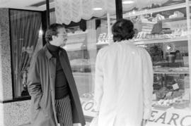
![Granville Mall - vendors [1 of 2]](/uploads/r/null/2/a/2ab50f7bd96cedf4b59404859099608e36f35b4081ddf0354ddcc81a5b6c380d/ffa46535-840b-4b08-ac80-cf6d4251f478-A64989_142.jpg)
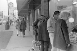
![Granville Mall - vendors [2 of 2]](/uploads/r/null/8/8/88a836af2caf48cd3f852852234c0f2983d631d83f7e96bb49a0b721ab87e884/8b24c19e-e7f9-4fb3-936d-bd768bc43330-A64990_142.jpg)