
Our picnic at the Goldstream, Easter
- AM427-S4-F4-: CVA 289-004.008
- Item
- 1927
Part of William Orson Banfield fonds
197 results with digital objects Show results with digital objects
Our picnic at the Goldstream, Easter
Part of William Orson Banfield fonds

Our picnic at the Goldstream, Easter
Part of William Orson Banfield fonds
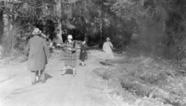
Our picnic at the Goldstream, Easter
Part of William Orson Banfield fonds

Part of William Orson Banfield fonds
![Olive [Sadler] triumphant, Myrtle [Kilpatrick] recumbent](/uploads/r/null/3/c/d/3cdd092c58003b9f1564602cb27b75a6b6d9d5329ce8d2579ba5ae570dbfbbef/0ca04af8-9f49-47bf-b9ec-aafb07d8ec09-CVA289-003_142.jpg)
Olive [Sadler] triumphant, Myrtle [Kilpatrick] recumbent
Part of William Orson Banfield fonds
Part of William Orson Banfield fonds

Part of William Orson Banfield fonds
![[Olive Kilpatrick, Myrtle Kilpatrick and Olive Sadler] ready to start for Parksville](/uploads/r/null/8/4/e/84e5b76d02e75b8bf5aeb46b564dd3787ba2e3514d77cc54d275b5cba4575b50/bf7277c0-163e-486f-9ab0-524d2d6f6f1f-CVA289-003_142.jpg)
[Olive Kilpatrick, Myrtle Kilpatrick and Olive Sadler] ready to start for Parksville
Part of William Orson Banfield fonds
![Olive arguing with Myrtle [Kilpatrick]](/uploads/r/null/f/b/5/fb5e43c6c9885b6013666776c041dbf07f6ecc2cc842ad061a6171a76617d2e2/242a8de0-b973-450f-b843-3390a5d5d031-CVA289-003_142.jpg)
Olive arguing with Myrtle [Kilpatrick]
Part of William Orson Banfield fonds

Northerly portion Vancouver Island
Item is a map of northern Vancouver Island and the adjacent British Columbia coast showing Crown and reserve lands, timber leases, district, park, and provincial forest boundaries, cities, municipalities, villages, post offices, hospitals, roads, railways, seaplane ports and anchorages, airports, elevations of some geographical features, and marine distances in nautical miles.


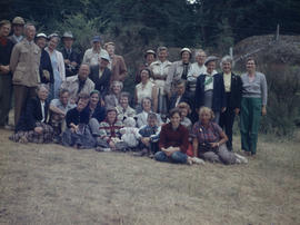
Nanoose Bay, May 1955 - Group on hill at Powder Point

Nanoose Bay, May 1955 - Digging up gooey-ducks, Marine Biology trip, V. I.
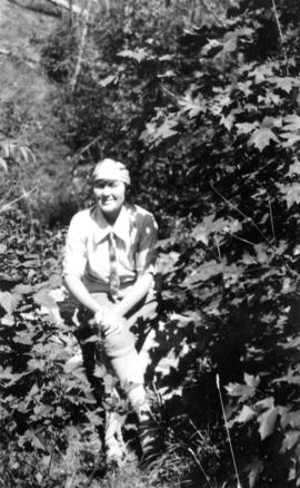
![Myrtle [Kilpatrick] and Olive [Sadler]](/uploads/r/null/2/2/a/22ae0074631268708a81b2647fa6c6d3a6d893c4b3007dcb789a11087d7dae2b/da34a586-a84c-4bbb-8416-fde3ccbf6515-CVA289-003_142.jpg)
Myrtle [Kilpatrick] and Olive [Sadler]
Part of William Orson Banfield fonds
![Myrtle [Kilpatrick]](/uploads/r/null/0/0/e/00eb0b77a13bfa824ec6d3f8ef73553f073ef19c95c4de4431d7880bb4fe78c0/0f25f379-7ce2-45a3-9701-e92d8743e8b1-CVA289-003_142.jpg)
Part of William Orson Banfield fonds

Mrs. Stevenson & sea urchin, Victoria outer harbour

Map of south western British Columbia showing coastal lumber producers
Primary map shows lumber shippers and producers in the Lower Mainland and Vancouver Island. Inset maps show lumber shippers and producers in Greater Vancouver and the location of the primary map in relation to the rest of Canada.

Map no. 1 shewing Union Steamship Company route and ports of call : lower run
Item is a map showing ports of call along Vancouver Island and the southern coast of British Columbia from Smith Sound to Vancouver.
![Group on V. Is. [Vancouver Island] at Nanoose](/uploads/r/null/8/d/6/8d62aa8abb26e5649d3ff49903d0fda750ad864238bf0e4dc1d28ee24dd0b29c/c2584b8a-4cd9-4593-b9e3-8adaa0eeaafe-2005-040_142.jpg)
Group on V. Is. [Vancouver Island] at Nanoose

Group on rocky point at Grouse Nest

![Going to [Mitlenatch Island]](/uploads/r/null/f/e/d/fed3a763e66009cfb8891b4f95035241216736342d267a32fea3f87c7f72d946/5f3248d6-b738-4c1d-b7f9-51b3a58bd94e-2005-040_142.jpg)


Fairbridge Farm, Vancouver Island : farm scenes
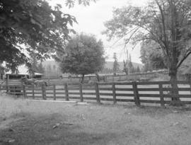
Fairbridge Farm, Vancouver Island : farm scenes

Fairbridge Farm, Vancouver Island : farm scenes

Fairbridge Farm, Vancouver Island : farm scenes
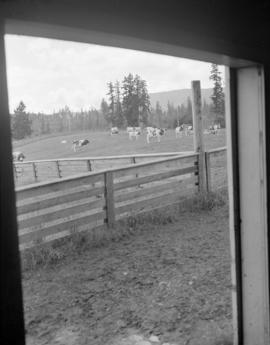
Fairbridge Farm, Vancouver Island : farm scenes
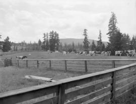
Fairbridge Farm, Vancouver Island : farm scenes

English Church, Courtenay, B.C.


Elk Falls plant interiors : roll grinder

Elk Falls plant interiors : roll grinder
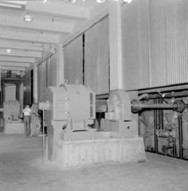
Elk Falls plant interiors : roll grinder

Elk Falls plant interiors : roll grinder


