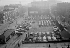
![[West Pender Street parking lot below sign for Canadian Imperial Bank of Commerce]](/uploads/r/null/c/4/6/c463104d8ad78b47d9d60b3eb5d4474e53a4f367da06a186b7fc047cc142c775/7ae934b1-4d1e-431f-8753-6c0f89908d3e-CVA1095-09073_142.jpg)
[West Pender Street parking lot below sign for Canadian Imperial Bank of Commerce]
- COV-S644-: CVA 1095-09073
- Item
- [between 1968 and 1973]
Part of City of Vancouver fonds
283 results with digital objects Show results with digital objects
[West Pender Street parking lot below sign for Canadian Imperial Bank of Commerce]
Part of City of Vancouver fonds
![[West Broadway and Trutch Street parking lot]](/uploads/r/null/6/0/7/607492c6ee4bc02763cf1b2c9c942ced62366c2c4707b440d34b3669d666236b/a09ea524-b569-4b5b-baff-eabd0d68b43e-CVA1095-11934_142.jpg)
[West Broadway and Trutch Street parking lot]
Part of City of Vancouver fonds
![[West Broadway and Trutch Street intersection]](/uploads/r/null/a/7/a/a7aac8cac3f6be63615eae17d067c48ba0d0033567554c71f7927578275c80ca/c04b8d2c-b1f8-4cbb-89f5-bee3076b89f7-CVA1095-11935_142.jpg)
[West Broadway and Trutch Street intersection]
Part of City of Vancouver fonds
![[View of parking lot and billboards]](/uploads/r/null/c/7/f/c7f5b12f7639ae7ad907d2545b7c8fbb276a17ceea69592db0508aaeec04e074/d6e5714d-5897-42e9-b114-f60dbaefe199-CVA1095-07302_142.jpg)
[View of parking lot and billboards]
Part of City of Vancouver fonds
![[View of 500 block Beatty Street from the intersection of West Pender Street and Cambie Street]](/uploads/r/null/4/b/f/4bf4571fa4a091046cd66a36c77894208f0f8b353b6e8800546935d93544cb3d/025056a3-61f6-4626-8c5e-7636824cd93e-CVA1095-14301_142.jpg)
[View of 500 block Beatty Street from the intersection of West Pender Street and Cambie Street]
Part of City of Vancouver fonds
![Tower 115 Alexander - 390 [6 of 6]](/uploads/r/null/4/6/7/467b6e5b23bccd6ab3010d065583b1b41b7ec0dfebd82ac2bb9afae54cc14f95/ff52f4e4-e7ba-46bd-aab7-be953c810451-CVA1095-08602_142.jpg)
Tower 115 Alexander - 390 [6 of 6]
Part of City of Vancouver fonds
![Tower 115 Alexander - 390 [5 of 6]](/uploads/r/null/9/b/8/9b8ff38e195fb66736cdf7a48d552fa1af92e3662dc03af2ffb6cab8231749c8/5340fd1c-fd36-48cf-96a7-42ed0998a142-CVA1095-08601_142.jpg)
Tower 115 Alexander - 390 [5 of 6]
Part of City of Vancouver fonds
![Tower 115 Alexander - 390 [4 of 6]](/uploads/r/null/b/a/f/bafea82d9e7d1b7e788e10d8061502f5844af4ed8dd1f216719be4fa229518f5/5f42fadf-e112-4d71-bc7d-87439707ab94-CVA1095-08600_142.jpg)
Tower 115 Alexander - 390 [4 of 6]
Part of City of Vancouver fonds
![Theatre Row Lanes [Alley]](/uploads/r/null/b/0/e/b0ebec50d8942b74213e451eb145b7d9e68a30dc978e37e27fc050b8e1697843/a0ddf967-feef-44fa-8ba5-4e9a6090d498-CVA1095-08810_142.jpg)
Part of City of Vancouver fonds
![Theatre Row Lanes [Alley]](/uploads/r/null/3/f/1/3f1c364fc34e9886826d29c929f5c27a29f0460d15f94a26dab9db493eadce84/d0408aa2-6d9e-4893-8da2-1c10476348d7-CVA1095-08813_142.jpg)
Part of City of Vancouver fonds
![Theatre Row Lanes [Alley]](/uploads/r/null/a/2/7/a27d4b66b49a8472049f4550d56becf5c7761bdcc493b2bdb0b41c1883d05de0/ac051c69-ed1d-423f-a8ec-c30610ed74ff-CVA1095-08817_142.jpg)
Part of City of Vancouver fonds
![Theatre Row Lanes [Alley]](/uploads/r/null/4/a/4/4a435e8083643b59627847db2f3734df4647a81efc83fb44e84206fe54c56d13/962177ed-7151-4416-99de-a28493cdd0f3-CVA1095-08811_142.jpg)
Part of City of Vancouver fonds
![Theatre Row Lanes [Alley]](/uploads/r/null/3/c/1/3c10423880874a022969b262a09d0593818e7de4202dd7e6fb623b6c8d299ebb/6688e2a7-f9e3-4d04-8f05-33c5121c420e-CVA1095-08812_142.jpg)
Part of City of Vancouver fonds
![Theatre Row Lanes [Alley]](/uploads/r/null/6/4/d/64d6d912a8abf1e85084424c29f93b7acc3bcfcbf22670b8e0069621496ee774/b8101da9-c20e-43cd-a75a-6201666f7d67-CVA1095-08815_142.jpg)
Part of City of Vancouver fonds
![Theatre Row Lanes [Alley]](/uploads/r/null/1/a/3/1a30053fa243de30dee3a02ccf15ac8ea6c412142c25716e47751ec80cce33cb/ef944a8a-81aa-4a36-8e30-0dc5c2faa43f-CVA1095-08816_142.jpg)
Part of City of Vancouver fonds
![Taylor Street [Train, parked cars, and overpass]](/uploads/r/null/1/0/7/1071c548026ea0273d314b79f3fa941757109815cbfcf25d716567c7627e17ce/4441cffd-f246-4170-973b-e36818a6a383-CVA1095-11195_142.jpg)
Taylor Street [Train, parked cars, and overpass]
Part of City of Vancouver fonds
![Taylor Street [Parking lot, 2 of 2]](/uploads/r/null/b/4/5/b45454fce45bc6066bda93c6bb1cd278b7d3ccebd67fa3823906ea2346704713/f8f74ba6-b0b1-450d-bfd5-aaf2c21cd3a5-CVA1095-11171_142.jpg)
Taylor Street [Parking lot, 2 of 2]
Part of City of Vancouver fonds
![Taylor Street [Parking lot, 1 of 2]](/uploads/r/null/2/6/3/26347f11ac3acf4ad4d59e66833d5966874bec890d63cfb3300d355579eb1664/a0d705be-8b88-4aab-a664-7da63588a86c-CVA1095-11170_142.jpg)
Taylor Street [Parking lot, 1 of 2]
Part of City of Vancouver fonds
![Taylor Street [Parked cars and overpass]](/uploads/r/null/d/5/9/d59a6a662ad138ce0882c9486c881d33d6de8028866ad58a2f3573daa8ab38e2/6c2d7089-4863-44d6-a66b-a0b4c01c4d1d-CVA1095-11194_142.jpg)
Taylor Street [Parked cars and overpass]
Part of City of Vancouver fonds
![Taylor Street [Building and parked cars, 4 of 4]](/uploads/r/null/c/d/1/cd13271d0fae23fbc3a56342a96b17adb0affb86cd37c42d3173485b558e4905/dbbdca29-5adc-4bf7-adce-b2311ecd687a-CVA1095-11193_142.jpg)
Taylor Street [Building and parked cars, 4 of 4]
Part of City of Vancouver fonds
![Taylor Street [Building and parked cars, 3 of 4]](/uploads/r/null/c/b/1/cb147bfde1bfa822a431a47ce8f8bb3264166556fe027a393916902f5cfc20bd/9a5ed7b3-f194-453f-9d87-4bb92341c110-CVA1095-11192_142.jpg)
Taylor Street [Building and parked cars, 3 of 4]
Part of City of Vancouver fonds
![Taylor Street [Building and parked cars, 2 of 4]](/uploads/r/null/f/4/9/f491f6f27afe4969d58525edb13b2ce439ff8b54360bf6c8a196202c40825a0a/dac0ad89-4790-42ce-85c8-9eb6eb764f0a-CVA1095-11191_142.jpg)
Taylor Street [Building and parked cars, 2 of 4]
Part of City of Vancouver fonds
![Taylor Street [Building and parked cars, 1 of 4]](/uploads/r/null/2/7/f/27f9b24a3394676ad5dc5390e848b5a0dd12306acc2aa295d464efa7b6c80b1b/395d4eac-0215-4be5-9c03-a03fc37122f4-CVA1095-11190_142.jpg)
Taylor Street [Building and parked cars, 1 of 4]
Part of City of Vancouver fonds
![Taylor Street [Building and parked cars]](/uploads/r/null/7/1/0/710e9ebf3311b3fe7b1b86682c38be15d975056041ba4f68f4655577812be1c4/63d38e4a-8fee-4fc1-b7cd-a7a69b57d24a-CVA1095-11179_142.jpg)
Taylor Street [Building and parked cars]
Part of City of Vancouver fonds
![Taylor Street [Building and parked cars]](/uploads/r/null/a/5/0/a506bc92e2672bbe6be3bcf3865037351a8414cf4ab4bfc3bc5b95d84a7c667d/c6afed60-b17a-4773-b9a7-03ba87b33b5d-CVA1095-11185_142.jpg)
Taylor Street [Building and parked cars]
Part of City of Vancouver fonds
![Taylor Street [Building and parked cars]](/uploads/r/null/a/a/3/aa3ab2e4573a3bdafcbf691a515d796bb564cda713ba7dfd315b02c30ec66d1a/29678e28-f6bb-44d2-8186-44e8b6725e00-CVA1095-11186_142.jpg)
Taylor Street [Building and parked cars]
Part of City of Vancouver fonds
![Taylor Street [Building and parked cars]](/uploads/r/null/2/0/b/20b845d1fd5517ac8cebebcd984fede2e73c3c5b538279615e5d59ffea0154b7/7ff3e2ef-affc-4cf5-a8fc-1f92059e8c98-CVA1095-11177_142.jpg)
Taylor Street [Building and parked cars]
Part of City of Vancouver fonds
![Taylor Street [Building and parked cars]](/uploads/r/null/7/8/a/78a92f3cd96182f2f1fa8c3e8cc0a1edb03e0b2be47abd56eb40b418e592dda1/91eb2c9f-908d-4e02-ae62-9723ceb42b24-CVA1095-11178_142.jpg)
Taylor Street [Building and parked cars]
Part of City of Vancouver fonds
![Taylor Street [Building and parked cars]](/uploads/r/null/5/d/1/5d18c79c1bb52b02aa034262cbc08c263e90bc05d60a731f5d10d9b161ae7b5f/465f0e72-7e03-4456-903d-764f2d935c5d-CVA1095-11181_142.jpg)
Taylor Street [Building and parked cars]
Part of City of Vancouver fonds
![Taylor Street [Building and parked cars]](/uploads/r/null/e/c/b/ecb2ddd7d8369bd0a443c61788eb6069257a8921975d67835840845a2b15b554/4461b276-6e5c-49bc-b7e4-4b500be9bc24-CVA1095-11184_142.jpg)
Taylor Street [Building and parked cars]
Part of City of Vancouver fonds

Part of City of Vancouver fonds

![[Standard Gas station]](/uploads/r/null/b/1/b/b1bf58459e587ebcbc4ca326aea32eaf7c8c936269c2ab6e7efe8f5215a7e866/0d14c0c1-1b45-4333-a032-8192952bb981-CVA1095-08613_142.jpg)
Part of City of Vancouver fonds
Item is a photograph that depicts a Standard Gas station at an intersection. Also visible is a sign for Buster's Auto Towing, located at 90 Keefer Street.
![[Sign and parking lot for Do Hing restaurant at 30 East Pender, 2 of 2]](/uploads/r/null/e/b/c/ebc84d802441586899b6a5e0ba9573f115ff5dc73bee4245be6f484e08c61b03/b618f2b8-5515-4b49-9260-5df51e17ae44-CVA1095-09458_142.jpg)
[Sign and parking lot for Do Hing restaurant at 30 East Pender, 2 of 2]
Part of City of Vancouver fonds
![[Sign and parking lot for Do Hing restaurant at 30 East Pender, 1 of 2]](/uploads/r/null/a/a/a/aaac94da5f21abef6b0a6afaf94f3a7d406ffcd6ceea3dd52e9ec06fe6830cb9/2644b466-87f3-421b-b90e-c9397db1cb08-CVA1095-09457_142.jpg)
[Sign and parking lot for Do Hing restaurant at 30 East Pender, 1 of 2]
Part of City of Vancouver fonds

Proposed customer parking areas
Part of City of Vancouver fonds
Item is a map showing proposed parking areas and the high density core area in downtown Vancouver from Burrard Street, Robson Street, and Nicola Street in the west to Main Street in the east.
![[Powell Street parking lot]](/uploads/r/null/5/3/8/5381017b6394f4aefe4a61fcdc3e49d1142457c3b389d47c2aa54fe431443798/292a8766-29c2-40e2-b2b8-8eb18220e1ad-CVA1095-12623_142.jpg)
Part of City of Vancouver fonds
![[Powell Street parking lot]](/uploads/r/null/4/1/c/41c15c3d72901432c94d6a74213bfe210b5ebc6fec1d52e0a839e11dd451bb98/475bf2fe-9044-45c6-bb94-e0cebcd38e9e-CVA1095-12631_142.jpg)
Part of City of Vancouver fonds
![Pender Street - 419 [Railway crossing]](/uploads/r/null/1/6/c/16cb029212dcdca344a809f77bebd099666b555f1aef058ff6dbc80ff8cdb403/a8b7dd2b-237a-431c-a767-0a1aa5e45b91-CVA1095-09332_142.jpg)
Pender Street - 419 [Railway crossing]
Part of City of Vancouver fonds
![Pender Street - 419 [Parking lot and loading bay]](/uploads/r/null/1/6/a/16a0c846d2c4e5374a512cab0f6ab10042b6fa02d060e36cae28963a7cb771fb/90458334-eef4-4523-a2a2-aec2e0c80700-CVA1095-09329_142.jpg)
Pender Street - 419 [Parking lot and loading bay]
Part of City of Vancouver fonds
![Pender Street - 419 [Parking lot and loading bay]](/uploads/r/null/b/4/2/b42688b7552a5190e37a41e46f206f53a06779dbae1a195530a1006e8b573c56/8574dc07-a59d-464e-a659-569454309cec-CVA1095-09330_142.jpg)
Pender Street - 419 [Parking lot and loading bay]
Part of City of Vancouver fonds

Part of City of Vancouver fonds

Part of City of Vancouver fonds

Part of City of Vancouver fonds
Item is a photograph that depicts a parking lot and 10 West Hastings, Skipper's Sea Foods, at the rear of the parking lot.

Part of City of Vancouver fonds
Item is a photograph that depicts a parking lot and the Bank of Montreal at the rear of the parking lot.

Part of City of Vancouver fonds
Item is a photograph that depicts railway and Skipper's Sea Foods at 10 West Hastings.
Pender Guy Program No. 27 & 28 - Parking Tape
![Pender and Hastings - 414 [Pender Centre]](/uploads/r/null/4/4/0/44051d3457ce20f9610ed036b061f9d53f9620dd945f741789a2d62245db2013/431ef3d9-d841-4287-82c8-24c45a3b685e-CVA1095-09464_142.jpg)
Pender and Hastings - 414 [Pender Centre]
Part of City of Vancouver fonds
![[Parking spaces between 1120 and 1126 Granville Street]](/uploads/r/null/1/5/a/15a031b63f1078510224c28417eb216504e7ffb5949bbaaa7d384f050fe620b5/86651a41-c4e0-4918-a069-e3f067fb2edf-CVA1095-10342_142.jpg)
[Parking spaces between 1120 and 1126 Granville Street]
Part of City of Vancouver fonds